Puerto Rico elevation
On our site we have elevation data and maps for 219 cities from Puerto Rico including San Juan as capital of the country.
Puerto Rico on topographic map
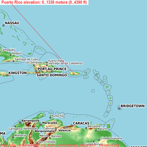
Puerto Rico elevation extremes
Land surface elevation extremes in Puerto Rico:
- Highest point in Puerto Rico: Cerro de Punta with 1338 meters (=4390 ft)
- Lowest point: Caribbean Sea with 0 meters (=0 ft)
- Elevation span: 1338 m (=4390 ft)
Statistics
- Main average elevation: 262 meters (= 860 ft)
- Average elevation of cities: 100 m (= 328 ft), and this is 296 m (971 ft) below average city elevation worldwide..[1]
- Area: 9,104 km² (= 3,515 sq mi)
- Population: 3,916,632
Puerto Rico has no neighboring country
This is only the list of largest 150 cities in ABC order:
If the city you are looking for is not listed, use the search box above.
Search by letter:
A B C D E F G H I J L M N O P Q R S T U V Y
A:
Adjuntas Aguada Aguadilla Aguas Buenas Aguas Claras Aguilita Aibonito Añasco Arecibo Arroyo
B:
Bairoa Bajadero Barahona Barceloneta Barranquitas Bayamón Boquerón Brenas Buena Vista
C:
Caban Cabo Rojo Cacao Caguas Campanilla Campo Rico Camuy Candelaria Candelaria Arenas Canovanas Capitanejo Carolina Carrizales Cataño Cayey Ceiba Ceiba Celada Ciales Cidra Coamo Coco Comerío Comunas Coquí Corazón Corozal Coto Laurel
D:
Dorado
E:
El Mangó Emajagua Estancias de Florida
F:
Fajardo Florida Franquez
G:
Galateo Guánica Guayabal Guayama Guayanilla Guaynabo Gurabo
H:
H. Rivera Colon Hatillo Hato Candal Hormigueros Humacao
I:
Imbery Ingenio Isabel Segunda Isabela
J:
Jayuya Jobos Juana Díaz Juncos
L:
La Alianza La Dolores La Fermina La Luisa La Playa Lajas Lares Las Ollas Las Piedras Levittown Lluveras Loíza Los Llanos Luis Llorens Torres Luis M. Cintron Luquillo Luyando
M:
Manatí Mariano Colón Martorell Maunabo Mayagüez Miranda Moca Monserrate Morovis
N:
Naguabo Naranjito
O:
Olimpo
P:
Pájaros Palmas Palomas Patillas Peñuelas Piedra Gorda Playa Fortuna Playita Ponce Potala Pastillo Puerto Real Punta Santiago
Q:
Quebradillas
R:
Rafael Capo Rafael Gonzalez Ramos Río Grande Río Lajas
S:
Sabana Sabana Grande Sabana Seca Salinas San Antonio San Antonio San Germán San Isidro San José San Juan San Lorenzo San Sebastián Santa Barbara Santa Isabel Santo Domingo Suárez
T:
Tallaboa Alta Tierras Nuevas Poniente Toa Alta Toa Baja Trujillo Alto
U:
Utuado
V:
Vázquez Vega Alta Vega Baja Vieques Villalba
Y:
Yabucoa Yauco
15 most populated cities are in red/bold font style.

A:
Adjuntas Aguada Aguadilla Aguas Buenas Aguas Claras Aguilita Aibonito Añasco Arecibo Arroyo
B:
Bairoa Bajadero Barahona Barceloneta Barranquitas Bayamón Boquerón Brenas Buena Vista
C:
Caban Cabo Rojo Cacao Caguas Campanilla Campo Rico Camuy Candelaria Candelaria Arenas Canovanas Capitanejo Carolina Carrizales Cataño Cayey Ceiba Ceiba Celada Ciales Cidra Coamo Coco Comerío Comunas Coquí Corazón Corozal Coto Laurel
D:
Dorado
E:
El Mangó Emajagua Estancias de Florida
F:
Fajardo Florida Franquez
G:
Galateo Guánica Guayabal Guayama Guayanilla Guaynabo Gurabo
H:
H. Rivera Colon Hatillo Hato Candal Hormigueros Humacao
I:
Imbery Ingenio Isabel Segunda Isabela
J:
Jayuya Jobos Juana Díaz Juncos
L:
La Alianza La Dolores La Fermina La Luisa La Playa Lajas Lares Las Ollas Las Piedras Levittown Lluveras Loíza Los Llanos Luis Llorens Torres Luis M. Cintron Luquillo Luyando
M:
Manatí Mariano Colón Martorell Maunabo Mayagüez Miranda Moca Monserrate Morovis
N:
Naguabo Naranjito
O:
Olimpo
P:
Pájaros Palmas Palomas Patillas Peñuelas Piedra Gorda Playa Fortuna Playita Ponce Potala Pastillo Puerto Real Punta Santiago
Q:
Quebradillas
R:
Rafael Capo Rafael Gonzalez Ramos Río Grande Río Lajas
S:
Sabana Sabana Grande Sabana Seca Salinas San Antonio San Antonio San Germán San Isidro San José San Juan San Lorenzo San Sebastián Santa Barbara Santa Isabel Santo Domingo Suárez
T:
Tallaboa Alta Tierras Nuevas Poniente Toa Alta Toa Baja Trujillo Alto
U:
Utuado
V:
Vázquez Vega Alta Vega Baja Vieques Villalba
Y:
Yabucoa Yauco
Sources
- Elevation extremes by country from wikipedia.
- Base map data: © OpenStreetMap contributors, | map style: © OpenTopoMap (CC-BY-SA)
- [1] Calculated only from 219 cities in our database
- Other city data from geonames.org with taken over terms of usage.
- Min/max latitude and longitude coordinates per country from latitudelongitude.org website.