Humacao elevation
Humacao, Puerto Rico elevation is 25 meters and Humacao elevation in feet is 82 ft above sea level [src 1]. Humacao is a seat of a first-order administrative division (feature code) with elevation that is 75 meters (246 ft) smaller than average city elevation in Puerto Rico.
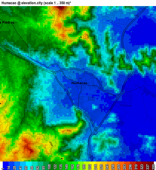
Below is the Elevation map of Humacao, which displays elevation range with different colors. Scale of the first map is from 1 to 350 m (3 to 1148 ft) with average elevation of 87 meters (=285 ft) [note 1]
These maps also provides idea of topography and contour of this city, they are displayed at different zoom levels. More info about maps, scale and edge coordinates you can find below images.
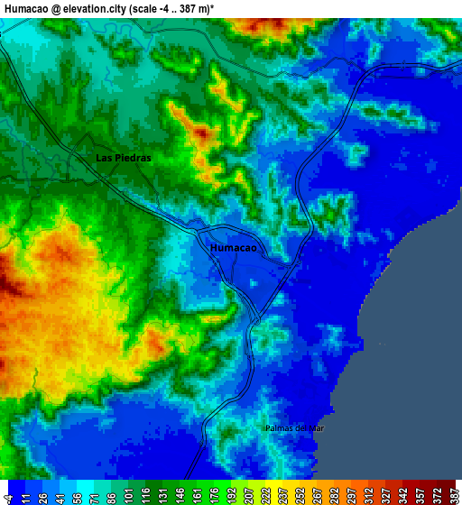
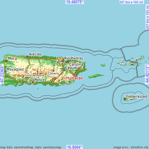
| \ | Map #1 | Map #2 | Topo.Map |
| Scale [m] | 1..350 m | -4..387 m | × |
| Scale [ft] | 3..1148 ft | -13..1270 ft | × |
| Average | 87 m = 285 ft | 95.2 m = 312 ft | × |
| Width | 9.29 km = 5.8 mi | 18.57 km = 11.5 mi | 297.1 km = 184.6 mi |
| Height | 9.29 km = 5.8 mi | 18.57 km = 11.5 mi | 297.2 km = 184.7 mi |
| ↑Max Latitude | 18.191434° | 18.233178° | 19.48075° |
| Latitude at center | 18.14968° | 18.14968° | 18.14968° |
| ↓Min Latitude | 18.107916° | 18.066142° | 16.8084° |
| ← Min Longitude | -65.871325° | -65.915271° | -67.23363° |
| Longitude center | -65.82738° | -65.82738° | -65.82738° |
| →Max Longitude | -65.783435° | -65.739489° | -64.42113° |
Nearby cities:
Cities around Humacao sort by population:
• Las Piedras elevation 136 m
5.5 km,  312°
312°
• Punta Santiago 4 m
8.6 km,  77°
77°
• La Fermina 130 m
4 km,  316°
316°
• Comunas 49 m
7.2 km,  193°
193°
• El Mangó 93 m
10.9 km,  329°
329°
• Antón Ruiz 31 m
4.4 km,  26°
26°
• Pueblito del Rio 83 m
9.5 km,  336°
336°
• Bajandas 38 m
4.9 km, 79°
• Río Blanco 17 m
8.7 km, 28°
• Candelero Arriba 73 m
5.4 km, 190°
• Boqueron 102 m
6.8 km, 340°
• Peña Pobre 103 m
7.3 km,  4°
4°
Multilingual:
 En español:
Humacao elevación 25 m.
 En France:
Humacao élévation 25 m.


Sources and notes:
- [note 1] Map square and city borders are not equal. Map elevation data is calculated only from area inside that square.
- [src 1] Elevation data from geonames database provided with same terms of usage.
- [src 2] The elevation map of Humacao is generated using elevation data from NASA's 3 arcsec (90m) resolution SRTM data.
- [src 3] Base (background) map © OpenStreetMap contributors tiles are generated by Geofabrik and OpenTopoMap.
Copyright & License:
This Humacao Elevation Map is licensed under CC BY-SA. You may reuse any part from this page, if you give a proper credit by linking to this URL:
 More info on terms of use page.