Santa Isabel elevation
Santa Isabel, Puerto Rico elevation is 6 meters and Santa Isabel elevation in feet is 20 ft above sea level [src 1]. Santa Isabel is a seat of a first-order administrative division (feature code) with elevation that is 94 meters (308 ft) smaller than average city elevation in Puerto Rico.
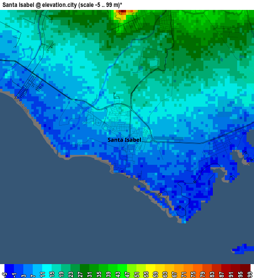
Below is the Elevation map of Santa Isabel, which displays elevation range with different colors. Scale of the first map is from -5 to 99 m (-16 to 325 ft) with average elevation of 13.7 meters (=45 ft) [note 1]
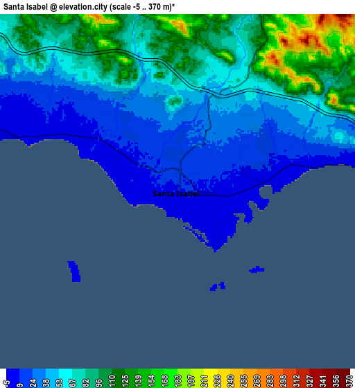
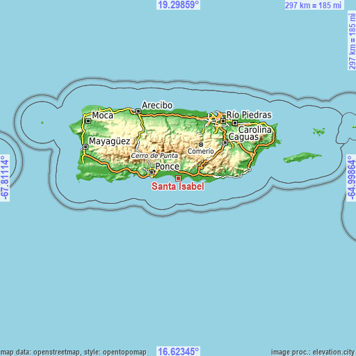
These maps also provides idea of topography and contour of this city, they are displayed at different zoom levels. More info about maps, scale and edge coordinates you can find below images.
| \ | Map #1 | Map #2 | Topo.Map |
| Scale [m] | -5..99 m | -5..370 m | × |
| Scale [ft] | -16..325 ft | -16..1214 ft | × |
| Average | 13.7 m = 45 ft | 62.4 m = 205 ft | × |
| Width | 9.3 km = 5.8 mi | 18.59 km = 11.6 mi | 297.4 km = 184.8 mi |
| Height | 9.3 km = 5.8 mi | 18.59 km = 11.6 mi | 297.5 km = 184.9 mi |
| ↑Max Latitude | 18.007878° | 18.049665° | 19.29859° |
| Latitude at center | 17.96608° | 17.96608° | 17.96608° |
| ↓Min Latitude | 17.924273° | 17.882455° | 16.62345° |
| ← Min Longitude | -66.448835° | -66.492781° | -67.81114° |
| Longitude center | -66.40489° | -66.40489° | -66.40489° |
| →Max Longitude | -66.360945° | -66.316999° | -64.99864° |
Nearby cities:
Cities around Santa Isabel sort by population:
• Coamo elevation 126 m
13.6 km,  21°
21°
• Salinas 9 m
11.4 km,  83°
83°
• Potala Pastillo 4 m
10.1 km,  286°
286°
• Mariano Colón 111 m
10 km,  50°
50°
• Los Llanos 140 m
9.9 km,  359°
359°
• Las Ollas 64 m
7.7 km,  344°
344°
• Jauca 2 m
4.2 km,  85°
85°
• El Ojo 33 m
4.4 km, 18°
• Playita Cortada 6 m
4.2 km,  300°
300°
• Las Ochenta 14 m
9.4 km, 77°
• Río Cañas Abajo 72 m
10.4 km,  320°
320°
• Parcelas Peñuelas 43 m
7.7 km,  61°
61°
Multilingual:
 En español:
Santa Isabel elevación 6 m.
 En France:
Santa Isabel élévation 6 m.
 Auf Deutsch:
Santa Isabel höhe über dem Meeresspiegel ist 6 m.

Sources and notes:
- [note 1] Map square and city borders are not equal. Map elevation data is calculated only from area inside that square.
- [src 1] Elevation data from geonames database provided with same terms of usage.
- [src 2] The elevation map of Santa Isabel is generated using elevation data from NASA's 3 arcsec (90m) resolution SRTM data.
- [src 3] Base (background) map © OpenStreetMap contributors tiles are generated by Geofabrik and OpenTopoMap.
Copyright & License:
This Santa Isabel Elevation Map is licensed under CC BY-SA. You may reuse any part from this page, if you give a proper credit by linking to this URL:
 More info on terms of use page.