Coamo elevation
Coamo, Puerto Rico elevation is 126 meters and Coamo elevation in feet is 413 ft above sea level [src 1]. Coamo is a seat of a first-order administrative division (feature code) with elevation that is 26 meters (85 ft) bigger than average city elevation in Puerto Rico.
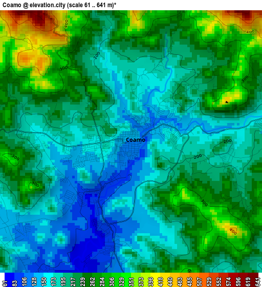
Below is the Elevation map of Coamo, which displays elevation range with different colors. Scale of the first map is from 61 to 641 m (200 to 2103 ft) with average elevation of 221.1 meters (=725 ft) [note 1]
These maps also provides idea of topography and contour of this city, they are displayed at different zoom levels. More info about maps, scale and edge coordinates you can find below images.
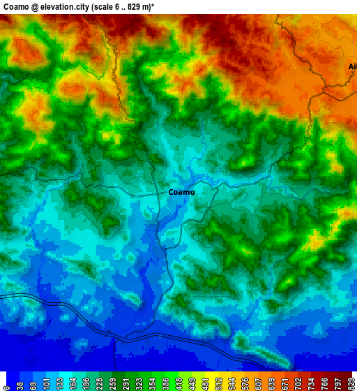
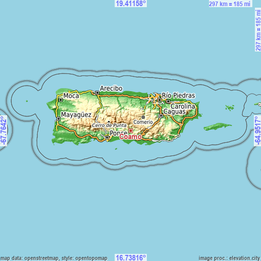
| \ | Map #1 | Map #2 | Topo.Map |
| Scale [m] | 61..641 m | 6..829 m | × |
| Scale [ft] | 200..2103 ft | 20..2720 ft | × |
| Average | 221.1 m = 725 ft | 291 m = 955 ft | × |
| Width | 9.29 km = 5.8 mi | 18.58 km = 11.5 mi | 297.3 km = 184.7 mi |
| Height | 9.29 km = 5.8 mi | 18.58 km = 11.5 mi | 297.3 km = 184.7 mi |
| ↑Max Latitude | 18.121731° | 18.163491° | 19.41158° |
| Latitude at center | 18.07996° | 18.07996° | 18.07996° |
| ↓Min Latitude | 18.03818° | 17.996389° | 16.73816° |
| ← Min Longitude | -66.401895° | -66.445841° | -67.7642° |
| Longitude center | -66.35795° | -66.35795° | -66.35795° |
| →Max Longitude | -66.314005° | -66.270059° | -64.9517° |
Nearby cities:
Cities around Coamo sort by population:
• Aibonito elevation 607 m
11.8 km,  55°
55°
• Mariano Colón 111 m
6.9 km,  156°
156°
• Los Llanos 140 m
5.8 km,  241°
241°
• Vázquez 157 m
12.7 km,  97°
97°
• Las Ollas 64 m
8.7 km,  233°
233°
• Jauca 2 m
12.4 km,  183°
183°
• El Ojo 33 m
9.2 km,  202°
202°
• Pastos 655 m
11.3 km,  68°
68°
• Las Ochenta 14 m
11.4 km, 158°
• Río Cañas Abajo 72 m
12.5 km,  248°
248°
• Parcelas Peñuelas 43 m
9.2 km,  168°
168°
• Palmarejo 241 m
3.7 km,  111°
111°
Multilingual:
 En español:
Coamo elevación 126 m.
 En France:
Coamo élévation 126 m.


Sources and notes:
- [note 1] Map square and city borders are not equal. Map elevation data is calculated only from area inside that square.
- [src 1] Elevation data from geonames database provided with same terms of usage.
- [src 2] The elevation map of Coamo is generated using elevation data from NASA's 3 arcsec (90m) resolution SRTM data.
- [src 3] Base (background) map © OpenStreetMap contributors tiles are generated by Geofabrik and OpenTopoMap.
Copyright & License:
This Coamo Elevation Map is licensed under CC BY-SA. You may reuse any part from this page, if you give a proper credit by linking to this URL:
 More info on terms of use page.