Isabel Segunda elevation
Isabel Segunda (Vieques), Puerto Rico elevation is 16 meters and Isabel Segunda elevation in feet is 52 ft above sea level [src 1]. Isabel Segunda is a seat of a first-order administrative division (feature code) with elevation that is 84 meters (276 ft) smaller than average city elevation in Puerto Rico.
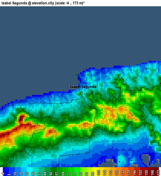
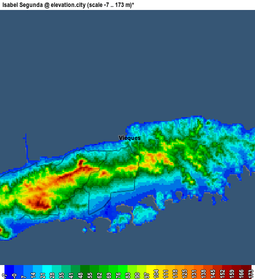
Below is the Elevation map of Isabel Segunda, which displays elevation range with different colors. Scale of the first map is from -4 to 173 m (-13 to 568 ft) with average elevation of 47 meters (=154 ft) [note 1]
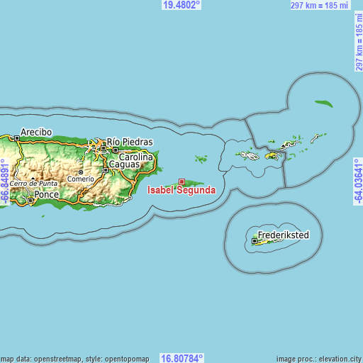
These maps also provides idea of topography and contour of this city, they are displayed at different zoom levels. More info about maps, scale and edge coordinates you can find below images.
| \ | Map #1 | Map #2 | Topo.Map |
| Scale [m] | -4..173 m | -7..173 m | × |
| Scale [ft] | -13..568 ft | -23..568 ft | × |
| Average | 47 m = 154 ft | 43 m = 141 ft | × |
| Width | 9.29 km = 5.8 mi | 18.57 km = 11.5 mi | 297.1 km = 184.6 mi |
| Height | 9.29 km = 5.8 mi | 18.57 km = 11.5 mi | 297.2 km = 184.7 mi |
| ↑Max Latitude | 18.190884° | 18.232628° | 19.4802° |
| Latitude at center | 18.14913° | 18.14913° | 18.14913° |
| ↓Min Latitude | 18.107366° | 18.065592° | 16.80784° |
| ← Min Longitude | -65.486605° | -65.530551° | -66.84891° |
| Longitude center | -65.44266° | -65.44266° | -65.44266° |
| →Max Longitude | -65.398715° | -65.354769° | -64.03641° |
Nearby cities:
Cities around Isabel Segunda sort by population:
• Fajardo elevation 16 m
29.6 km,  311°
311°
• Ceiba 24 m
25.2 km,  300°
300°
• Punta Santiago 4 m
32.3 km,  273°
273°
• Naguabo 20 m
31.6 km,  282°
282°
• Aguas Claras 34 m
25.1 km, 297°
• Luis M. Cintron 27 m
26.6 km, 308°
• Ramos 51 m
35.5 km, 306°
• Duque 75 m
33.1 km,  287°
287°
• Daguao 35 m
26.8 km, 288°
• Culebra 7 m
22.7 km,  41°
41°
• Bajandas 38 m
35.8 km, 271°
• Esperanza 8 m
6.5 km,  207°
207°
Multilingual:
 En español:
Isabel Segunda elevación 16 m.
 En France:
Isabel Segunda élévation 16 m.
 Auf Deutsch:
Isabel Segunda höhe über dem Meeresspiegel ist 16 m.

Sources and notes:
- [note 1] Map square and city borders are not equal. Map elevation data is calculated only from area inside that square.
- [src 1] Elevation data from geonames database provided with same terms of usage.
- [src 2] The elevation map of Isabel Segunda is generated using elevation data from NASA's 3 arcsec (90m) resolution SRTM data.
- [src 3] Base (background) map © OpenStreetMap contributors tiles are generated by Geofabrik and OpenTopoMap.
Copyright & License:
This Isabel Segunda Elevation Map is licensed under CC BY-SA. You may reuse any part from this page, if you give a proper credit by linking to this URL:
 More info on terms of use page.