Naguabo elevation
Naguabo, Puerto Rico elevation is 20 meters and Naguabo elevation in feet is 66 ft above sea level [src 1]. Naguabo is a seat of a first-order administrative division (feature code) with elevation that is 80 meters (262 ft) smaller than average city elevation in Puerto Rico.
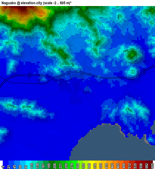
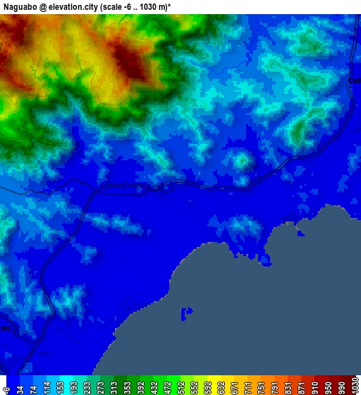
Below is the Elevation map of Naguabo, which displays elevation range with different colors. Scale of the first map is from -2 to 605 m (-7 to 1985 ft) with average elevation of 61.6 meters (=202 ft) [note 1]
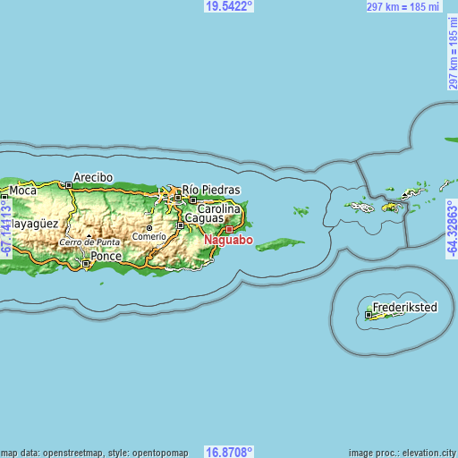
These maps also provides idea of topography and contour of this city, they are displayed at different zoom levels. More info about maps, scale and edge coordinates you can find below images.
| \ | Map #1 | Map #2 | Topo.Map |
| Scale [m] | -2..605 m | -6..1030 m | × |
| Scale [ft] | -7..1985 ft | -20..3379 ft | × |
| Average | 61.6 m = 202 ft | 174.7 m = 573 ft | × |
| Width | 9.28 km = 5.8 mi | 18.57 km = 11.5 mi | 297 km = 184.5 mi |
| Height | 9.28 km = 5.8 mi | 18.57 km = 11.5 mi | 297.1 km = 184.6 mi |
| ↑Max Latitude | 18.253359° | 18.295088° | 19.5422° |
| Latitude at center | 18.21162° | 18.21162° | 18.21162° |
| ↓Min Latitude | 18.169871° | 18.128112° | 16.8708° |
| ← Min Longitude | -65.778825° | -65.822771° | -67.14113° |
| Longitude center | -65.73488° | -65.73488° | -65.73488° |
| →Max Longitude | -65.690935° | -65.646989° | -64.32863° |
Nearby cities:
Cities around Naguabo sort by population:
• Humacao elevation 25 m
12 km,  234°
234°
• Ceiba 24 m
10.8 km,  57°
57°
• Punta Santiago 4 m
5.2 km,  195°
195°
• Aguas Claras 34 m
9.7 km, 61°
• La Fermina 130 m
13.2 km,  252°
252°
• Antón Ruiz 31 m
8.3 km, 249°
• Duque 75 m
2.9 km,  345°
345°
• Daguao 35 m
5.7 km,  73°
73°
• Bajandas 38 m
7.8 km,  219°
219°
• Río Blanco 17 m
5.7 km,  277°
277°
• Boqueron 102 m
12 km,  267°
267°
• Peña Pobre 103 m
9.2 km, 272°
Multilingual:
 En español:
Naguabo elevación 20 m.
 En France:
Naguabo élévation 20 m.


Sources and notes:
- [note 1] Map square and city borders are not equal. Map elevation data is calculated only from area inside that square.
- [src 1] Elevation data from geonames database provided with same terms of usage.
- [src 2] The elevation map of Naguabo is generated using elevation data from NASA's 3 arcsec (90m) resolution SRTM data.
- [src 3] Base (background) map © OpenStreetMap contributors tiles are generated by Geofabrik and OpenTopoMap.
Copyright & License:
This Naguabo Elevation Map is licensed under CC BY-SA. You may reuse any part from this page, if you give a proper credit by linking to this URL:
 More info on terms of use page.