Aguadilla elevation
Aguadilla, Puerto Rico elevation is 7 meters and Aguadilla elevation in feet is 23 ft above sea level [src 1]. Aguadilla is a seat of a first-order administrative division (feature code) with elevation that is 93 meters (305 ft) smaller than average city elevation in Puerto Rico.
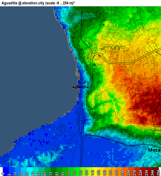
Below is the Elevation map of Aguadilla, which displays elevation range with different colors. Scale of the first map is from -8 to 254 m (-26 to 833 ft) with average elevation of 91.9 meters (=302 ft) [note 1]
These maps also provides idea of topography and contour of this city, they are displayed at different zoom levels. More info about maps, scale and edge coordinates you can find below images.
| \ | Map #1 | Map #2 | Topo.Map |
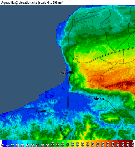
| Scale [m] | -8..254 m | -8..296 m | × |
| Scale [ft] | -26..833 ft | -26..971 ft | × |
| Average | 91.9 m = 302 ft | 90.1 m = 296 ft | × |
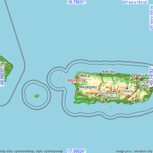
| Width | 9.27 km = 5.8 mi | 18.54 km = 11.5 mi | 296.7 km = 184.4 mi |
| Height | 9.27 km = 5.8 mi | 18.54 km = 11.5 mi | 296.7 km = 184.4 mi |
| ↑Max Latitude | 18.469137° | 18.510814° | 19.75631° |
| Latitude at center | 18.42745° | 18.42745° | 18.42745° |
| ↓Min Latitude | 18.385753° | 18.344046° | 17.08824° |
| ← Min Longitude | -67.198015° | -67.241961° | -68.56032° |
| Longitude center | -67.15407° | -67.15407° | -67.15407° |
| →Max Longitude | -67.110125° | -67.066179° | -65.74782° |
Nearby cities:
Cities around Aguadilla sort by population:
• Isabela elevation 76 m
15.9 km,  59°
59°
• Moca 49 m
5.6 km,  130°
130°
• Aguada 20 m
6.4 km,  214°
214°
• Caban 173 m
2.6 km,  47°
47°
• Luyando 39 m
7 km,  182°
182°
• San Antonio 69 m
9.3 km,  39°
39°
• Mora 138 m
13.4 km,  72°
72°
• Las Marias 14 m
14.9 km, 176°
• Aceitunas 184 m
9.6 km,  79°
79°
• Rafael Hernandez 109 m
9.3 km, 58°
• Rincón 15 m
14 km,  226°
226°
• Stella 8 m
15.3 km,  219°
219°
Multilingual:
 En español:
Aguadilla elevación 7 m.
 En France:
Aguadilla élévation 7 m.


Sources and notes:
- [note 1] Map square and city borders are not equal. Map elevation data is calculated only from area inside that square.
- [src 1] Elevation data from geonames database provided with same terms of usage.
- [src 2] The elevation map of Aguadilla is generated using elevation data from NASA's 3 arcsec (90m) resolution SRTM data.
- [src 3] Base (background) map © OpenStreetMap contributors tiles are generated by Geofabrik and OpenTopoMap.
Copyright & License:
This Aguadilla Elevation Map is licensed under CC BY-SA. You may reuse any part from this page, if you give a proper credit by linking to this URL:
 More info on terms of use page.