San Sebastián elevation
San Sebastián, Puerto Rico elevation is 83 meters and San Sebastián elevation in feet is 272 ft above sea level [src 1]. San Sebastián is a seat of a first-order administrative division (feature code) with elevation that is 17 meters (56 ft) smaller than average city elevation in Puerto Rico.
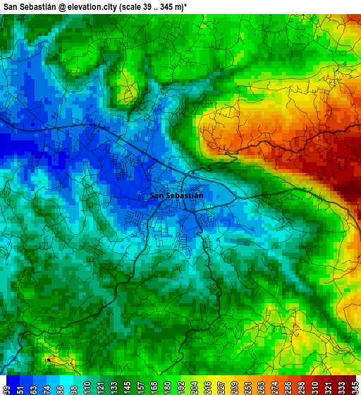
Below is the Elevation map of San Sebastián, which displays elevation range with different colors. Scale of the first map is from 39 to 345 m (128 to 1132 ft) with average elevation of 149.3 meters (=490 ft) [note 1]
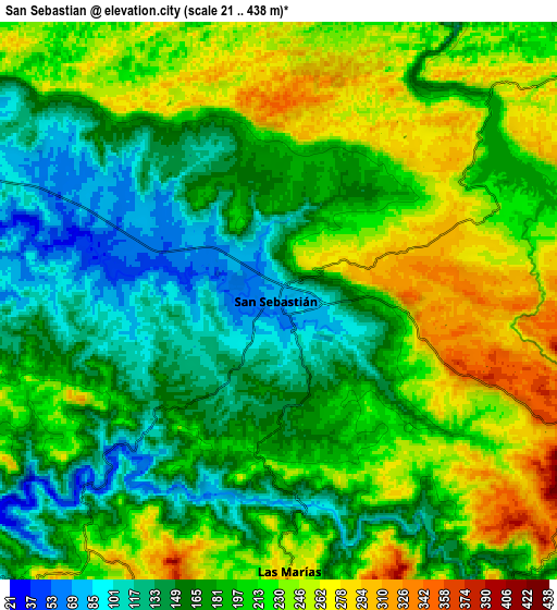
These maps also provides idea of topography and contour of this city, they are displayed at different zoom levels. More info about maps, scale and edge coordinates you can find below images.
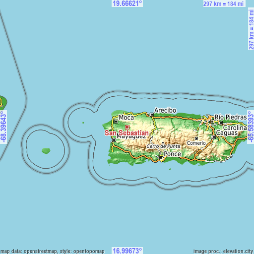
| \ | Map #1 | Map #2 | Topo.Map |
| Scale [m] | 39..345 m | 21..438 m | × |
| Scale [ft] | 128..1132 ft | 69..1437 ft | × |
| Average | 149.3 m = 490 ft | 195.6 m = 642 ft | × |
| Width | 9.28 km = 5.8 mi | 18.55 km = 11.5 mi | 296.8 km = 184.4 mi |
| Height | 9.28 km = 5.8 mi | 18.55 km = 11.5 mi | 296.8 km = 184.4 mi |
| ↑Max Latitude | 18.378329° | 18.420028° | 19.66621° |
| Latitude at center | 18.33662° | 18.33662° | 18.33662° |
| ↓Min Latitude | 18.294901° | 18.253172° | 16.99673° |
| ← Min Longitude | -67.034125° | -67.078071° | -68.39643° |
| Longitude center | -66.99018° | -66.99018° | -66.99018° |
| →Max Longitude | -66.946235° | -66.902289° | -65.58393° |
Nearby cities:
Cities around San Sebastián sort by population:
• Lares elevation 349 m
12.8 km,  111°
111°
• Quebradillas 119 m
16.2 km,  19°
19°
• Moca 49 m
14.5 km,  296°
296°
• Cacao 241 m
12.4 km,  26°
26°
• Piedra Gorda 180 m
15.3 km,  44°
44°
• Mora 138 m
14.8 km,  342°
342°
• Aceitunas 184 m
14.2 km,  326°
326°
• Espino 27 m
15.2 km,  243°
243°
• San Antonio 164 m
13.5 km, 18°
• Juncal 359 m
7.9 km, 108°
• Quebrada 311 m
16.8 km,  82°
82°
• Las Marías 300 m
9.4 km,  181°
181°
Multilingual:
 En español:
San Sebastián elevación 83 m.
 En France:
San Sebastián élévation 83 m.
 Auf Deutsch:
San Sebastián höhe über dem Meeresspiegel ist 83 m.

Sources and notes:
- [note 1] Map square and city borders are not equal. Map elevation data is calculated only from area inside that square.
- [src 1] Elevation data from geonames database provided with same terms of usage.
- [src 2] The elevation map of San Sebastián is generated using elevation data from NASA's 3 arcsec (90m) resolution SRTM data.
- [src 3] Base (background) map © OpenStreetMap contributors tiles are generated by Geofabrik and OpenTopoMap.
Copyright & License:
This San Sebastián Elevation Map is licensed under CC BY-SA. You may reuse any part from this page, if you give a proper credit by linking to this URL:
 More info on terms of use page.