Manatí elevation
Manatí, Puerto Rico elevation is 33 meters and Manatí elevation in feet is 108 ft above sea level [src 1]. Manatí is a seat of a first-order administrative division (feature code) with elevation that is 67 meters (220 ft) smaller than average city elevation in Puerto Rico.
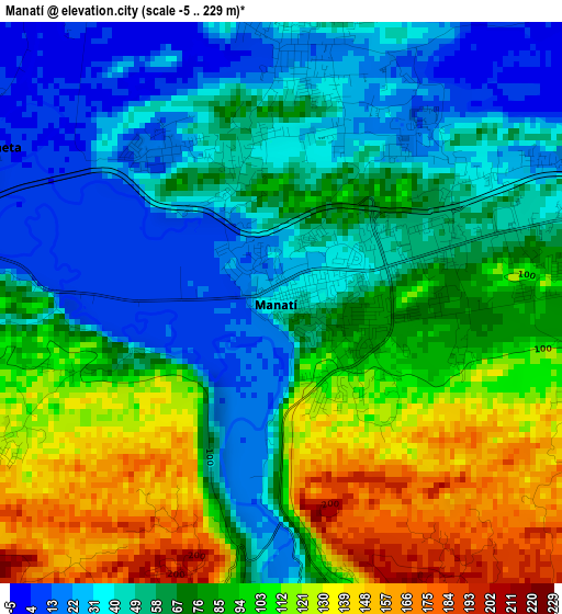
Below is the Elevation map of Manatí, which displays elevation range with different colors. Scale of the first map is from -5 to 229 m (-16 to 751 ft) with average elevation of 73.5 meters (=241 ft) [note 1]
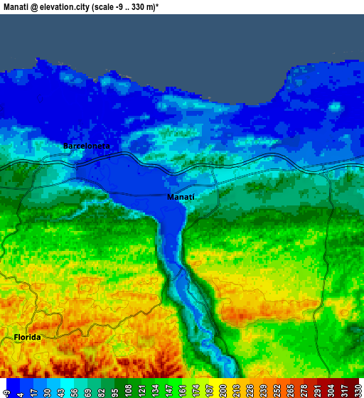
These maps also provides idea of topography and contour of this city, they are displayed at different zoom levels. More info about maps, scale and edge coordinates you can find below images.
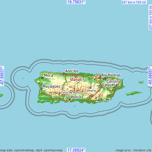
| \ | Map #1 | Map #2 | Topo.Map |
| Scale [m] | -5..229 m | -9..330 m | × |
| Scale [ft] | -16..751 ft | -30..1083 ft | × |
| Average | 73.5 m = 241 ft | 105.8 m = 347 ft | × |
| Width | 9.27 km = 5.8 mi | 18.54 km = 11.5 mi | 296.7 km = 184.4 mi |
| Height | 9.27 km = 5.8 mi | 18.54 km = 11.5 mi | 296.7 km = 184.4 mi |
| ↑Max Latitude | 18.469137° | 18.510814° | 19.75631° |
| Latitude at center | 18.42745° | 18.42745° | 18.42745° |
| ↓Min Latitude | 18.385753° | 18.344046° | 17.08824° |
| ← Min Longitude | -66.536065° | -66.580011° | -67.89837° |
| Longitude center | -66.49212° | -66.49212° | -66.49212° |
| →Max Longitude | -66.448175° | -66.404229° | -65.08587° |
Nearby cities:
Cities around Manatí sort by population:
• Vega Baja elevation 12 m
11.2 km,  80°
80°
• Barceloneta 9 m
5.5 km,  297°
297°
• Estancias de Florida 200 m
10.6 km,  230°
230°
• Florida 193 m
10.3 km, 225°
• Ciales 93 m
10.5 km,  166°
166°
• Imbery 57 m
6.4 km,  279°
279°
• La Luisa 17 m
3 km,  321°
321°
• Barahona 166 m
9.8 km,  149°
149°
• Tierras Nuevas Poniente 25 m
3.8 km,  5°
5°
• Coto Norte 81 m
5.5 km,  86°
86°
• Garrochales 17 m
8.3 km,  290°
290°
• Bufalo 135 m
8.6 km,  263°
263°
Multilingual:
 En español:
Manatí elevación 33 m.
 En France:
Manatí élévation 33 m.


Sources and notes:
- [note 1] Map square and city borders are not equal. Map elevation data is calculated only from area inside that square.
- [src 1] Elevation data from geonames database provided with same terms of usage.
- [src 2] The elevation map of Manatí is generated using elevation data from NASA's 3 arcsec (90m) resolution SRTM data.
- [src 3] Base (background) map © OpenStreetMap contributors tiles are generated by Geofabrik and OpenTopoMap.
Copyright & License:
This Manatí Elevation Map is licensed under CC BY-SA. You may reuse any part from this page, if you give a proper credit by linking to this URL:
 More info on terms of use page.