Villalba elevation
Villalba, Puerto Rico elevation is 159 meters and Villalba elevation in feet is 522 ft above sea level [src 1]. Villalba is a seat of a first-order administrative division (feature code) with elevation that is 59 meters (194 ft) bigger than average city elevation in Puerto Rico.
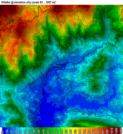
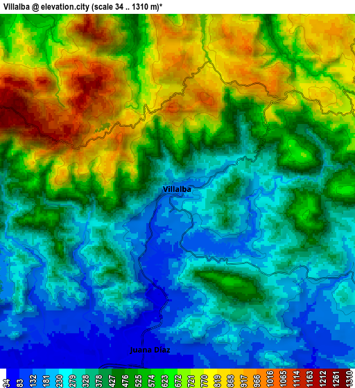
Below is the Elevation map of Villalba, which displays elevation range with different colors. Scale of the first map is from 83 to 1097 m (272 to 3599 ft) with average elevation of 411.4 meters (=1350 ft) [note 1]
These maps also provides idea of topography and contour of this city, they are displayed at different zoom levels. More info about maps, scale and edge coordinates you can find below images.
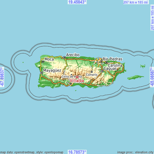
| \ | Map #1 | Map #2 | Topo.Map |
| Scale [m] | 83..1097 m | 34..1310 m | × |
| Scale [ft] | 272..3599 ft | 112..4298 ft | × |
| Average | 411.4 m = 1350 ft | 481 m = 1578 ft | × |
| Width | 9.29 km = 5.8 mi | 18.58 km = 11.5 mi | 297.2 km = 184.7 mi |
| Height | 9.29 km = 5.8 mi | 18.57 km = 11.5 mi | 297.2 km = 184.7 mi |
| ↑Max Latitude | 18.168939° | 18.210689° | 19.45843° |
| Latitude at center | 18.12718° | 18.12718° | 18.12718° |
| ↓Min Latitude | 18.085411° | 18.043632° | 16.78573° |
| ← Min Longitude | -66.536065° | -66.580011° | -67.89837° |
| Longitude center | -66.49212° | -66.49212° | -66.49212° |
| →Max Longitude | -66.448175° | -66.404229° | -65.08587° |
Nearby cities:
Cities around Villalba sort by population:
• Coamo elevation 126 m
15.1 km,  110°
110°
• Juana Díaz 50 m
8.4 km,  190°
190°
• Aguilita 29 m
12.4 km,  201°
201°
• Potala Pastillo 4 m
15.1 km,  181°
181°
• Coto Laurel 71 m
10.6 km,  215°
215°
• Jayuya 441 m
14.6 km,  314°
314°
• Luis Llorens Torres 81 m
8.6 km,  205°
205°
• Capitanejo 19 m
13.3 km, 199°
• Guayabal 79 m
5.2 km, 190°
• Los Llanos 140 m
12.1 km,  131°
131°
• Las Ollas 64 m
12.7 km,  145°
145°
• Río Cañas Abajo 72 m
10.2 km,  165°
165°
Multilingual:
 En español:
Villalba elevación 159 m.
 En France:
Villalba élévation 159 m.
 Auf Deutsch:
Villalba höhe über dem Meeresspiegel ist 159 m.

Sources and notes:
- [note 1] Map square and city borders are not equal. Map elevation data is calculated only from area inside that square.
- [src 1] Elevation data from geonames database provided with same terms of usage.
- [src 2] The elevation map of Villalba is generated using elevation data from NASA's 3 arcsec (90m) resolution SRTM data.
- [src 3] Base (background) map © OpenStreetMap contributors tiles are generated by Geofabrik and OpenTopoMap.
Copyright & License:
This Villalba Elevation Map is licensed under CC BY-SA. You may reuse any part from this page, if you give a proper credit by linking to this URL:
 More info on terms of use page.