Jayuya elevation
Jayuya, Puerto Rico elevation is 441 meters and Jayuya elevation in feet is 1447 ft above sea level [src 1]. Jayuya is a seat of a first-order administrative division (feature code) with elevation that is 341 meters (1119 ft) bigger than average city elevation in Puerto Rico.
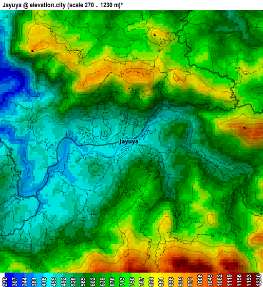
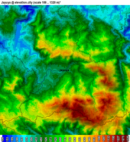
Below is the Elevation map of Jayuya, which displays elevation range with different colors. Scale of the first map is from 270 to 1230 m (886 to 4035 ft) with average elevation of 647.2 meters (=2123 ft) [note 1]
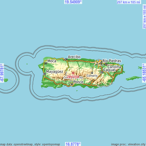
These maps also provides idea of topography and contour of this city, they are displayed at different zoom levels. More info about maps, scale and edge coordinates you can find below images.
| \ | Map #1 | Map #2 | Topo.Map |
| Scale [m] | 270..1230 m | 106..1320 m | × |
| Scale [ft] | 886..4035 ft | 348..4331 ft | × |
| Average | 647.2 m = 2123 ft | 621.3 m = 2038 ft | × |
| Width | 9.28 km = 5.8 mi | 18.57 km = 11.5 mi | 297 km = 184.5 mi |
| Height | 9.28 km = 5.8 mi | 18.57 km = 11.5 mi | 297 km = 184.5 mi |
| ↑Max Latitude | 18.260307° | 18.302035° | 19.54909° |
| Latitude at center | 18.21857° | 18.21857° | 18.21857° |
| ↓Min Latitude | 18.176823° | 18.135065° | 16.8778° |
| ← Min Longitude | -66.635505° | -66.679451° | -67.99781° |
| Longitude center | -66.59156° | -66.59156° | -66.59156° |
| →Max Longitude | -66.547615° | -66.503669° | -65.18531° |
Nearby cities:
Cities around Jayuya sort by population:
• Utuado elevation 145 m
12.6 km,  294°
294°
• Juana Díaz 50 m
20.5 km,  154°
154°
• Estancias de Florida 200 m
16.6 km,  8°
8°
• Florida 193 m
16.3 km, 11°
• Adjuntas 501 m
15.1 km,  245°
245°
• Villalba 159 m
14.6 km,  134°
134°
• Coto Laurel 71 m
19.3 km,  167°
167°
• Luis Llorens Torres 81 m
19.2 km,  159°
159°
• Ciales 93 m
18.4 km,  44°
44°
• Guayabal 79 m
18 km, 147°
• La Alianza 170 m
19.9 km,  356°
356°
• Cayuco 431 m
17.6 km,  297°
297°
Multilingual:
 En español:
Jayuya elevación 441 m.
 En France:
Jayuya élévation 441 m.


Sources and notes:
- [note 1] Map square and city borders are not equal. Map elevation data is calculated only from area inside that square.
- [src 1] Elevation data from geonames database provided with same terms of usage.
- [src 2] The elevation map of Jayuya is generated using elevation data from NASA's 3 arcsec (90m) resolution SRTM data.
- [src 3] Base (background) map © OpenStreetMap contributors tiles are generated by Geofabrik and OpenTopoMap.
Copyright & License:
This Jayuya Elevation Map is licensed under CC BY-SA. You may reuse any part from this page, if you give a proper credit by linking to this URL:
 More info on terms of use page.