Candelaria elevation
Candelaria (Toa Baja, Candelaria Barrio), Puerto Rico elevation is 74 meters and Candelaria elevation in feet is 243 ft above sea level [src 1]. Candelaria is a populated place (feature code) with elevation that is 26 meters (85 ft) smaller than average city elevation in Puerto Rico.
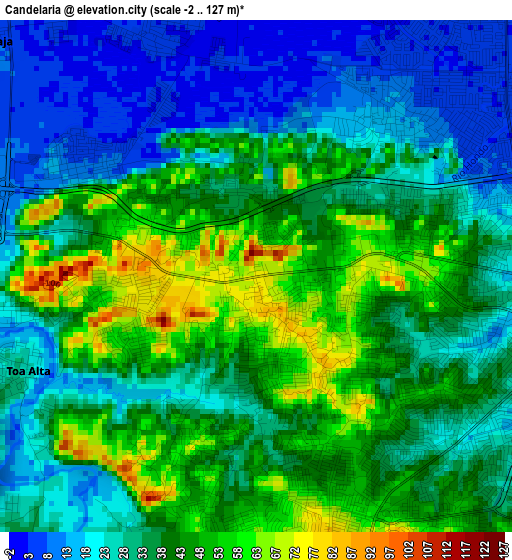
Below is the Elevation map of Candelaria, which displays elevation range with different colors. Scale of the first map is from -2 to 127 m (-7 to 417 ft) with average elevation of 35.3 meters (=116 ft) [note 1]
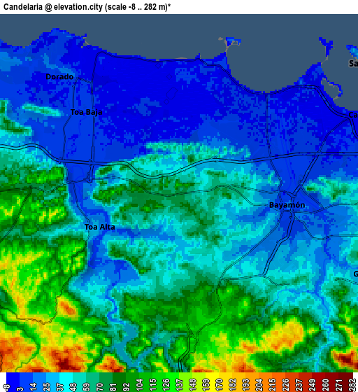
These maps also provides idea of topography and contour of this city, they are displayed at different zoom levels. More info about maps, scale and edge coordinates you can find below images.
| \ | Map #1 | Map #2 | Topo.Map |
| Scale [m] | -2..127 m | -8..282 m | × |
| Scale [ft] | -7..417 ft | -26..925 ft | × |
| Average | 35.3 m = 116 ft | 55.4 m = 182 ft | × |
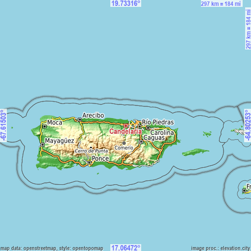
| Width | 9.27 km = 5.8 mi | 18.55 km = 11.5 mi | 296.7 km = 184.4 mi |
| Height | 9.27 km = 5.8 mi | 18.55 km = 11.5 mi | 296.7 km = 184.4 mi |
| ↑Max Latitude | 18.445803° | 18.487485° | 19.73316° |
| Latitude at center | 18.40411° | 18.40411° | 18.40411° |
| ↓Min Latitude | 18.362407° | 18.320695° | 17.06472° |
| ← Min Longitude | -66.252725° | -66.296671° | -67.61503° |
| Longitude center | -66.20878° | -66.20878° | -66.20878° |
| →Max Longitude | -66.164835° | -66.120889° | -64.80253° |
Nearby cities:
Cities around Candelaria sort by population:
• Bayamón elevation 20 m
5.6 km,  96°
96°
• Levittown 3 m
5.9 km,  29°
29°
• Pájaros 53 m
4 km,  192°
192°
• Campanilla 8 m
3.5 km,  302°
302°
• Sabana Seca 16 m
3.6 km,  45°
45°
• Candelaria Arenas 36 m
1.7 km,  327°
327°
• Ingenio 5 m
4.6 km,  336°
336°
• Toa Alta 25 m
4.5 km,  247°
247°
• San José 18 m
5 km,  262°
262°
• Río Lajas 136 m
6.3 km, 260°
• Toa Baja 6 m
6.9 km,  309°
309°
• Mucarabones 35 m
1.7 km,  207°
207°
Multilingual:
 En español:
Candelaria elevación 74 m.
 En France:
Candelaria élévation 74 m.
 Auf Deutsch:
Candelaria höhe über dem Meeresspiegel ist 74 m.

Sources and notes:
- [note 1] Map square and city borders are not equal. Map elevation data is calculated only from area inside that square.
- [src 1] Elevation data from geonames database provided with same terms of usage.
- [src 2] The elevation map of Candelaria is generated using elevation data from NASA's 3 arcsec (90m) resolution SRTM data.
- [src 3] Base (background) map © OpenStreetMap contributors tiles are generated by Geofabrik and OpenTopoMap.
Copyright & License:
This Candelaria Elevation Map is licensed under CC BY-SA. You may reuse any part from this page, if you give a proper credit by linking to this URL:
 More info on terms of use page.