San Lorenzo elevation
San Lorenzo, Puerto Rico elevation is 97 meters and San Lorenzo elevation in feet is 318 ft above sea level [src 1]. San Lorenzo is a seat of a first-order administrative division (feature code) with elevation that is 3 meters (10 ft) smaller than average city elevation in Puerto Rico.
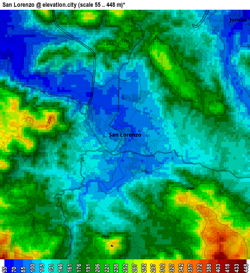
Below is the Elevation map of San Lorenzo, which displays elevation range with different colors. Scale of the first map is from 55 to 448 m (180 to 1470 ft) with average elevation of 161.8 meters (=531 ft) [note 1]
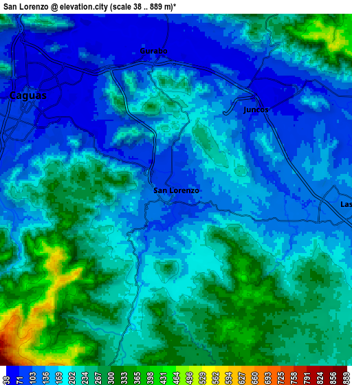
These maps also provides idea of topography and contour of this city, they are displayed at different zoom levels. More info about maps, scale and edge coordinates you can find below images.
| \ | Map #1 | Map #2 | Topo.Map |
| Scale [m] | 55..448 m | 38..889 m | × |
| Scale [ft] | 180..1470 ft | 125..2917 ft | × |
| Average | 161.8 m = 531 ft | 194.8 m = 639 ft | × |
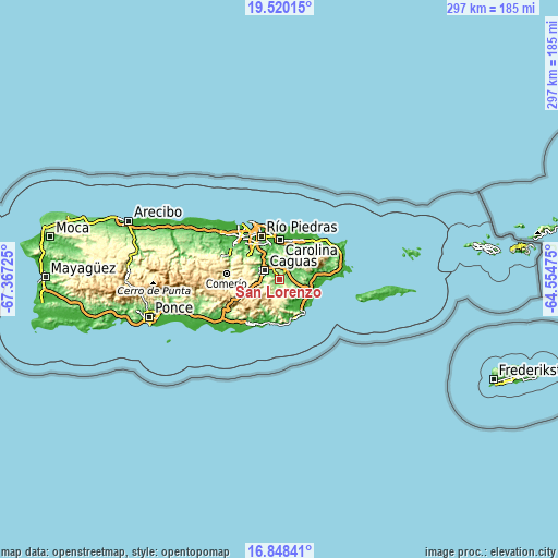
| Width | 9.28 km = 5.8 mi | 18.57 km = 11.5 mi | 297.1 km = 184.6 mi |
| Height | 9.28 km = 5.8 mi | 18.57 km = 11.5 mi | 297.1 km = 184.6 mi |
| ↑Max Latitude | 18.231144° | 18.272879° | 19.52015° |
| Latitude at center | 18.1894° | 18.1894° | 18.1894° |
| ↓Min Latitude | 18.147646° | 18.105881° | 16.84841° |
| ← Min Longitude | -66.004945° | -66.048891° | -67.36725° |
| Longitude center | -65.961° | -65.961° | -65.961° |
| →Max Longitude | -65.917055° | -65.873109° | -64.55475° |
Nearby cities:
Cities around San Lorenzo sort by population:
• Caguas elevation 65 m
10.5 km,  298°
298°
• Gurabo 68 m
7.3 km,  350°
350°
• Juncos 68 m
6 km,  44°
44°
• Las Piedras 136 m
10 km,  94°
94°
• Celada 84 m
9.2 km,  356°
356°
• La Fermina 130 m
11.5 km,  97°
97°
• Bairoa 64 m
11.4 km,  312°
312°
• El Mangó 93 m
9.9 km,  59°
59°
• Pueblito del Rio 83 m
11.2 km,  67°
67°
• Jagual 208 m
4.8 km,  229°
229°
• Benitez 400 m
12.7 km, 42°
• Boqueron 102 m
12.1 km,  80°
80°
Multilingual:
 En español:
San Lorenzo elevación 97 m.
 En France:
San Lorenzo élévation 97 m.
 Auf Deutsch:
San Lorenzo höhe über dem Meeresspiegel ist 97 m.

Sources and notes:
- [note 1] Map square and city borders are not equal. Map elevation data is calculated only from area inside that square.
- [src 1] Elevation data from geonames database provided with same terms of usage.
- [src 2] The elevation map of San Lorenzo is generated using elevation data from NASA's 3 arcsec (90m) resolution SRTM data.
- [src 3] Base (background) map © OpenStreetMap contributors tiles are generated by Geofabrik and OpenTopoMap.
Copyright & License:
This San Lorenzo Elevation Map is licensed under CC BY-SA. You may reuse any part from this page, if you give a proper credit by linking to this URL:
 More info on terms of use page.