Cidra elevation
Cidra, Puerto Rico elevation is 426 meters and Cidra elevation in feet is 1398 ft above sea level [src 1]. Cidra is a seat of a first-order administrative division (feature code) with elevation that is 326 meters (1070 ft) bigger than average city elevation in Puerto Rico.
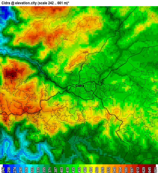
Below is the Elevation map of Cidra, which displays elevation range with different colors. Scale of the first map is from 242 to 661 m (794 to 2169 ft) with average elevation of 444.7 meters (=1459 ft) [note 1]
These maps also provides idea of topography and contour of this city, they are displayed at different zoom levels. More info about maps, scale and edge coordinates you can find below images.
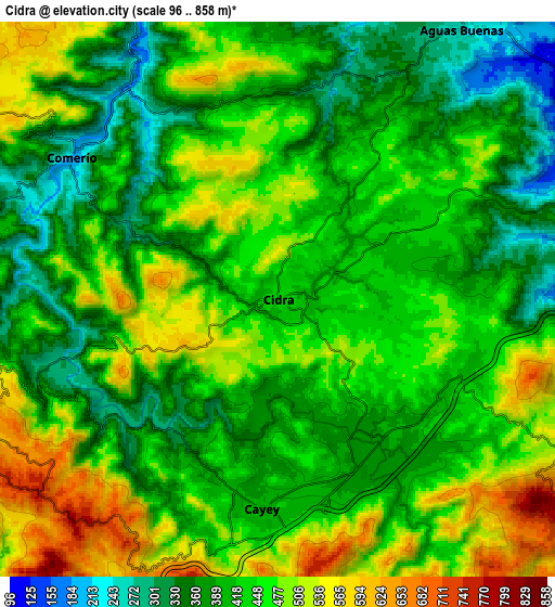
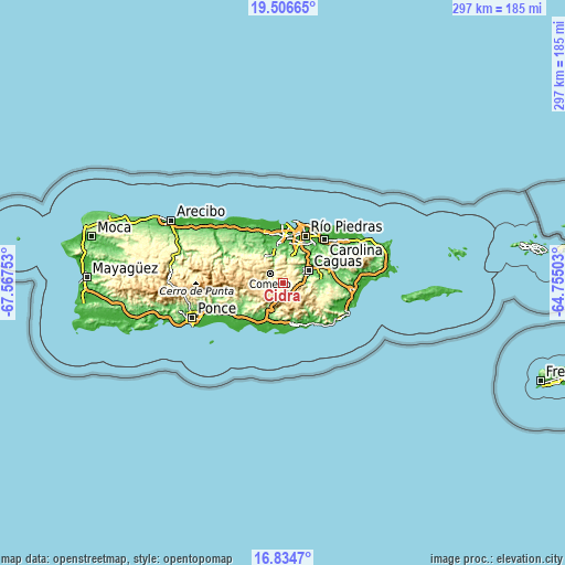
| \ | Map #1 | Map #2 | Topo.Map |
| Scale [m] | 242..661 m | 96..858 m | × |
| Scale [ft] | 794..2169 ft | 315..2815 ft | × |
| Average | 444.7 m = 1459 ft | 436.1 m = 1431 ft | × |
| Width | 9.28 km = 5.8 mi | 18.57 km = 11.5 mi | 297.1 km = 184.6 mi |
| Height | 9.28 km = 5.8 mi | 18.57 km = 11.5 mi | 297.1 km = 184.6 mi |
| ↑Max Latitude | 18.217538° | 18.259275° | 19.50665° |
| Latitude at center | 18.17579° | 18.17579° | 18.17579° |
| ↓Min Latitude | 18.134032° | 18.092265° | 16.8347° |
| ← Min Longitude | -66.205225° | -66.249171° | -67.56753° |
| Longitude center | -66.16128° | -66.16128° | -66.16128° |
| →Max Longitude | -66.117335° | -66.073389° | -64.75503° |
Nearby cities:
Cities around Cidra sort by population:
• Cayey elevation 397 m
7.1 km,  184°
184°
• Aibonito 607 m
11.8 km,  250°
250°
• Comerío 202 m
8.3 km,  304°
304°
• Aguas Buenas 259 m
10.9 km,  34°
34°
• G. L. Garcia 443 m
8.1 km,  131°
131°
• Palomas 597 m
11.8 km, 302°
• Bayamon 445 m
5.1 km,  87°
87°
• Parcelas Nuevas 424 m
4.1 km,  196°
196°
• Pastos 655 m
12.2 km,  237°
237°
• Parcelas La Milagrosa 552 m
2.9 km,  258°
258°
• Sumidero 450 m
5.9 km,  35°
35°
• Santa Clara 450 m
5.9 km, 35°
Multilingual:
 En español:
Cidra elevación 426 m.
 En France:
Cidra élévation 426 m.


Sources and notes:
- [note 1] Map square and city borders are not equal. Map elevation data is calculated only from area inside that square.
- [src 1] Elevation data from geonames database provided with same terms of usage.
- [src 2] The elevation map of Cidra is generated using elevation data from NASA's 3 arcsec (90m) resolution SRTM data.
- [src 3] Base (background) map © OpenStreetMap contributors tiles are generated by Geofabrik and OpenTopoMap.
Copyright & License:
This Cidra Elevation Map is licensed under CC BY-SA. You may reuse any part from this page, if you give a proper credit by linking to this URL:
 More info on terms of use page.