Akron elevation
Akron (Indiana, Fulton County), United States elevation is 261 meters and Akron elevation in feet is 856 ft above sea level [src 1]. Akron is a populated place (feature code) with elevation that is 18 meters (59 ft) smaller than average city elevation in United States.
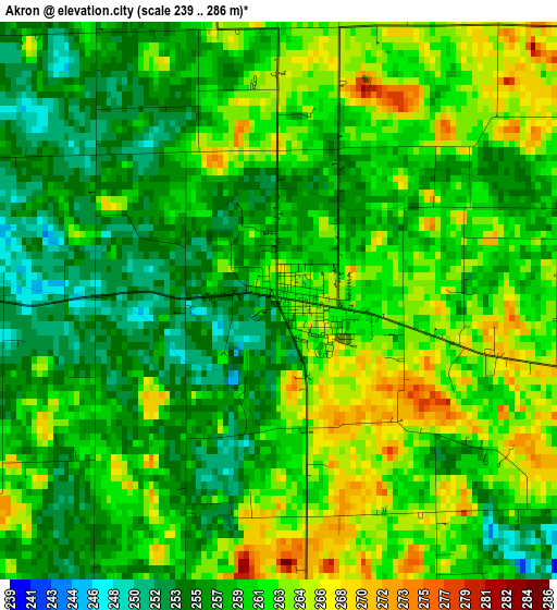
Below is the Elevation map of Akron, which displays elevation range with different colors. Scale of the first map is from 239 to 286 m (784 to 938 ft) with average elevation of 259.7 meters (=852 ft) [note 1]
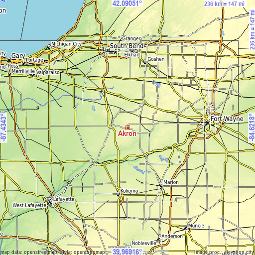
These maps also provides idea of topography and contour of this city, they are displayed at different zoom levels. More info about maps, scale and edge coordinates you can find below images.
| \ | Map #1 | Topo.Map |
| Scale [m] | 239..286 m | × |
| Scale [ft] | 784..938 ft | × |
| Average | 259.7 m = 852 ft | × |
| Width | 7.37 km = 4.6 mi | 235.9 km = 146.6 mi |
| Height | 7.37 km = 4.6 mi | 235.9 km = 146.6 mi |
| ↑Max Latitude | 41.071518° | 42.09051° |
| Latitude at center | 41.03838° | 41.03838° |
| ↓Min Latitude | 41.005225° | 39.96916° |
| ← Min Longitude | -86.071995° | -87.4343° |
| Longitude center | -86.02805° | -86.02805° |
| →Max Longitude | -85.984105° | -84.6218° |
Nearby cities:
Cities around Akron sort by population:
• Warsaw elevation 251 m
26.6 km,  33°
33°
• Peru 203 m
31.8 km,  186°
186°
• Wabash 216 m
31.9 km,  146°
146°
• Rochester 239 m
16 km,  280°
280°
• North Manchester 240 m
22.2 km,  100°
100°
• Winona Lake 253 m
27.2 km,  39°
39°
• Bourbon 258 m
29.5 km,  345°
345°
• South Whitley 246 m
33.9 km,  81°
81°
• Argos 246 m
27.1 km,  324°
324°
• Culver 236 m
38.7 km,  301°
301°
• Andrews 223 m
40.8 km,  118°
118°
• Pierceton 281 m
32.5 km,  56°
56°
Multilingual:
 En español:
Akron elevación 261 m.
 En France:
Akron élévation 261 m.


Sources and notes:
- [note 1] Map square and city borders are not equal. Map elevation data is calculated only from area inside that square.
- [src 1] Elevation data from geonames database provided with same terms of usage.
- [src 2] The elevation map of Akron is generated using elevation data from NASA's 3 arcsec (90m) resolution SRTM data.
- [src 3] Base (background) map © OpenStreetMap contributors tiles are generated by Geofabrik and OpenTopoMap.
Copyright & License:
This Akron Elevation Map is licensed under CC BY-SA. You may reuse any part from this page, if you give a proper credit by linking to this URL:
 More info on terms of use page.