Bourbon elevation
Bourbon (Indiana, Marshall County), United States elevation is 258 meters and Bourbon elevation in feet is 846 ft above sea level [src 1]. Bourbon is a populated place (feature code) with elevation that is 21 meters (69 ft) smaller than average city elevation in United States.
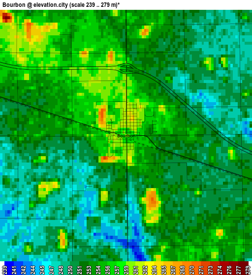
Below is the Elevation map of Bourbon, which displays elevation range with different colors. Scale of the first map is from 239 to 279 m (784 to 915 ft) with average elevation of 252.5 meters (=828 ft) [note 1]
These maps also provides idea of topography and contour of this city, they are displayed at different zoom levels. More info about maps, scale and edge coordinates you can find below images.
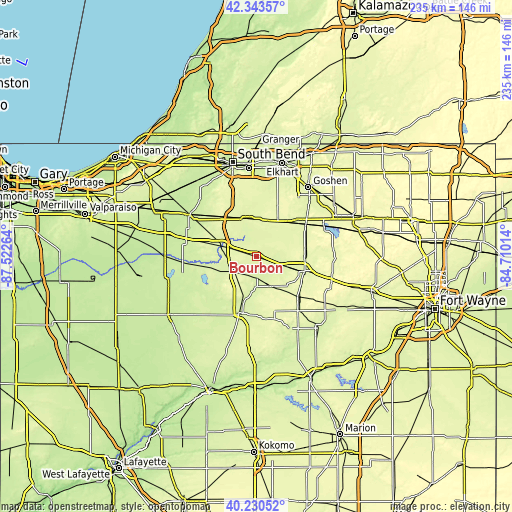
| \ | Map #1 | Topo.Map |
| Scale [m] | 239..279 m | × |
| Scale [ft] | 784..915 ft | × |
| Average | 252.5 m = 828 ft | × |
| Width | 7.34 km = 4.6 mi | 234.9 km = 146 mi |
| Height | 7.34 km = 4.6 mi | 234.9 km = 146 mi |
| ↑Max Latitude | 41.328608° | 42.34357° |
| Latitude at center | 41.2956° | 41.2956° |
| ↓Min Latitude | 41.262575° | 40.23052° |
| ← Min Longitude | -86.160335° | -87.52264° |
| Longitude center | -86.11639° | -86.11639° |
| →Max Longitude | -86.072445° | -84.71014° |
Nearby cities:
Cities around Bourbon sort by population:
• Warsaw elevation 251 m
22.9 km,  106°
106°
• Plymouth 246 m
17 km,  288°
288°
• Nappanee 268 m
19 km,  30°
30°
• Rochester 239 m
27 km,  197°
197°
• Winona Lake 253 m
25.8 km, 107°
• Bremen 261 m
17 km,  351°
351°
• Wakarusa 259 m
27.9 km,  16°
16°
• Argos 246 m
10.4 km,  231°
231°
• Milford 255 m
25.9 km,  60°
60°
• New Paris 250 m
33.1 km,  46°
46°
• Culver 236 m
27 km,  251°
251°
• Akron 261 m
29.5 km,  165°
165°
Multilingual:
 En español:
Bourbon elevación 258 m.
 En France:
Bourbon élévation 258 m.


Sources and notes:
- [note 1] Map square and city borders are not equal. Map elevation data is calculated only from area inside that square.
- [src 1] Elevation data from geonames database provided with same terms of usage.
- [src 2] The elevation map of Bourbon is generated using elevation data from NASA's 3 arcsec (90m) resolution SRTM data.
- [src 3] Base (background) map © OpenStreetMap contributors tiles are generated by Geofabrik and OpenTopoMap.
Copyright & License:
This Bourbon Elevation Map is licensed under CC BY-SA. You may reuse any part from this page, if you give a proper credit by linking to this URL:
 More info on terms of use page.