Atlantic elevation
Atlantic (Iowa, Cass County), United States elevation is 372 meters and Atlantic elevation in feet is 1220 ft above sea level [src 1]. Atlantic is a seat of a second-order administrative division (feature code) with elevation that is 93 meters (305 ft) bigger than average city elevation in United States.
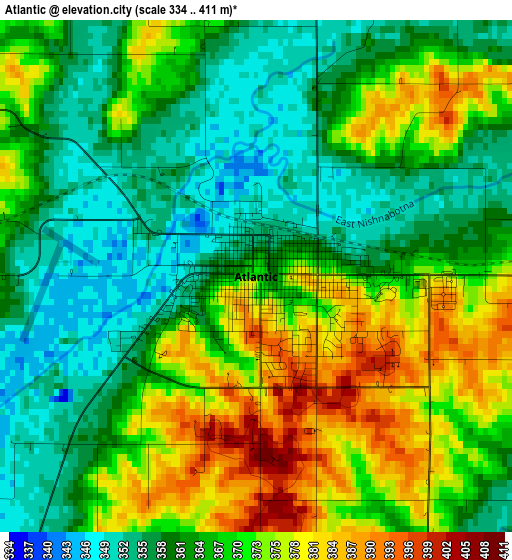
Below is the Elevation map of Atlantic, which displays elevation range with different colors. Scale of the first map is from 334 to 411 m (1096 to 1348 ft) with average elevation of 366.2 meters (=1201 ft) [note 1]
These maps also provides idea of topography and contour of this city, they are displayed at different zoom levels. More info about maps, scale and edge coordinates you can find below images.
| \ | Map #1 | Map #2 | Topo.Map |
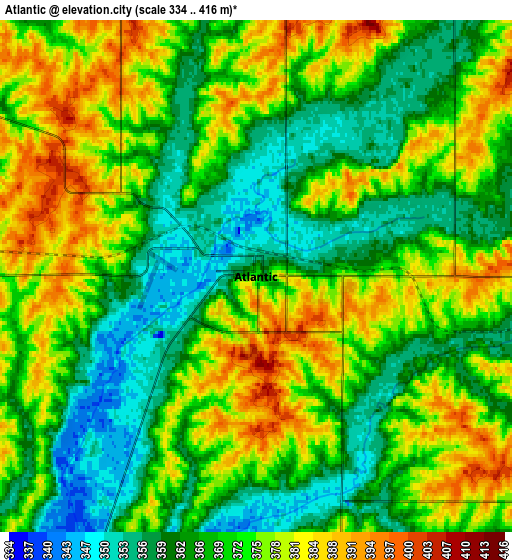
| Scale [m] | 334..411 m | 334..416 m | × |
| Scale [ft] | 1096..1348 ft | 1096..1365 ft | × |
| Average | 366.2 m = 1201 ft | 370.8 m = 1217 ft | × |
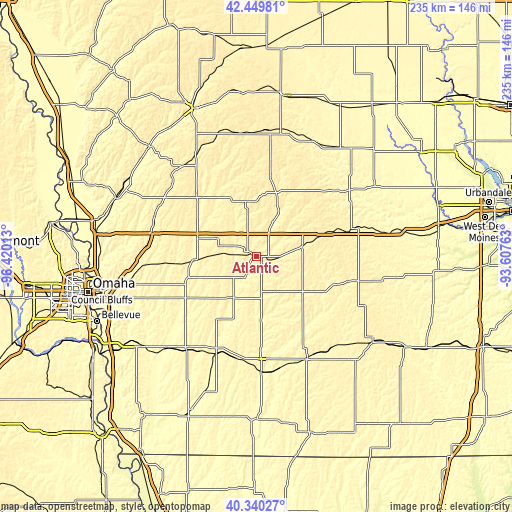
| Width | 7.33 km = 4.6 mi | 14.66 km = 9.1 mi | 234.6 km = 145.8 mi |
| Height | 7.33 km = 4.6 mi | 14.66 km = 9.1 mi | 234.6 km = 145.8 mi |
| ↑Max Latitude | 41.436554° | 41.469491° | 42.44981° |
| Latitude at center | 41.4036° | 41.4036° | 41.4036° |
| ↓Min Latitude | 41.37063° | 41.337642° | 40.34027° |
| ← Min Longitude | -95.057825° | -95.101771° | -96.42013° |
| Longitude center | -95.01388° | -95.01388° | -95.01388° |
| →Max Longitude | -94.969935° | -94.925989° | -93.60763° |
Nearby cities:
Cities around Atlantic sort by population:
• Red Oak elevation 320 m
47.2 km,  202°
202°
• Harlan 385 m
38 km,  316°
316°
• Audubon 397 m
35.6 km,  10°
10°
• Greenfield 417 m
47.4 km,  103°
103°
• Stuart 367 m
59 km,  79°
79°
• Corning 365 m
51.4 km,  153°
153°
• Guthrie Center 339 m
52.3 km,  54°
54°
• Oakland 342 m
33.6 km,  251°
251°
• Avoca 360 m
28.2 km,  286°
286°
• Manning 409 m
56.4 km,  355°
355°
• Coon Rapids 354 m
59 km,  28°
28°
• Villisca 327 m
52.8 km,  176°
176°
Multilingual:
 En español:
Atlantic elevación 372 m.
 En France:
Atlantic élévation 372 m.
 Auf Deutsch:
Atlantic höhe über dem Meeresspiegel ist 372 m.

Sources and notes:
- [note 1] Map square and city borders are not equal. Map elevation data is calculated only from area inside that square.
- [src 1] Elevation data from geonames database provided with same terms of usage.
- [src 2] The elevation map of Atlantic is generated using elevation data from NASA's 3 arcsec (90m) resolution SRTM data.
- [src 3] Base (background) map © OpenStreetMap contributors tiles are generated by Geofabrik and OpenTopoMap.
Copyright & License:
This Atlantic Elevation Map is licensed under CC BY-SA. You may reuse any part from this page, if you give a proper credit by linking to this URL:
 More info on terms of use page.