Ifon elevation
Ifon (Ondo, Ose), Nigeria elevation is 184 meters and Ifon elevation in feet is 604 ft above sea level [src 1]. Ifon is a seat of a second-order administrative division (feature code) with elevation that is 113 meters (371 ft) smaller than average city elevation in Nigeria.
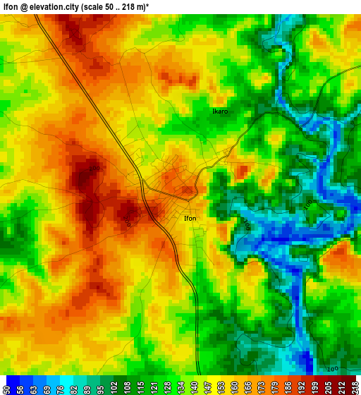
Below is the Elevation map of Ifon, which displays elevation range with different colors. Scale of the first map is from 50 to 218 m (164 to 715 ft) with average elevation of 140.6 meters (=461 ft) [note 1]
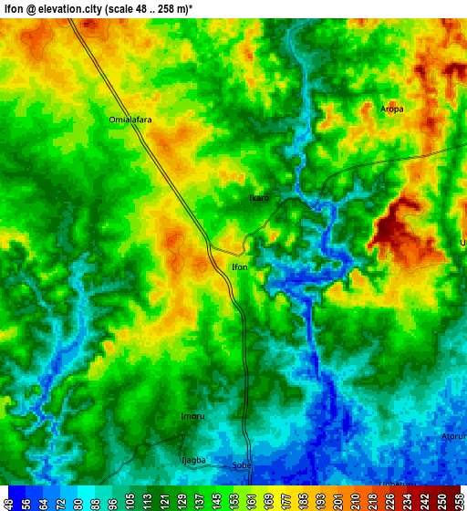
These maps also provides idea of topography and contour of this city, they are displayed at different zoom levels. More info about maps, scale and edge coordinates you can find below images.
| \ | Map #1 | Map #2 | Topo.Map |
| Scale [m] | 50..218 m | 48..258 m | × |
| Scale [ft] | 164..715 ft | 157..846 ft | × |
| Average | 140.6 m = 461 ft | 133.8 m = 439 ft | × |
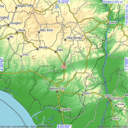
| Width | 9.7 km = 6 mi | 19.4 km = 12.1 mi | 310.4 km = 192.9 mi |
| Height | 9.7 km = 6 mi | 19.4 km = 12.1 mi | 310.4 km = 192.9 mi |
| ↑Max Latitude | 6.973352° | 7.01697° | 8.3235° |
| Latitude at center | 6.92973° | 6.92973° | 6.92973° |
| ↓Min Latitude | 6.886104° | 6.842473° | 5.53182° |
| ← Min Longitude | 5.729735° | 5.685789° | 4.36743° |
| Longitude center | 5.77368° | 5.77368° | 5.77368° |
| →Max Longitude | 5.817625° | 5.861571° | 7.17993° |
Nearby cities:
Cities around Ifon sort by population:
• Owo elevation 348 m
36.1 km,  325°
325°
• Auchi 188 m
56.2 km,  74°
74°
• Ekpoma 364 m
45.5 km,  117°
117°
• Igarra 296 m
54.5 km,  42°
42°
• Iguobazuwa 128 m
61.5 km,  228°
228°
• Isua 357 m
60.2 km,  14°
14°
• Oka 537 m
59.1 km,  3°
3°
• Irrua 398 m
53.7 km,  113°
113°
• Okada 74 m
47.1 km,  242°
242°
• Ehor 245 m
41.9 km,  146°
146°
• Afuze 134 m
30 km,  81°
81°
• Sabongida-Ora 84 m
17.6 km,  99°
99°
Multilingual:
 En español:
Ifon elevación 184 m.
 En France:
Ifon élévation 184 m.


Sources and notes:
- [note 1] Map square and city borders are not equal. Map elevation data is calculated only from area inside that square.
- [src 1] Elevation data from geonames database provided with same terms of usage.
- [src 2] The elevation map of Ifon is generated using elevation data from NASA's 3 arcsec (90m) resolution SRTM data.
- [src 3] Base (background) map © OpenStreetMap contributors tiles are generated by Geofabrik and OpenTopoMap.
Copyright & License:
This Ifon Elevation Map is licensed under CC BY-SA. You may reuse any part from this page, if you give a proper credit by linking to this URL:
 More info on terms of use page.