Tuzantla elevation
Tuzantla (Michoacán), Mexico elevation is 655 meters and Tuzantla elevation in feet is 2149 ft above sea level [src 1]. Tuzantla is a populated place (feature code) with elevation that is 659 meters (2162 ft) smaller than average city elevation in Mexico.
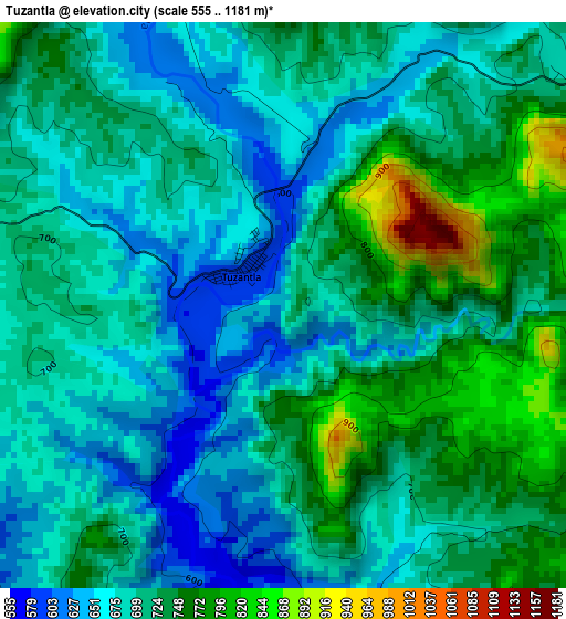
Below is the Elevation map of Tuzantla, which displays elevation range with different colors. Scale of the first map is from 555 to 1181 m (1821 to 3875 ft) with average elevation of 705.9 meters (=2316 ft) [note 1]
These maps also provides idea of topography and contour of this city, they are displayed at different zoom levels. More info about maps, scale and edge coordinates you can find below images.
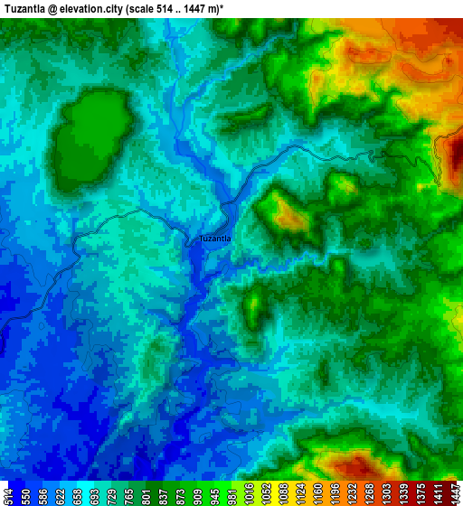
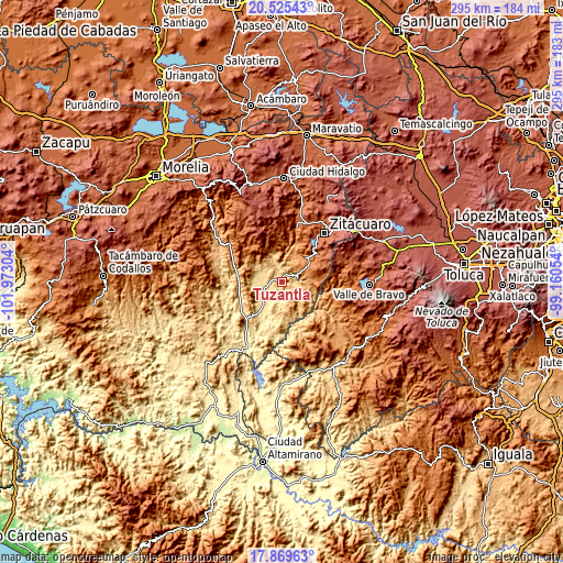
| \ | Map #1 | Map #2 | Topo.Map |
| Scale [m] | 555..1181 m | 514..1447 m | × |
| Scale [ft] | 1821..3875 ft | 1686..4747 ft | × |
| Average | 705.9 m = 2316 ft | 754.9 m = 2477 ft | × |
| Width | 9.23 km = 5.7 mi | 18.46 km = 11.5 mi | 295.3 km = 183.5 mi |
| Height | 9.23 km = 5.7 mi | 18.46 km = 11.5 mi | 295.3 km = 183.5 mi |
| ↑Max Latitude | 19.244385° | 19.285869° | 20.52543° |
| Latitude at center | 19.20289° | 19.20289° | 19.20289° |
| ↓Min Latitude | 19.161385° | 19.119869° | 17.86963° |
| ← Min Longitude | -100.610735° | -100.654681° | -101.97304° |
| Longitude center | -100.56679° | -100.56679° | -100.56679° |
| →Max Longitude | -100.522845° | -100.478899° | -99.16054° |
Nearby cities:
Cities around Tuzantla sort by population:
• Jungapeo de Juárez elevation 1314 m
29.5 km,  14°
14°
• Benito Juárez 1325 m
18.6 km,  48°
48°
• Benito Juárez 1129 m
11 km,  72°
72°
• Parícuaro 1280 m
13.1 km,  60°
60°
• Otzoloapan 1380 m
29.9 km,  108°
108°
• La Encarnación 1733 m
29.6 km,  38°
38°
• Rancho Viejo 1564 m
16.5 km, 71°
• Aputzio de Juárez 2114 m
27.8 km, 56°
• Santa Ana de Guerrero (El Cascabel) 1313 m
15.5 km, 58°
• Cerro Colorado de Ocampo 1245 m
16.6 km, 39°
• Huanguitío 1269 m
23.1 km,  21°
21°
• Susupuato de Guerrero 1257 m
16.7 km,  85°
85°
Multilingual:
 En español:
Tuzantla elevación 655 m.
 En France:
Tuzantla élévation 655 m.
 Auf Deutsch:
Tuzantla höhe über dem Meeresspiegel ist 655 m.

Sources and notes:
- [note 1] Map square and city borders are not equal. Map elevation data is calculated only from area inside that square.
- [src 1] Elevation data from geonames database provided with same terms of usage.
- [src 2] The elevation map of Tuzantla is generated using elevation data from NASA's 3 arcsec (90m) resolution SRTM data.
- [src 3] Base (background) map © OpenStreetMap contributors tiles are generated by Geofabrik and OpenTopoMap.
Copyright & License:
This Tuzantla Elevation Map is licensed under CC BY-SA. You may reuse any part from this page, if you give a proper credit by linking to this URL:
 More info on terms of use page.