La Encarnación elevation
La Encarnación (Michoacán, Zitácuaro), Mexico elevation is 1733 meters and La Encarnación elevation in feet is 5686 ft above sea level [src 1]. La Encarnación is a populated place (feature code) with elevation that is 419 meters (1375 ft) bigger than average city elevation in Mexico.
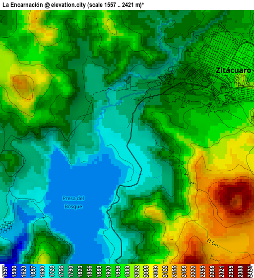
Below is the Elevation map of La Encarnación, which displays elevation range with different colors. Scale of the first map is from 1557 to 2421 m (5108 to 7943 ft) with average elevation of 1883 meters (=6178 ft) [note 1]
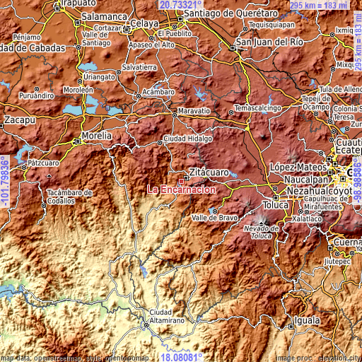
These maps also provides idea of topography and contour of this city, they are displayed at different zoom levels. More info about maps, scale and edge coordinates you can find below images.
| \ | Map #1 | Topo.Map |
| Scale [m] | 1557..2421 m | × |
| Scale [ft] | 5108..7943 ft | × |
| Average | 1883 m = 6178 ft | × |
| Width | 9.22 km = 5.7 mi | 294.9 km = 183.2 mi |
| Height | 9.22 km = 5.7 mi | 294.9 km = 183.2 mi |
| ↑Max Latitude | 19.453862° | 20.73321° |
| Latitude at center | 19.41242° | 19.41242° |
| ↓Min Latitude | 19.370968° | 18.08081° |
| ← Min Longitude | -100.436055° | -101.79836° |
| Longitude center | -100.39211° | -100.39211° |
| →Max Longitude | -100.348165° | -98.98586° |
Nearby cities:
Cities around La Encarnación sort by population:
• Heróica Zitácuaro elevation 1958 m
4.5 km,  54°
54°
• Rincón de Nicolás Romero (Cedros Tercera Manzana) 2325 m
9.9 km,  89°
89°
• San Felipe los Alzati (Colonia Nueva) 1898 m
8.8 km,  12°
12°
• Curungueo 1949 m
7.7 km,  41°
41°
• Colonia Emiliano Zapata (San Juan Zitácuaro) 2193 m
9.9 km,  66°
66°
• Valle Verde 1917 m
7.7 km,  30°
30°
• Aputzio de Juárez 2114 m
9.2 km,  148°
148°
• Rincón de Curungueo 1954 m
9.4 km, 32°
• La Mesa (La Mesa de Cedano) 2156 m
7.9 km,  59°
59°
• Ocurio 1948 m
8.5 km,  337°
337°
• Huanguitío 1269 m
10.1 km,  260°
260°
• Camémbaro 1740 m
1.8 km, 336°
Multilingual:
 En español:
La Encarnación elevación 1733 m.
 En France:
La Encarnación élévation 1733 m.
 Auf Deutsch:
La Encarnación höhe über dem Meeresspiegel ist 1733 m.

Sources and notes:
- [note 1] Map square and city borders are not equal. Map elevation data is calculated only from area inside that square.
- [src 1] Elevation data from geonames database provided with same terms of usage.
- [src 2] The elevation map of La Encarnación is generated using elevation data from NASA's 3 arcsec (90m) resolution SRTM data.
- [src 3] Base (background) map © OpenStreetMap contributors tiles are generated by Geofabrik and OpenTopoMap.
Copyright & License:
This La Encarnación Elevation Map is licensed under CC BY-SA. You may reuse any part from this page, if you give a proper credit by linking to this URL:
 More info on terms of use page.