Bélâbre elevation
Bélâbre (Centre, Département de l'Indre), France elevation is 106 meters and Bélâbre elevation in feet is 348 ft above sea level [src 1]. Bélâbre is a populated place (feature code) with elevation that is 68 meters (223 ft) smaller than average city elevation in France.
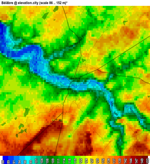
Below is the Elevation map of Bélâbre, which displays elevation range with different colors. Scale of the first map is from 86 to 152 m (282 to 499 ft) with average elevation of 121.3 meters (=398 ft) [note 1]
These maps also provides idea of topography and contour of this city, they are displayed at different zoom levels. More info about maps, scale and edge coordinates you can find below images.
| \ | Map #1 | Topo.Map |
| Scale [m] | 86..152 m | × |
| Scale [ft] | 282..499 ft | × |
| Average | 121.3 m = 398 ft | × |
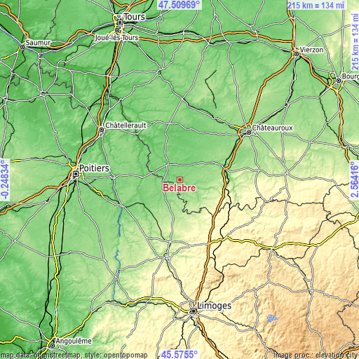
| Width | 6.72 km = 4.2 mi | 215.1 km = 133.7 mi |
| Height | 6.72 km = 4.2 mi | 215 km = 133.6 mi |
| ↑Max Latitude | 46.581423° | 47.50969° |
| Latitude at center | 46.55121° | 46.55121° |
| ↓Min Latitude | 46.52098° | 45.5755° |
| ← Min Longitude | 1.113965° | -0.24834° |
| Longitude center | 1.15791° | 1.15791° |
| →Max Longitude | 1.201855° | 2.56416° |
Nearby cities:
Cities around Bélâbre sort by population:
• Montmorillon elevation 113 m
26.1 km,  237°
237°
• Le Blanc 115 m
11.7 km,  321°
321°
• Argenton-sur-Creuse 112 m
28 km,  81°
81°
• Saint-Gaultier 109 m
21.6 km,  64°
64°
• Saint-Marcel 146 m
27.7 km, 78°
• Lathus-Saint-Rémy 176 m
28.6 km,  212°
212°
• Tournon-Saint-Martin 73 m
25.6 km, 322°
• Chaillac 186 m
16.9 km,  140°
140°
• Saulgé 98 m
29 km,  228°
228°
• Saint-Savin 80 m
22.5 km,  274°
274°
• Martizay 82 m
29.8 km,  342°
342°
• Pouligny-Saint-Pierre 117 m
17.1 km,  327°
327°
Multilingual:
 En español:
Bélâbre elevación 106 m.
 En France:
Bélâbre élévation 106 m.


Sources and notes:
- [note 1] Map square and city borders are not equal. Map elevation data is calculated only from area inside that square.
- [src 1] Elevation data from geonames database provided with same terms of usage.
- [src 2] The elevation map of Bélâbre is generated using elevation data from NASA's 3 arcsec (90m) resolution SRTM data.
- [src 3] Base (background) map © OpenStreetMap contributors tiles are generated by Geofabrik and OpenTopoMap.
Copyright & License:
This Bélâbre Elevation Map is licensed under CC BY-SA. You may reuse any part from this page, if you give a proper credit by linking to this URL:
 More info on terms of use page.