Saint-Savin elevation
Saint-Savin (Nouvelle-Aquitaine, Vienne), France elevation is 80 meters and Saint-Savin elevation in feet is 262 ft above sea level [src 1]. Saint-Savin is a populated place (feature code) with elevation that is 94 meters (308 ft) smaller than average city elevation in France.
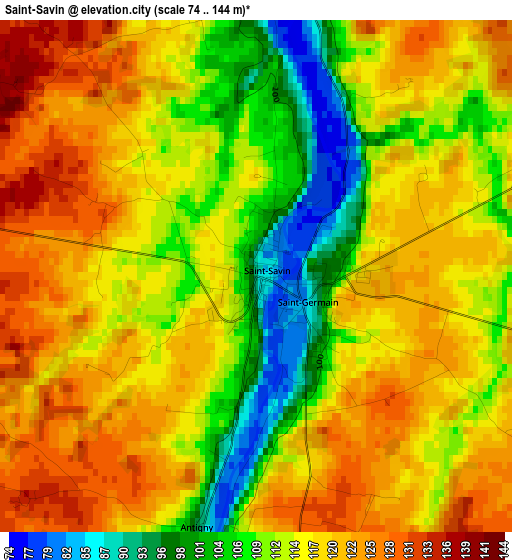
Below is the Elevation map of Saint-Savin, which displays elevation range with different colors. Scale of the first map is from 74 to 144 m (243 to 472 ft) with average elevation of 115.5 meters (=379 ft) [note 1]
These maps also provides idea of topography and contour of this city, they are displayed at different zoom levels. More info about maps, scale and edge coordinates you can find below images.
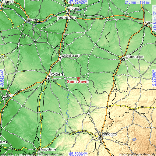
| \ | Map #1 | Topo.Map |
| Scale [m] | 74..144 m | × |
| Scale [ft] | 243..472 ft | × |
| Average | 115.5 m = 379 ft | × |
| Width | 6.72 km = 4.2 mi | 215 km = 133.6 mi |
| Height | 6.72 km = 4.2 mi | 215 km = 133.6 mi |
| ↑Max Latitude | 46.596255° | 47.52426° |
| Latitude at center | 46.56605° | 46.56605° |
| ↓Min Latitude | 46.535828° | 45.59061° |
| ← Min Longitude | 0.819865° | -0.54244° |
| Longitude center | 0.86381° | 0.86381° |
| →Max Longitude | 0.907755° | 2.27006° |
Nearby cities:
Cities around Saint-Savin sort by population:
• Montmorillon elevation 113 m
15.5 km,  178°
178°
• Chauvigny 89 m
16.8 km,  271°
271°
• Le Blanc 115 m
17 km,  63°
63°
• Lussac-les-Châteaux 104 m
21.1 km,  210°
210°
• Bonnes 63 m
21 km,  281°
281°
• Tournon-Saint-Martin 73 m
20 km,  20°
20°
• Pleumartin 137 m
20.5 km,  338°
338°
• Tercé 123 m
23.6 km,  256°
256°
• Saulgé 98 m
21 km, 177°
• Archigny 131 m
20.1 km,  306°
306°
• Bélâbre 106 m
22.5 km,  94°
94°
• Pouligny-Saint-Pierre 117 m
18.5 km,  46°
46°
Multilingual:
 En español:
Saint-Savin elevación 80 m.
 En France:
Saint-Savin élévation 80 m.
 Auf Deutsch:
Saint-Savin höhe über dem Meeresspiegel ist 80 m.

Sources and notes:
- [note 1] Map square and city borders are not equal. Map elevation data is calculated only from area inside that square.
- [src 1] Elevation data from geonames database provided with same terms of usage.
- [src 2] The elevation map of Saint-Savin is generated using elevation data from NASA's 3 arcsec (90m) resolution SRTM data.
- [src 3] Base (background) map © OpenStreetMap contributors tiles are generated by Geofabrik and OpenTopoMap.
Copyright & License:
This Saint-Savin Elevation Map is licensed under CC BY-SA. You may reuse any part from this page, if you give a proper credit by linking to this URL:
 More info on terms of use page.