Rians elevation
Rians (Provence-Alpes-Côte d'Azur, Var), France elevation is 392 meters and Rians elevation in feet is 1286 ft above sea level [src 1]. Rians is a populated place (feature code) with elevation that is 218 meters (715 ft) bigger than average city elevation in France.
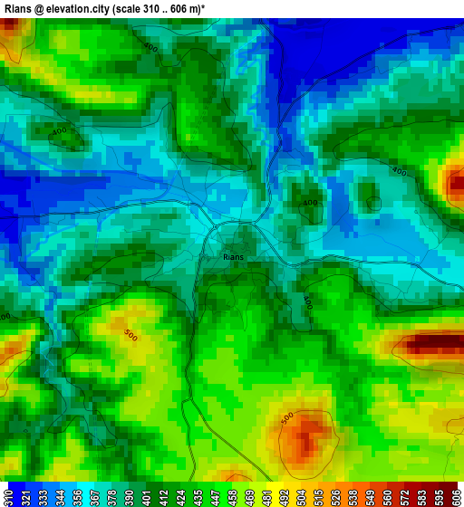
Below is the Elevation map of Rians, which displays elevation range with different colors. Scale of the first map is from 310 to 606 m (1017 to 1988 ft) with average elevation of 409.6 meters (=1344 ft) [note 1]
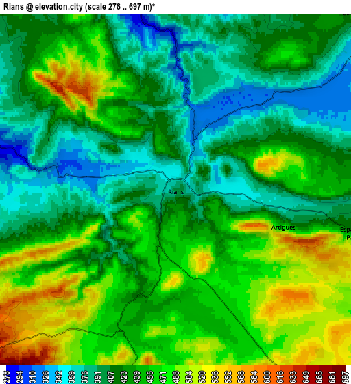
These maps also provides idea of topography and contour of this city, they are displayed at different zoom levels. More info about maps, scale and edge coordinates you can find below images.
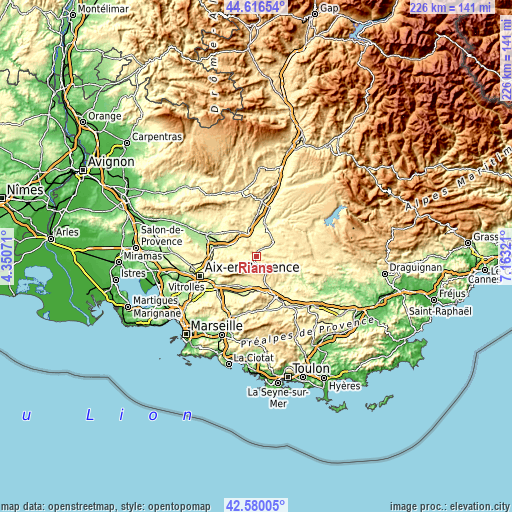
| \ | Map #1 | Map #2 | Topo.Map |
| Scale [m] | 310..606 m | 278..697 m | × |
| Scale [ft] | 1017..1988 ft | 912..2287 ft | × |
| Average | 409.6 m = 1344 ft | 434.7 m = 1426 ft | × |
| Width | 7.08 km = 4.4 mi | 14.15 km = 8.8 mi | 226.4 km = 140.7 mi |
| Height | 7.08 km = 4.4 mi | 14.15 km = 8.8 mi | 226.4 km = 140.7 mi |
| ↑Max Latitude | 43.638722° | 43.670517° | 44.61654° |
| Latitude at center | 43.60691° | 43.60691° | 43.60691° |
| ↓Min Latitude | 43.575081° | 43.543236° | 42.58005° |
| ← Min Longitude | 5.713015° | 5.669069° | 4.35071° |
| Longitude center | 5.75696° | 5.75696° | 5.75696° |
| →Max Longitude | 5.800905° | 5.844851° | 7.16321° |
Nearby cities:
Cities around Rians sort by population:
• Saint-Maximin-la-Sainte-Baume elevation 313 m
19.5 km,  154°
154°
• Trets 247 m
18.6 km,  198°
198°
• Pourrières 304 m
11.4 km,  189°
189°
• Rousset 264 m
17.7 km,  218°
218°
• Peyrolles-en-Provence 218 m
14.5 km,  287°
287°
• Jouques 310 m
10.2 km, 289°
• Meyrargues 272 m
18.8 km,  280°
280°
• Vinon-sur-Verdon 275 m
13.8 km,  18°
18°
• Puyloubier 350 m
11.2 km, 215°
• Saint-Julien 464 m
15.3 km,  52°
52°
• Ginasservis 423 m
10.3 km, 46°
• Beaumont-de-Pertuis 333 m
15.5 km,  339°
339°
Multilingual:
 En español:
Rians elevación 392 m.
 En France:
Rians élévation 392 m.


Sources and notes:
- [note 1] Map square and city borders are not equal. Map elevation data is calculated only from area inside that square.
- [src 1] Elevation data from geonames database provided with same terms of usage.
- [src 2] The elevation map of Rians is generated using elevation data from NASA's 3 arcsec (90m) resolution SRTM data.
- [src 3] Base (background) map © OpenStreetMap contributors tiles are generated by Geofabrik and OpenTopoMap.
Copyright & License:
This Rians Elevation Map is licensed under CC BY-SA. You may reuse any part from this page, if you give a proper credit by linking to this URL:
 More info on terms of use page.