Pourrières elevation
Pourrières (Provence-Alpes-Côte d'Azur, Var), France elevation is 304 meters and Pourrières elevation in feet is 997 ft above sea level [src 1]. Pourrières is a populated place (feature code) with elevation that is 130 meters (427 ft) bigger than average city elevation in France.
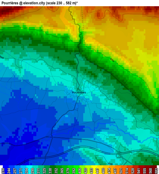
Below is the Elevation map of Pourrières, which displays elevation range with different colors. Scale of the first map is from 230 to 582 m (755 to 1909 ft) with average elevation of 339.1 meters (=1113 ft) [note 1]
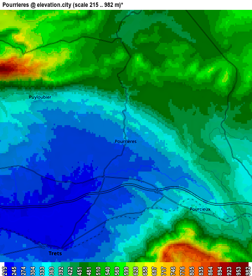
These maps also provides idea of topography and contour of this city, they are displayed at different zoom levels. More info about maps, scale and edge coordinates you can find below images.
| \ | Map #1 | Map #2 | Topo.Map |
| Scale [m] | 230..582 m | 215..982 m | × |
| Scale [ft] | 755..1909 ft | 705..3222 ft | × |
| Average | 339.1 m = 1113 ft | 402.7 m = 1321 ft | × |
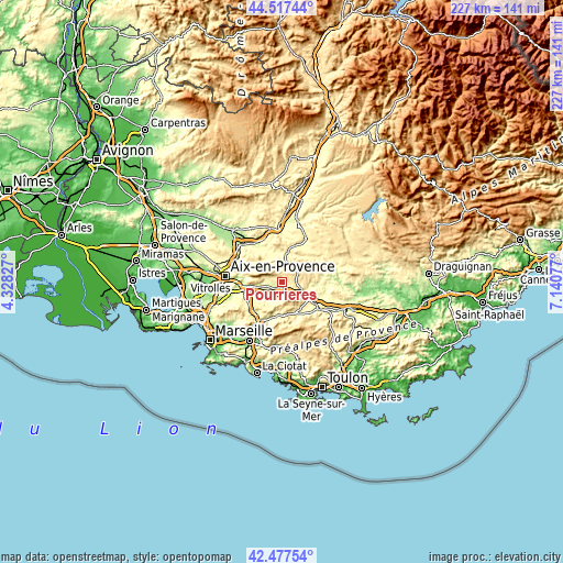
| Width | 7.09 km = 4.4 mi | 14.18 km = 8.8 mi | 226.8 km = 140.9 mi |
| Height | 7.09 km = 4.4 mi | 14.18 km = 8.8 mi | 226.8 km = 140.9 mi |
| ↑Max Latitude | 43.537975° | 43.569823° | 44.51744° |
| Latitude at center | 43.50611° | 43.50611° | 43.50611° |
| ↓Min Latitude | 43.474228° | 43.442329° | 42.47754° |
| ← Min Longitude | 5.690575° | 5.646629° | 4.32827° |
| Longitude center | 5.73452° | 5.73452° | 5.73452° |
| →Max Longitude | 5.778465° | 5.822411° | 7.14077° |
Nearby cities:
Cities around Pourrières sort by population:
• Saint-Maximin-la-Sainte-Baume elevation 313 m
12.1 km,  122°
122°
• Trets 247 m
7.7 km,  212°
212°
• Fuveau 257 m
15 km,  248°
248°
• Saint-Zacharie 278 m
13.6 km,  189°
189°
• Rousset 264 m
9.6 km, 254°
• Rians 392 m
11.4 km,  9°
9°
• Nans-les-Pins 398 m
15.5 km,  165°
165°
• Peynier 272 m
9.9 km,  229°
229°
• Châteauneuf-le-Rouge 230 m
13.5 km,  262°
262°
• Puyloubier 350 m
5.1 km,  294°
294°
• Belcodène 396 m
14.7 km, 232°
• Rougiers 364 m
15.8 km,  143°
143°
Multilingual:
 En español:
Pourrières elevación 304 m.
 En France:
Pourrières élévation 304 m.
 Auf Deutsch:
Pourrières höhe über dem Meeresspiegel ist 304 m.

Sources and notes:
- [note 1] Map square and city borders are not equal. Map elevation data is calculated only from area inside that square.
- [src 1] Elevation data from geonames database provided with same terms of usage.
- [src 2] The elevation map of Pourrières is generated using elevation data from NASA's 3 arcsec (90m) resolution SRTM data.
- [src 3] Base (background) map © OpenStreetMap contributors tiles are generated by Geofabrik and OpenTopoMap.
Copyright & License:
This Pourrières Elevation Map is licensed under CC BY-SA. You may reuse any part from this page, if you give a proper credit by linking to this URL:
 More info on terms of use page.