Humada elevation
Humada (Castille and León, Provincia de Burgos), Spain elevation is 958 meters and Humada elevation in feet is 3143 ft above sea level [src 1]. Humada is a seat of a third-order administrative division (feature code) with elevation that is 355 meters (1165 ft) bigger than average city elevation in Spain.
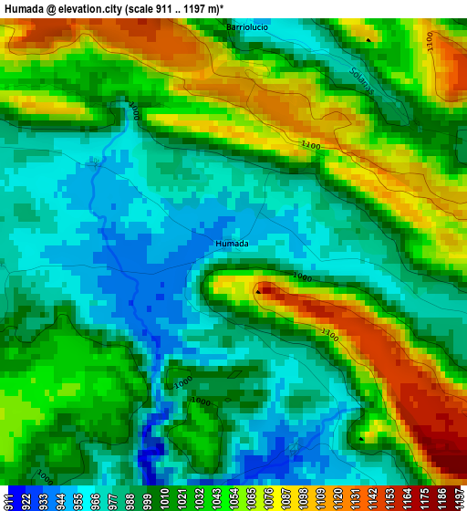
Below is the Elevation map of Humada, which displays elevation range with different colors. Scale of the first map is from 911 to 1197 m (2989 to 3927 ft) with average elevation of 1017.3 meters (=3338 ft) [note 1]
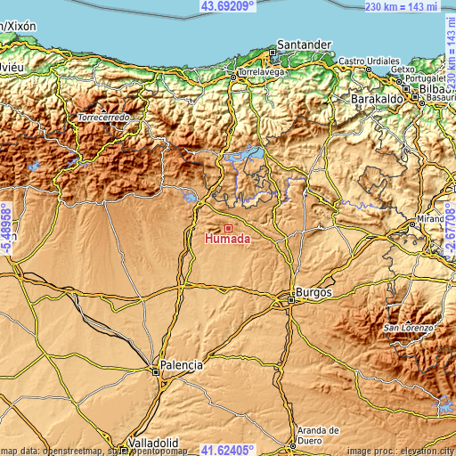
These maps also provides idea of topography and contour of this city, they are displayed at different zoom levels. More info about maps, scale and edge coordinates you can find below images.
| \ | Map #1 | Topo.Map |
| Scale [m] | 911..1197 m | × |
| Scale [ft] | 2989..3927 ft | × |
| Average | 1017.3 m = 3338 ft | × |
| Width | 7.19 km = 4.5 mi | 229.9 km = 142.9 mi |
| Height | 7.19 km = 4.5 mi | 229.9 km = 142.9 mi |
| ↑Max Latitude | 42.698975° | 43.69209° |
| Latitude at center | 42.66667° | 42.66667° |
| ↓Min Latitude | 42.634348° | 41.62405° |
| ← Min Longitude | -4.127275° | -5.48958° |
| Longitude center | -4.08333° | -4.08333° |
| →Max Longitude | -4.039385° | -2.67708° |
Nearby cities:
Cities around Humada sort by population:
• Aguilar de Campoo elevation 904 m
20.2 km,  314°
314°
• Herrera de Pisuerga 849 m
21.7 km,  248°
248°
• Villadiego 841 m
17.8 km,  160°
160°
• Alar del Rey 852 m
18.8 km,  267°
267°
• Sotresgudo 872 m
12.4 km,  218°
218°
• Pomar de Valdivia 940 m
13.8 km,  330°
330°
• Basconcillos del Tozo 912 m
8.6 km,  62°
62°
• Prádanos de Ojeda 933 m
21.6 km, 274°
• Sargentes de la Lora 1016 m
20.6 km, 56°
• Rebolledo de la Torre 956 m
12 km,  282°
282°
• Berzosilla 818 m
13.2 km,  16°
16°
• Rezmondo 829 m
21.1 km, 217°
Multilingual:
 En español:
Humada elevación 958 m.
 En France:
Humada élévation 958 m.


Sources and notes:
- [note 1] Map square and city borders are not equal. Map elevation data is calculated only from area inside that square.
- [src 1] Elevation data from geonames database provided with same terms of usage.
- [src 2] The elevation map of Humada is generated using elevation data from NASA's 3 arcsec (90m) resolution SRTM data.
- [src 3] Base (background) map © OpenStreetMap contributors tiles are generated by Geofabrik and OpenTopoMap.
Copyright & License:
This Humada Elevation Map is licensed under CC BY-SA. You may reuse any part from this page, if you give a proper credit by linking to this URL:
 More info on terms of use page.