Berzosilla elevation
Berzosilla (Castille and León, Provincia de Palencia), Spain elevation is 818 meters and Berzosilla elevation in feet is 2684 ft above sea level [src 1]. Berzosilla is a seat of a third-order administrative division (feature code) with elevation that is 215 meters (705 ft) bigger than average city elevation in Spain.
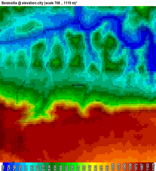
Below is the Elevation map of Berzosilla, which displays elevation range with different colors. Scale of the first map is from 708 to 1119 m (2323 to 3671 ft) with average elevation of 895.5 meters (=2938 ft) [note 1]
These maps also provides idea of topography and contour of this city, they are displayed at different zoom levels. More info about maps, scale and edge coordinates you can find below images.
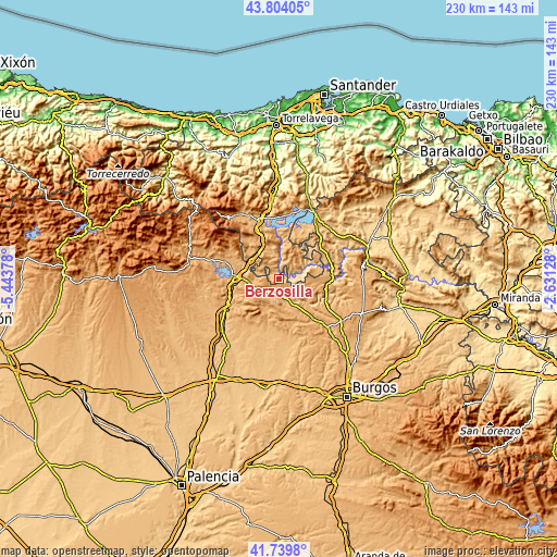
| \ | Map #1 | Topo.Map |
| Scale [m] | 708..1119 m | × |
| Scale [ft] | 2323..3671 ft | × |
| Average | 895.5 m = 2938 ft | × |
| Width | 7.17 km = 4.5 mi | 229.5 km = 142.6 mi |
| Height | 7.17 km = 4.5 mi | 229.5 km = 142.6 mi |
| ↑Max Latitude | 42.812776° | 43.80405° |
| Latitude at center | 42.78053° | 42.78053° |
| ↓Min Latitude | 42.748267° | 41.7398° |
| ← Min Longitude | -4.081475° | -5.44378° |
| Longitude center | -4.03753° | -4.03753° |
| →Max Longitude | -3.993585° | -2.63128° |
Nearby cities:
Cities around Berzosilla sort by population:
• Aguilar de Campoo elevation 904 m
18.1 km,  274°
274°
• Villaescusa 875 m
22.8 km,  332°
332°
• Barruelo de Santullán 1069 m
24.6 km,  304°
304°
• Mataporquera 927 m
14.6 km,  315°
315°
• San Martín de Elines 724 m
14.8 km,  68°
68°
• Pomar de Valdivia 940 m
10.6 km, 266°
• Basconcillos del Tozo 912 m
9.5 km,  155°
155°
• Tubilla del Agua 781 m
20.9 km,  112°
112°
• Sargentes de la Lora 1016 m
13.5 km,  95°
95°
• Arija 846 m
24.9 km,  17°
17°
• Humada 958 m
13.2 km,  196°
196°
• Rebolledo de la Torre 956 m
18.5 km,  236°
236°
Multilingual:
 En español:
Berzosilla elevación 818 m.
 En France:
Berzosilla élévation 818 m.
 Auf Deutsch:
Berzosilla höhe über dem Meeresspiegel ist 818 m.

Sources and notes:
- [note 1] Map square and city borders are not equal. Map elevation data is calculated only from area inside that square.
- [src 1] Elevation data from geonames database provided with same terms of usage.
- [src 2] The elevation map of Berzosilla is generated using elevation data from NASA's 3 arcsec (90m) resolution SRTM data.
- [src 3] Base (background) map © OpenStreetMap contributors tiles are generated by Geofabrik and OpenTopoMap.
Copyright & License:
This Berzosilla Elevation Map is licensed under CC BY-SA. You may reuse any part from this page, if you give a proper credit by linking to this URL:
 More info on terms of use page.