Ubstadt-Weiher elevation
Ubstadt-Weiher (Baden-Württemberg, Karlsruhe Region), Germany elevation is 129 meters and Ubstadt-Weiher elevation in feet is 423 ft above sea level [src 1]. Ubstadt-Weiher is a seat of a fourth-order administrative division (feature code) with elevation that is 129 meters (423 ft) smaller than average city elevation in Germany.
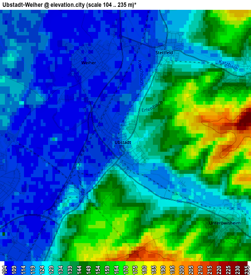
Below is the Elevation map of Ubstadt-Weiher, which displays elevation range with different colors. Scale of the first map is from 104 to 235 m (341 to 771 ft) with average elevation of 133.4 meters (=438 ft) [note 1]
These maps also provides idea of topography and contour of this city, they are displayed at different zoom levels. More info about maps, scale and edge coordinates you can find below images.
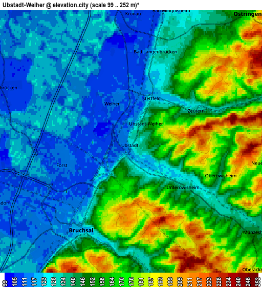
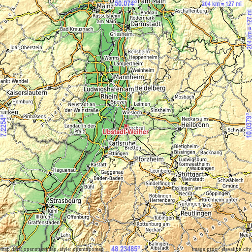
| \ | Map #1 | Map #2 | Topo.Map |
| Scale [m] | 104..235 m | 99..252 m | × |
| Scale [ft] | 341..771 ft | 325..827 ft | × |
| Average | 133.4 m = 438 ft | 144.2 m = 473 ft | × |
| Width | 6.39 km = 4 mi | 12.78 km = 7.9 mi | 204.5 km = 127.1 mi |
| Height | 6.39 km = 4 mi | 12.78 km = 7.9 mi | 204.5 km = 127.1 mi |
| ↑Max Latitude | 49.191688° | 49.220399° | 50.074° |
| Latitude at center | 49.16296° | 49.16296° | 49.16296° |
| ↓Min Latitude | 49.134215° | 49.105454° | 48.23485° |
| ← Min Longitude | 8.587705° | 8.543759° | 7.2254° |
| Longitude center | 8.63165° | 8.63165° | 8.63165° |
| →Max Longitude | 8.675595° | 8.719541° | 10.0379° |
Nearby cities:
Cities around Ubstadt-Weiher sort by population:
• Bruchsal elevation 118 m
4.9 km,  209°
209°
• Kraichtal 218 m
7.6 km,  104°
104°
• Östringen 163 m
8.5 km,  43°
43°
• Sankt Leon-Rot 110 m
11.5 km,  355°
355°
• Graben-Neudorf 109 m
10.1 km,  272°
272°
• Karlsdorf-Neuthard 110 m
8 km,  246°
246°
• Mühlhausen 143 m
11.8 km, 35°
• Forst 112 m
3.7 km,  262°
262°
• Kronau 109 m
6.6 km, 359°
• Hambrücken 107 m
7.3 km,  294°
294°
• Malsch 181 m
10.1 km,  21°
21°
• Gondelsheim 157 m
11.7 km,  170°
170°
Multilingual:
 En español:
Ubstadt-Weiher elevación 129 m.
 En France:
Ubstadt-Weiher élévation 129 m.
 Auf Deutsch:
Ubstadt-Weiher höhe über dem Meeresspiegel ist 129 m.

Sources and notes:
- [note 1] Map square and city borders are not equal. Map elevation data is calculated only from area inside that square.
- [src 1] Elevation data from geonames database provided with same terms of usage.
- [src 2] The elevation map of Ubstadt-Weiher is generated using elevation data from NASA's 3 arcsec (90m) resolution SRTM data.
- [src 3] Base (background) map © OpenStreetMap contributors tiles are generated by Geofabrik and OpenTopoMap.
Copyright & License:
This Ubstadt-Weiher Elevation Map is licensed under CC BY-SA. You may reuse any part from this page, if you give a proper credit by linking to this URL:
 More info on terms of use page.