Kronau elevation
Kronau (Baden-Württemberg, Karlsruhe Region), Germany elevation is 109 meters and Kronau elevation in feet is 358 ft above sea level [src 1]. Kronau is a seat of a fourth-order administrative division (feature code) with elevation that is 149 meters (489 ft) smaller than average city elevation in Germany.
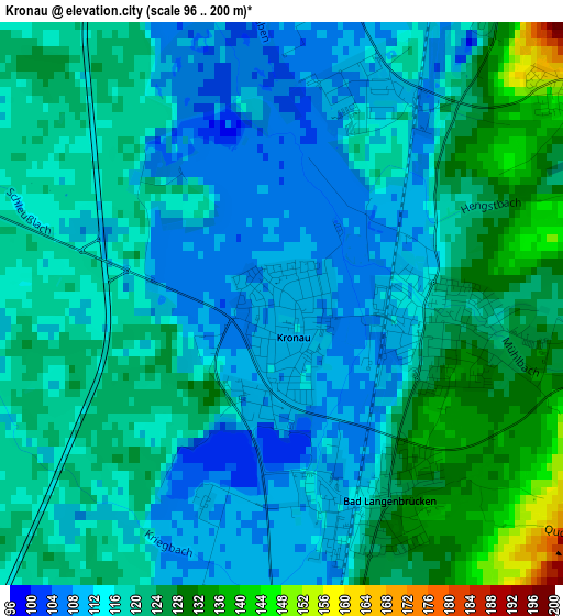
Below is the Elevation map of Kronau, which displays elevation range with different colors. Scale of the first map is from 96 to 200 m (315 to 656 ft) with average elevation of 117.5 meters (=385 ft) [note 1]
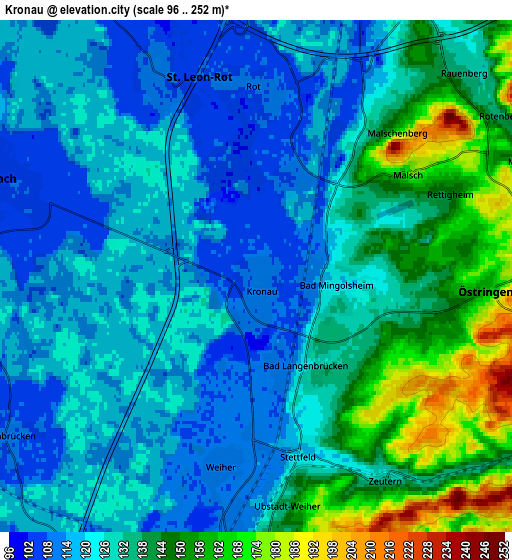
These maps also provides idea of topography and contour of this city, they are displayed at different zoom levels. More info about maps, scale and edge coordinates you can find below images.
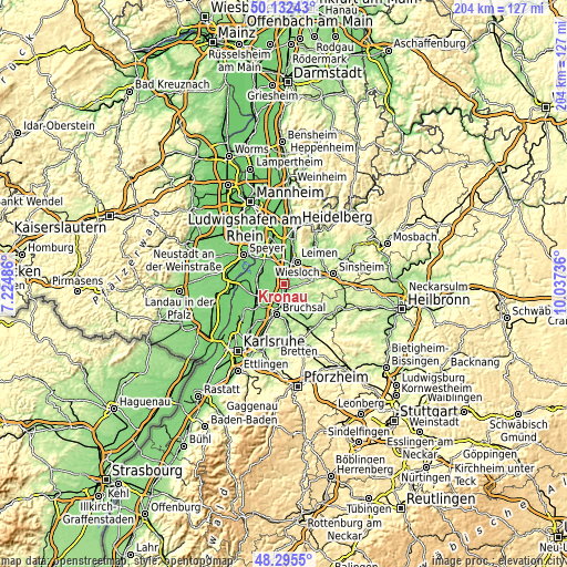
| \ | Map #1 | Map #2 | Topo.Map |
| Scale [m] | 96..200 m | 96..252 m | × |
| Scale [ft] | 315..656 ft | 315..827 ft | × |
| Average | 117.5 m = 385 ft | 129.5 m = 425 ft | × |
| Width | 6.38 km = 4 mi | 12.77 km = 7.9 mi | 204.2 km = 126.9 mi |
| Height | 6.38 km = 4 mi | 12.77 km = 7.9 mi | 204.2 km = 126.9 mi |
| ↑Max Latitude | 49.251193° | 49.27987° | 50.13243° |
| Latitude at center | 49.2225° | 49.2225° | 49.2225° |
| ↓Min Latitude | 49.19379° | 49.165063° | 48.2955° |
| ← Min Longitude | 8.587165° | 8.543219° | 7.22486° |
| Longitude center | 8.63111° | 8.63111° | 8.63111° |
| →Max Longitude | 8.675055° | 8.719001° | 10.03736° |
Nearby cities:
Cities around Kronau sort by population:
• Wiesloch elevation 134 m
9.4 km,  31°
31°
• Waghäusel 106 m
9.1 km,  289°
289°
• Walldorf 105 m
9.4 km,  5°
5°
• Östringen 163 m
5.9 km,  93°
93°
• Ubstadt-Weiher 129 m
6.6 km,  179°
179°
• Sankt Leon-Rot 110 m
4.9 km,  348°
348°
• Mühlhausen 143 m
7.5 km,  67°
67°
• Forst 112 m
8 km,  207°
207°
• Rauenberg 131 m
7.4 km,  45°
45°
• Reilingen 102 m
9.7 km,  330°
330°
• Hambrücken 107 m
7.5 km,  241°
241°
• Malsch 181 m
4.7 km, 53°
Multilingual:
 En español:
Kronau elevación 109 m.
 En France:
Kronau élévation 109 m.


Sources and notes:
- [note 1] Map square and city borders are not equal. Map elevation data is calculated only from area inside that square.
- [src 1] Elevation data from geonames database provided with same terms of usage.
- [src 2] The elevation map of Kronau is generated using elevation data from NASA's 3 arcsec (90m) resolution SRTM data.
- [src 3] Base (background) map © OpenStreetMap contributors tiles are generated by Geofabrik and OpenTopoMap.
Copyright & License:
This Kronau Elevation Map is licensed under CC BY-SA. You may reuse any part from this page, if you give a proper credit by linking to this URL:
 More info on terms of use page.