Gondelsheim elevation
Gondelsheim (Baden-Württemberg, Karlsruhe Region), Germany elevation is 157 meters and Gondelsheim elevation in feet is 515 ft above sea level [src 1]. Gondelsheim is a seat of a fourth-order administrative division (feature code) with elevation that is 101 meters (331 ft) smaller than average city elevation in Germany.
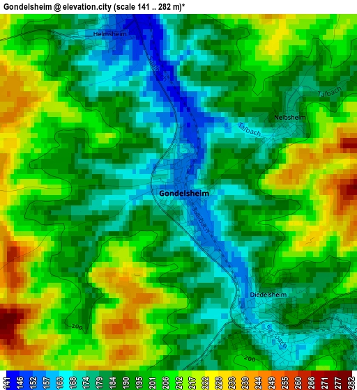
Below is the Elevation map of Gondelsheim, which displays elevation range with different colors. Scale of the first map is from 141 to 282 m (463 to 925 ft) with average elevation of 195.4 meters (=641 ft) [note 1]
These maps also provides idea of topography and contour of this city, they are displayed at different zoom levels. More info about maps, scale and edge coordinates you can find below images.
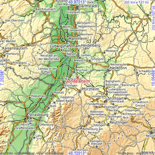
| \ | Map #1 | Topo.Map |
| Scale [m] | 141..282 m | × |
| Scale [ft] | 463..925 ft | × |
| Average | 195.4 m = 641 ft | × |
| Width | 6.4 km = 4 mi | 204.9 km = 127.3 mi |
| Height | 6.4 km = 4 mi | 204.9 km = 127.3 mi |
| ↑Max Latitude | 49.087958° | 49.97213° |
| Latitude at center | 49.05917° | 49.05917° |
| ↓Min Latitude | 49.030365° | 48.12913° |
| ← Min Longitude | 8.614385° | 7.25208° |
| Longitude center | 8.65833° | 8.65833° |
| →Max Longitude | 8.702275° | 10.06458° |
Nearby cities:
Cities around Gondelsheim sort by population:
• Bruchsal elevation 118 m
8.5 km,  328°
328°
• Bretten 183 m
4.4 km,  124°
124°
• Kraichtal 218 m
11.1 km,  29°
29°
• Ubstadt-Weiher 129 m
11.7 km,  350°
350°
• Oberderdingen 185 m
10.6 km,  86°
86°
• Königsbach-Stein 169 m
11.1 km,  200°
200°
• Weingarten 115 m
9.6 km,  266°
266°
• Knittlingen 190 m
8.1 km, 118°
• Jöhlingen 160 m
6.9 km,  244°
244°
• Eisingen 259 m
12.2 km,  177°
177°
• Wössingen 182 m
6.4 km,  215°
215°
• Ölbronn-Dürrn 260 m
12.3 km,  146°
146°
Multilingual:
 En español:
Gondelsheim elevación 157 m.
 En France:
Gondelsheim élévation 157 m.
 Auf Deutsch:
Gondelsheim höhe über dem Meeresspiegel ist 157 m.

Sources and notes:
- [note 1] Map square and city borders are not equal. Map elevation data is calculated only from area inside that square.
- [src 1] Elevation data from geonames database provided with same terms of usage.
- [src 2] The elevation map of Gondelsheim is generated using elevation data from NASA's 3 arcsec (90m) resolution SRTM data.
- [src 3] Base (background) map © OpenStreetMap contributors tiles are generated by Geofabrik and OpenTopoMap.
Copyright & License:
This Gondelsheim Elevation Map is licensed under CC BY-SA. You may reuse any part from this page, if you give a proper credit by linking to this URL:
 More info on terms of use page.