Bruchsal elevation
Bruchsal (Baden-Württemberg, Karlsruhe Region), Germany elevation is 118 meters and Bruchsal elevation in feet is 387 ft above sea level [src 1]. Bruchsal is a populated place (feature code) with elevation that is 140 meters (459 ft) smaller than average city elevation in Germany.
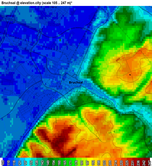
Below is the Elevation map of Bruchsal, which displays elevation range with different colors. Scale of the first map is from 105 to 247 m (344 to 810 ft) with average elevation of 147.7 meters (=485 ft) [note 1]
These maps also provides idea of topography and contour of this city, they are displayed at different zoom levels. More info about maps, scale and edge coordinates you can find below images.
| \ | Map #1 | Map #2 | Topo.Map |
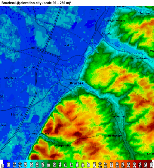
| Scale [m] | 105..247 m | 99..269 m | × |
| Scale [ft] | 344..810 ft | 325..883 ft | × |
| Average | 147.7 m = 485 ft | 149.6 m = 491 ft | × |
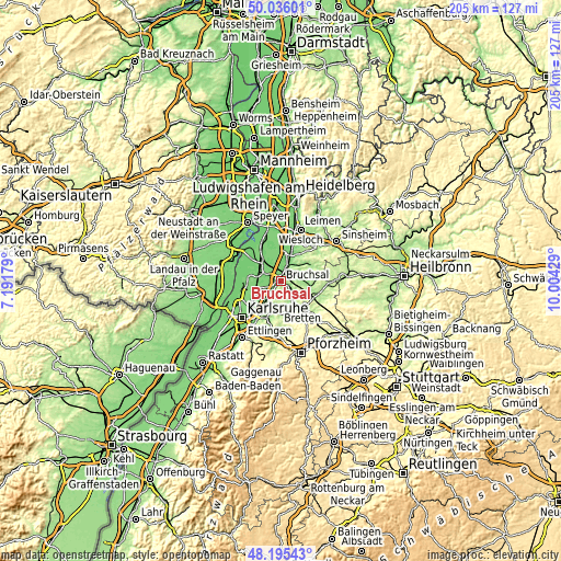
| Width | 6.4 km = 4 mi | 12.79 km = 7.9 mi | 204.7 km = 127.2 mi |
| Height | 6.4 km = 4 mi | 12.79 km = 7.9 mi | 204.6 km = 127.1 mi |
| ↑Max Latitude | 49.15301° | 49.181744° | 50.03601° |
| Latitude at center | 49.12426° | 49.12426° | 49.12426° |
| ↓Min Latitude | 49.095493° | 49.066709° | 48.19543° |
| ← Min Longitude | 8.554095° | 8.510149° | 7.19179° |
| Longitude center | 8.59804° | 8.59804° | 8.59804° |
| →Max Longitude | 8.641985° | 8.685931° | 10.00429° |
Nearby cities:
Cities around Bruchsal sort by population:
• Bretten elevation 183 m
12.6 km,  140°
140°
• Kraichtal 218 m
10.1 km,  76°
76°
• Ubstadt-Weiher 129 m
4.9 km,  29°
29°
• Graben-Neudorf 109 m
9 km,  301°
301°
• Weingarten 115 m
9.3 km,  213°
213°
• Karlsdorf-Neuthard 110 m
5.1 km,  283°
283°
• Forst 112 m
4 km,  341°
341°
• Kronau 109 m
11.2 km,  12°
12°
• Jöhlingen 160 m
10.4 km,  189°
189°
• Hambrücken 107 m
8.4 km,  330°
330°
• Wössingen 182 m
12.5 km,  176°
176°
• Gondelsheim 157 m
8.5 km,  148°
148°
Multilingual:
 En español:
Bruchsal elevación 118 m.
 En France:
Bruchsal élévation 118 m.
 Auf Deutsch:
Bruchsal höhe über dem Meeresspiegel ist 118 m.

Sources and notes:
- [note 1] Map square and city borders are not equal. Map elevation data is calculated only from area inside that square.
- [src 1] Elevation data from geonames database provided with same terms of usage.
- [src 2] The elevation map of Bruchsal is generated using elevation data from NASA's 3 arcsec (90m) resolution SRTM data.
- [src 3] Base (background) map © OpenStreetMap contributors tiles are generated by Geofabrik and OpenTopoMap.
Copyright & License:
This Bruchsal Elevation Map is licensed under CC BY-SA. You may reuse any part from this page, if you give a proper credit by linking to this URL:
 More info on terms of use page.