Losheim elevation
Losheim (Saarland), Germany elevation is 296 meters and Losheim elevation in feet is 971 ft above sea level [src 1]. Losheim is a populated place (feature code) with elevation that is 38 meters (125 ft) bigger than average city elevation in Germany.
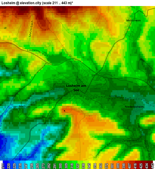
Below is the Elevation map of Losheim, which displays elevation range with different colors. Scale of the first map is from 211 to 443 m (692 to 1453 ft) with average elevation of 321.8 meters (=1056 ft) [note 1]
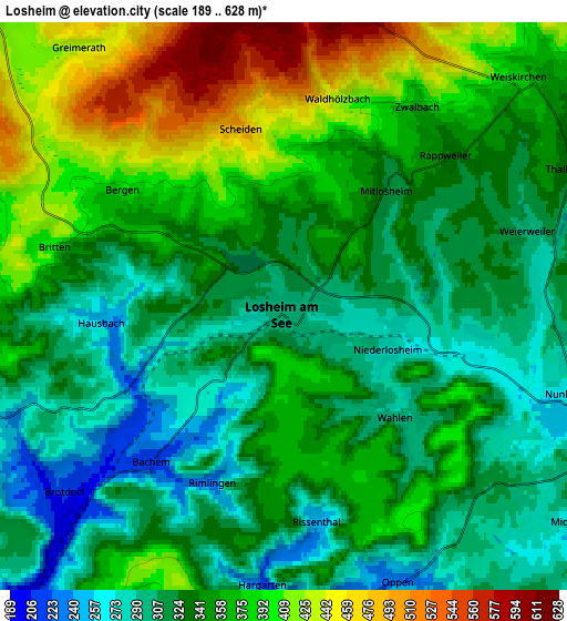
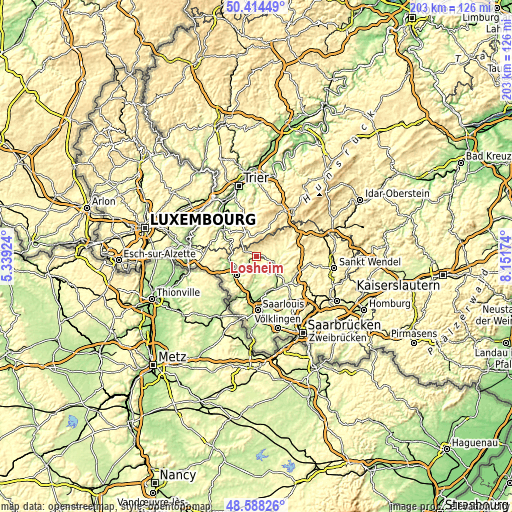
These maps also provides idea of topography and contour of this city, they are displayed at different zoom levels. More info about maps, scale and edge coordinates you can find below images.
| \ | Map #1 | Map #2 | Topo.Map |
| Scale [m] | 211..443 m | 189..628 m | × |
| Scale [ft] | 692..1453 ft | 620..2060 ft | × |
| Average | 321.8 m = 1056 ft | 348.3 m = 1143 ft | × |
| Width | 6.35 km = 3.9 mi | 12.69 km = 7.9 mi | 203.1 km = 126.2 mi |
| Height | 6.35 km = 3.9 mi | 12.69 km = 7.9 mi | 203 km = 126.1 mi |
| ↑Max Latitude | 49.538426° | 49.566936° | 50.41449° |
| Latitude at center | 49.5099° | 49.5099° | 49.5099° |
| ↓Min Latitude | 49.481357° | 49.452798° | 48.58826° |
| ← Min Longitude | 6.701545° | 6.657599° | 5.33924° |
| Longitude center | 6.74549° | 6.74549° | 6.74549° |
| →Max Longitude | 6.789435° | 6.833381° | 8.15174° |
Nearby cities:
Cities around Losheim sort by population:
• Merzig elevation 177 m
10.7 km,  226°
226°
• Schmelz 218 m
11.4 km,  138°
138°
• Wadern 296 m
10.8 km,  71°
71°
• Beckingen 216 m
12.7 km,  195°
195°
• Nalbach 238 m
14.3 km,  169°
169°
• Weiskirchen 352 m
6.8 km,  49°
49°
• Mettlach 161 m
11.7 km,  261°
261°
• Saarhölzbach 169 m
10 km,  273°
273°
• Zerf 364 m
11 km,  335°
335°
• Britten 367 m
5.1 km,  283°
283°
• Schillingen 485 m
14 km,  11°
11°
• Greimerath 436 m
7.3 km,  322°
322°
Multilingual:
 En español:
Losheim elevación 296 m.
 En France:
Losheim élévation 296 m.
 Auf Deutsch:
Losheim am See höhe über dem Meeresspiegel ist 296 m.

Sources and notes:
- [note 1] Map square and city borders are not equal. Map elevation data is calculated only from area inside that square.
- [src 1] Elevation data from geonames database provided with same terms of usage.
- [src 2] The elevation map of Losheim is generated using elevation data from NASA's 3 arcsec (90m) resolution SRTM data.
- [src 3] Base (background) map © OpenStreetMap contributors tiles are generated by Geofabrik and OpenTopoMap.
Copyright & License:
This Losheim Elevation Map is licensed under CC BY-SA. You may reuse any part from this page, if you give a proper credit by linking to this URL:
 More info on terms of use page.