Mettlach elevation
Mettlach (Saarland), Germany elevation is 161 meters and Mettlach elevation in feet is 528 ft above sea level [src 1]. Mettlach is a seat of a fourth-order administrative division (feature code) with elevation that is 97 meters (318 ft) smaller than average city elevation in Germany.
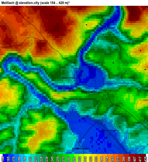
Below is the Elevation map of Mettlach, which displays elevation range with different colors. Scale of the first map is from 154 to 428 m (505 to 1404 ft) with average elevation of 267.8 meters (=879 ft) [note 1]
These maps also provides idea of topography and contour of this city, they are displayed at different zoom levels. More info about maps, scale and edge coordinates you can find below images.
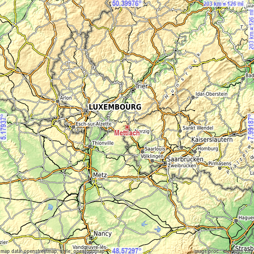
| \ | Map #1 | Topo.Map |
| Scale [m] | 154..428 m | × |
| Scale [ft] | 505..1404 ft | × |
| Average | 267.8 m = 879 ft | × |
| Width | 6.35 km = 3.9 mi | 203.1 km = 126.2 mi |
| Height | 6.35 km = 3.9 mi | 203.1 km = 126.2 mi |
| ↑Max Latitude | 49.523425° | 50.39976° |
| Latitude at center | 49.49489° | 49.49489° |
| ↓Min Latitude | 49.466338° | 48.57297° |
| ← Min Longitude | 6.541675° | 5.17937° |
| Longitude center | 6.58562° | 6.58562° |
| →Max Longitude | 6.629565° | 7.99187° |
Nearby cities:
Cities around Mettlach sort by population:
• Merzig elevation 177 m
6.9 km,  146°
146°
• Losheim 296 m
11.7 km,  81°
81°
• Saarburg 177 m
12.8 km,  346°
346°
• Orscholz 412 m
4.5 km,  285°
285°
• Saarhölzbach 169 m
2.8 km,  34°
34°
• Serrig 165 m
9 km, 354°
• Irsch 213 m
12.2 km,  3°
3°
• Freudenburg 371 m
6.6 km,  324°
324°
• Britten 367 m
7.2 km,  66°
66°
• Weiten 385 m
5.1 km, 320°
• Trassem 191 m
10.3 km,  334°
334°
• Greimerath 436 m
10.3 km,  43°
43°
Multilingual:
 En español:
Mettlach elevación 161 m.
 En France:
Mettlach élévation 161 m.
 Auf Deutsch:
Mettlach höhe über dem Meeresspiegel ist 161 m.

Sources and notes:
- [note 1] Map square and city borders are not equal. Map elevation data is calculated only from area inside that square.
- [src 1] Elevation data from geonames database provided with same terms of usage.
- [src 2] The elevation map of Mettlach is generated using elevation data from NASA's 3 arcsec (90m) resolution SRTM data.
- [src 3] Base (background) map © OpenStreetMap contributors tiles are generated by Geofabrik and OpenTopoMap.
Copyright & License:
This Mettlach Elevation Map is licensed under CC BY-SA. You may reuse any part from this page, if you give a proper credit by linking to this URL:
 More info on terms of use page.