Beckingen elevation
Beckingen (Saarland), Germany elevation is 216 meters and Beckingen elevation in feet is 709 ft above sea level [src 1]. Beckingen is a seat of a fourth-order administrative division (feature code) with elevation that is 42 meters (138 ft) smaller than average city elevation in Germany.
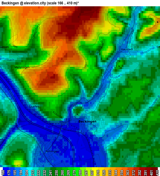
Below is the Elevation map of Beckingen, which displays elevation range with different colors. Scale of the first map is from 166 to 410 m (545 to 1345 ft) with average elevation of 253 meters (=830 ft) [note 1]
These maps also provides idea of topography and contour of this city, they are displayed at different zoom levels. More info about maps, scale and edge coordinates you can find below images.
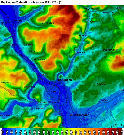
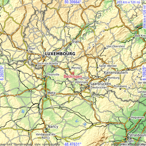
| \ | Map #1 | Map #2 | Topo.Map |
| Scale [m] | 166..410 m | 163..429 m | × |
| Scale [ft] | 545..1345 ft | 535..1407 ft | × |
| Average | 253 m = 830 ft | 253.1 m = 830 ft | × |
| Width | 6.36 km = 4 mi | 12.72 km = 7.9 mi | 203.5 km = 126.4 mi |
| Height | 6.36 km = 4 mi | 12.72 km = 7.9 mi | 203.5 km = 126.4 mi |
| ↑Max Latitude | 49.42859° | 49.457164° | 50.30664° |
| Latitude at center | 49.4° | 49.4° | 49.4° |
| ↓Min Latitude | 49.371393° | 49.34277° | 48.47631° |
| ← Min Longitude | 6.656055° | 6.612109° | 5.29375° |
| Longitude center | 6.7° | 6.7° | 6.7° |
| →Max Longitude | 6.743945° | 6.787891° | 8.10625° |
Nearby cities:
Cities around Beckingen sort by population:
• Saarlouis elevation 183 m
10.3 km,  158°
158°
• Merzig 177 m
6.5 km,  317°
317°
• Dillingen 190 m
5.3 km, 157°
• Schwalbach 210 m
14 km,  142°
142°
• Schmelz 218 m
11.5 km,  71°
71°
• Losheim 296 m
12.7 km,  15°
15°
• Saarwellingen 205 m
9.1 km,  123°
123°
• Wallerfangen 188 m
8.1 km,  174°
174°
• Nalbach 238 m
6.3 km,  107°
107°
• Ensdorf 198 m
12.7 km,  151°
151°
• Mettlach 161 m
13.4 km, 321°
• Britten 367 m
13.5 km,  352°
352°
Multilingual:
 En español:
Beckingen elevación 216 m.
 En France:
Beckingen élévation 216 m.
 Auf Deutsch:
Beckingen höhe über dem Meeresspiegel ist 216 m.

Sources and notes:
- [note 1] Map square and city borders are not equal. Map elevation data is calculated only from area inside that square.
- [src 1] Elevation data from geonames database provided with same terms of usage.
- [src 2] The elevation map of Beckingen is generated using elevation data from NASA's 3 arcsec (90m) resolution SRTM data.
- [src 3] Base (background) map © OpenStreetMap contributors tiles are generated by Geofabrik and OpenTopoMap.
Copyright & License:
This Beckingen Elevation Map is licensed under CC BY-SA. You may reuse any part from this page, if you give a proper credit by linking to this URL:
 More info on terms of use page.