Wadern elevation
Wadern (Saarland), Germany elevation is 296 meters and Wadern elevation in feet is 971 ft above sea level [src 1]. Wadern is a populated place (feature code) with elevation that is 38 meters (125 ft) bigger than average city elevation in Germany.
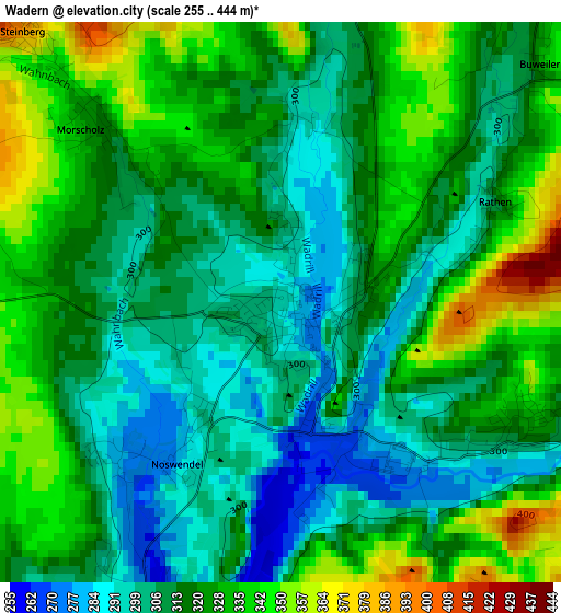
Below is the Elevation map of Wadern, which displays elevation range with different colors. Scale of the first map is from 255 to 444 m (837 to 1457 ft) with average elevation of 318.4 meters (=1045 ft) [note 1]
These maps also provides idea of topography and contour of this city, they are displayed at different zoom levels. More info about maps, scale and edge coordinates you can find below images.
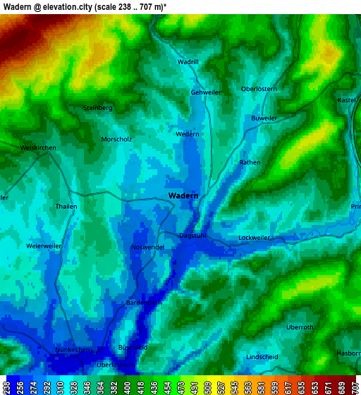
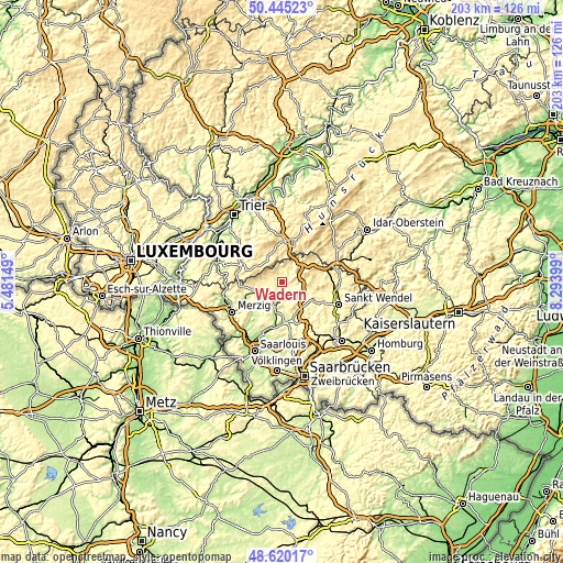
| \ | Map #1 | Map #2 | Topo.Map |
| Scale [m] | 255..444 m | 238..707 m | × |
| Scale [ft] | 837..1457 ft | 781..2320 ft | × |
| Average | 318.4 m = 1045 ft | 367.1 m = 1204 ft | × |
| Width | 6.34 km = 3.9 mi | 12.68 km = 7.9 mi | 202.9 km = 126.1 mi |
| Height | 6.34 km = 3.9 mi | 12.68 km = 7.9 mi | 202.9 km = 126.1 mi |
| ↑Max Latitude | 49.569728° | 49.598219° | 50.44523° |
| Latitude at center | 49.54122° | 49.54122° | 49.54122° |
| ↓Min Latitude | 49.512696° | 49.484154° | 48.62017° |
| ← Min Longitude | 6.843795° | 6.799849° | 5.48149° |
| Longitude center | 6.88774° | 6.88774° | 6.88774° |
| →Max Longitude | 6.931685° | 6.975631° | 8.29399° |
Nearby cities:
Cities around Wadern sort by population:
• Lebach elevation 221 m
14.5 km,  173°
173°
• Schmelz 218 m
12.3 km,  192°
192°
• Losheim 296 m
10.8 km,  251°
251°
• Tholey 389 m
12.5 km,  120°
120°
• Nonnweiler 397 m
9.5 km,  38°
38°
• Oberthal 318 m
14.5 km,  102°
102°
• Weiskirchen 352 m
5.2 km,  280°
280°
• Hermeskeil 526 m
13.3 km,  17°
17°
• Kell 467 m
11.3 km,  336°
336°
• Schillingen 485 m
12.7 km,  323°
323°
• Gusenburg 490 m
10.3 km,  4°
4°
• Greimerath 436 m
14.9 km, 278°
Multilingual:
 En español:
Wadern elevación 296 m.
 En France:
Wadern élévation 296 m.


Sources and notes:
- [note 1] Map square and city borders are not equal. Map elevation data is calculated only from area inside that square.
- [src 1] Elevation data from geonames database provided with same terms of usage.
- [src 2] The elevation map of Wadern is generated using elevation data from NASA's 3 arcsec (90m) resolution SRTM data.
- [src 3] Base (background) map © OpenStreetMap contributors tiles are generated by Geofabrik and OpenTopoMap.
Copyright & License:
This Wadern Elevation Map is licensed under CC BY-SA. You may reuse any part from this page, if you give a proper credit by linking to this URL:
 More info on terms of use page.