Tholey elevation
Tholey (Saarland), Germany elevation is 389 meters and Tholey elevation in feet is 1276 ft above sea level [src 1]. Tholey is a seat of a fourth-order administrative division (feature code) with elevation that is 131 meters (430 ft) bigger than average city elevation in Germany.
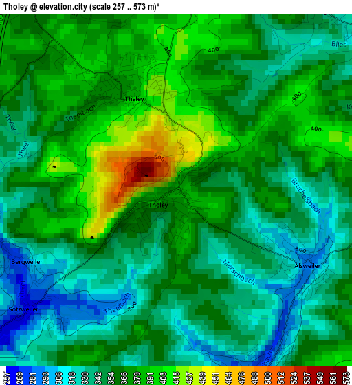
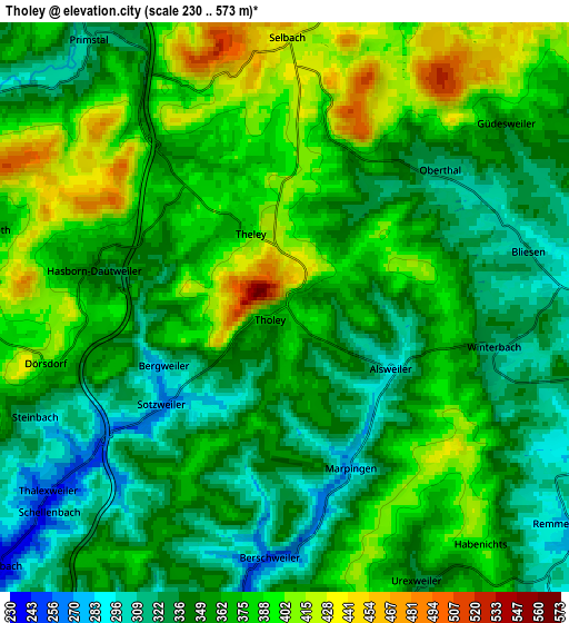
Below is the Elevation map of Tholey, which displays elevation range with different colors. Scale of the first map is from 257 to 573 m (843 to 1880 ft) with average elevation of 360 meters (=1181 ft) [note 1]
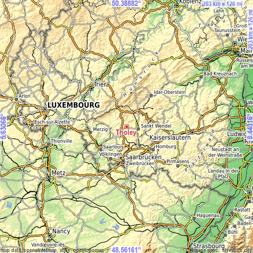
These maps also provides idea of topography and contour of this city, they are displayed at different zoom levels. More info about maps, scale and edge coordinates you can find below images.
| \ | Map #1 | Map #2 | Topo.Map |
| Scale [m] | 257..573 m | 230..573 m | × |
| Scale [ft] | 843..1880 ft | 755..1880 ft | × |
| Average | 360 m = 1181 ft | 361.3 m = 1185 ft | × |
| Width | 6.35 km = 3.9 mi | 12.7 km = 7.9 mi | 203.2 km = 126.3 mi |
| Height | 6.35 km = 3.9 mi | 12.7 km = 7.9 mi | 203.2 km = 126.3 mi |
| ↑Max Latitude | 49.512281° | 49.540806° | 50.38882° |
| Latitude at center | 49.48374° | 49.48374° | 49.48374° |
| ↓Min Latitude | 49.455182° | 49.426607° | 48.56161° |
| ← Min Longitude | 6.992965° | 6.949019° | 5.63066° |
| Longitude center | 7.03691° | 7.03691° | 7.03691° |
| →Max Longitude | 7.080855° | 7.124801° | 8.44316° |
Nearby cities:
Cities around Tholey sort by population:
• Sankt Wendel elevation 280 m
9.7 km,  101°
101°
• Lebach 221 m
12.2 km,  228°
228°
• Illingen 294 m
12.3 km,  176°
176°
• Eppelborn 244 m
10.6 km,  208°
208°
• Schmelz 218 m
14.6 km,  247°
247°
• Wadern 296 m
12.5 km,  300°
300°
• Ottweiler 254 m
13 km,  134°
134°
• Marpingen 285 m
3.8 km,  156°
156°
• Nohfelden 351 m
13.8 km,  33°
33°
• Namborn 340 m
8.6 km,  60°
60°
• Oberthal 318 m
4.7 km,  46°
46°
• Mainzweiler 305 m
9.4 km,  141°
141°
Multilingual:
 En español:
Tholey elevación 389 m.
 En France:
Tholey élévation 389 m.


Sources and notes:
- [note 1] Map square and city borders are not equal. Map elevation data is calculated only from area inside that square.
- [src 1] Elevation data from geonames database provided with same terms of usage.
- [src 2] The elevation map of Tholey is generated using elevation data from NASA's 3 arcsec (90m) resolution SRTM data.
- [src 3] Base (background) map © OpenStreetMap contributors tiles are generated by Geofabrik and OpenTopoMap.
Copyright & License:
This Tholey Elevation Map is licensed under CC BY-SA. You may reuse any part from this page, if you give a proper credit by linking to this URL:
 More info on terms of use page.