Pritzwalk elevation
Pritzwalk (Brandenburg), Germany elevation is 63 meters and Pritzwalk elevation in feet is 207 ft above sea level [src 1]. Pritzwalk is a populated place (feature code) with elevation that is 195 meters (640 ft) smaller than average city elevation in Germany.
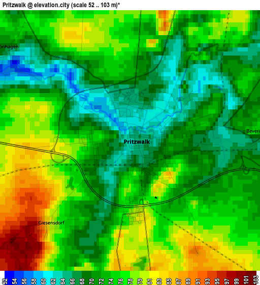
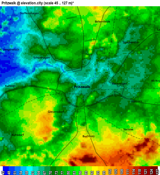
Below is the Elevation map of Pritzwalk, which displays elevation range with different colors. Scale of the first map is from 52 to 103 m (171 to 338 ft) with average elevation of 73.8 meters (=242 ft) [note 1]
These maps also provides idea of topography and contour of this city, they are displayed at different zoom levels. More info about maps, scale and edge coordinates you can find below images.
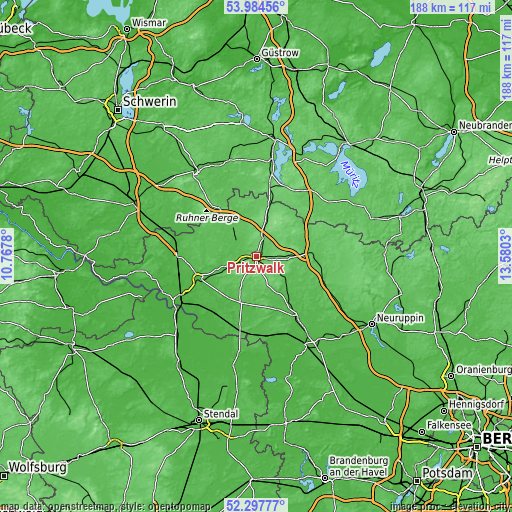
| \ | Map #1 | Map #2 | Topo.Map |
| Scale [m] | 52..103 m | 45..127 m | × |
| Scale [ft] | 171..338 ft | 148..417 ft | × |
| Average | 73.8 m = 242 ft | 78.1 m = 256 ft | × |
| Width | 5.86 km = 3.6 mi | 11.72 km = 7.3 mi | 187.6 km = 116.6 mi |
| Height | 5.86 km = 3.6 mi | 11.72 km = 7.3 mi | 187.5 km = 116.5 mi |
| ↑Max Latitude | 53.175797° | 53.202128° | 53.98456° |
| Latitude at center | 53.14945° | 53.14945° | 53.14945° |
| ↓Min Latitude | 53.123087° | 53.096707° | 52.29777° |
| ← Min Longitude | 12.130105° | 12.086159° | 10.7678° |
| Longitude center | 12.17405° | 12.17405° | 12.17405° |
| →Max Longitude | 12.217995° | 12.261941° | 13.5803° |
Nearby cities:
Cities around Pritzwalk sort by population:
• Wittstock elevation 66 m
20.6 km,  86°
86°
• Perleberg 32 m
22.7 km,  248°
248°
• Kyritz 45 m
27.5 km,  147°
147°
• Karstädt 32 m
28.8 km,  272°
272°
• Groß Pankow 57 m
8.9 km, 248°
• Heiligengrabe 79 m
12.6 km, 92°
• Gumtow 58 m
19.2 km,  164°
164°
• Plattenburg 33 m
23.3 km,  204°
204°
• Putlitz 57 m
14.1 km,  321°
321°
• Bad Wilsnack 27 m
26.2 km,  214°
214°
• Weisen 24 m
29.3 km,  241°
241°
• Breddin 44 m
29.5 km,  173°
173°
Multilingual:
 En español:
Pritzwalk elevación 63 m.
 En France:
Pritzwalk élévation 63 m.
 Auf Deutsch:
Pritzwalk höhe über dem Meeresspiegel ist 63 m.

Sources and notes:
- [note 1] Map square and city borders are not equal. Map elevation data is calculated only from area inside that square.
- [src 1] Elevation data from geonames database provided with same terms of usage.
- [src 2] The elevation map of Pritzwalk is generated using elevation data from NASA's 3 arcsec (90m) resolution SRTM data.
- [src 3] Base (background) map © OpenStreetMap contributors tiles are generated by Geofabrik and OpenTopoMap.
Copyright & License:
This Pritzwalk Elevation Map is licensed under CC BY-SA. You may reuse any part from this page, if you give a proper credit by linking to this URL:
 More info on terms of use page.