Wittstock elevation
Wittstock (Brandenburg), Germany elevation is 66 meters and Wittstock elevation in feet is 217 ft above sea level [src 1]. Wittstock is a populated place (feature code) with elevation that is 192 meters (630 ft) smaller than average city elevation in Germany.
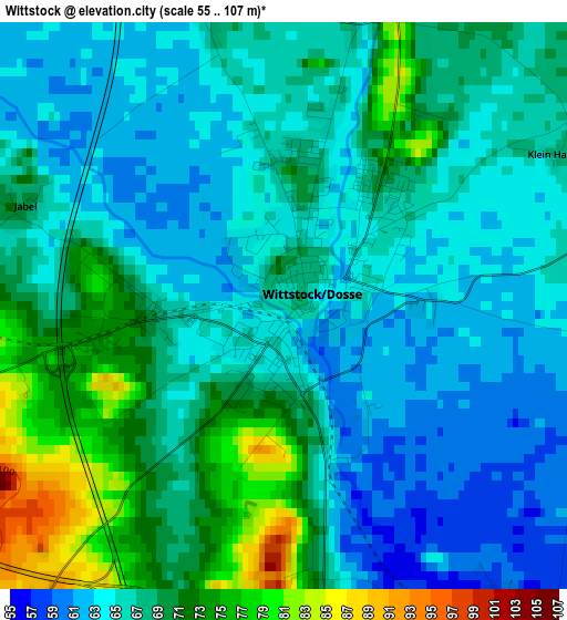
Below is the Elevation map of Wittstock, which displays elevation range with different colors. Scale of the first map is from 55 to 107 m (180 to 351 ft) with average elevation of 66.9 meters (=219 ft) [note 1]
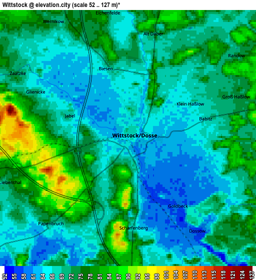
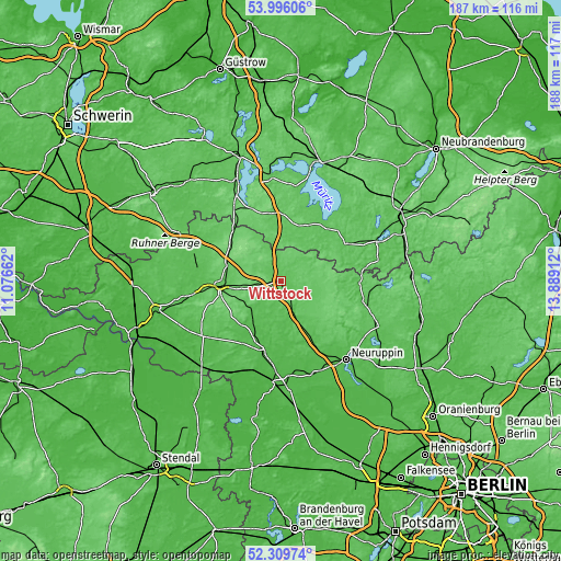
These maps also provides idea of topography and contour of this city, they are displayed at different zoom levels. More info about maps, scale and edge coordinates you can find below images.
| \ | Map #1 | Map #2 | Topo.Map |
| Scale [m] | 55..107 m | 52..127 m | × |
| Scale [ft] | 180..351 ft | 171..417 ft | × |
| Average | 66.9 m = 219 ft | 71.5 m = 235 ft | × |
| Width | 5.86 km = 3.6 mi | 11.72 km = 7.3 mi | 187.5 km = 116.5 mi |
| Height | 5.86 km = 3.6 mi | 11.72 km = 7.3 mi | 187.5 km = 116.5 mi |
| ↑Max Latitude | 53.18752° | 53.213844° | 53.99606° |
| Latitude at center | 53.16118° | 53.16118° | 53.16118° |
| ↓Min Latitude | 53.134824° | 53.108451° | 52.30974° |
| ← Min Longitude | 12.438925° | 12.394979° | 11.07662° |
| Longitude center | 12.48287° | 12.48287° | 12.48287° |
| →Max Longitude | 12.526815° | 12.570761° | 13.88912° |
Nearby cities:
Cities around Wittstock sort by population:
• Neuruppin elevation 45 m
33.6 km,  140°
140°
• Pritzwalk 63 m
20.6 km,  266°
266°
• Kyritz 45 m
25 km,  193°
193°
• Rheinsberg 61 m
28.6 km,  103°
103°
• Wusterhausen 36 m
30.1 km,  182°
182°
• Röbel 67 m
25.2 km,  18°
18°
• Groß Pankow 57 m
29.3 km,  260°
260°
• Heiligengrabe 79 m
8.2 km, 257°
• Gumtow 58 m
25.2 km,  218°
218°
• Wesenberg 59 m
35 km,  67°
67°
• Putlitz 57 m
31 km,  288°
288°
• Rechlin 67 m
25.2 km,  39°
39°
Multilingual:
 En español:
Wittstock elevación 66 m.
 En France:
Wittstock élévation 66 m.
 Auf Deutsch:
Wittstock höhe über dem Meeresspiegel ist 66 m.

Sources and notes:
- [note 1] Map square and city borders are not equal. Map elevation data is calculated only from area inside that square.
- [src 1] Elevation data from geonames database provided with same terms of usage.
- [src 2] The elevation map of Wittstock is generated using elevation data from NASA's 3 arcsec (90m) resolution SRTM data.
- [src 3] Base (background) map © OpenStreetMap contributors tiles are generated by Geofabrik and OpenTopoMap.
Copyright & License:
This Wittstock Elevation Map is licensed under CC BY-SA. You may reuse any part from this page, if you give a proper credit by linking to this URL:
 More info on terms of use page.