Karstädt elevation
Karstädt (Brandenburg), Germany elevation is 32 meters and Karstädt elevation in feet is 105 ft above sea level [src 1]. Karstädt is a seat of a fourth-order administrative division (feature code) with elevation that is 226 meters (741 ft) smaller than average city elevation in Germany.
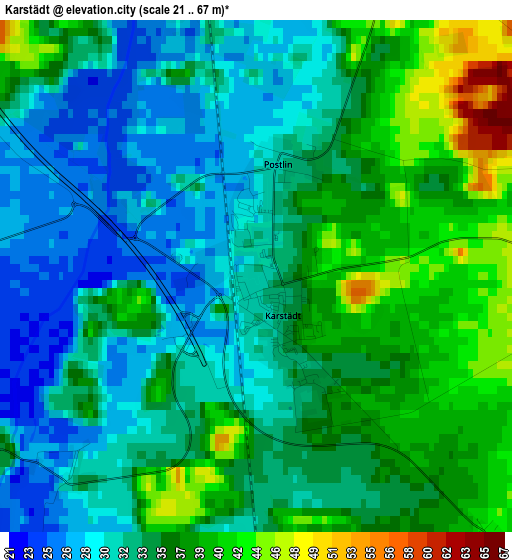
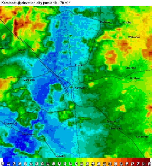
Below is the Elevation map of Karstädt, which displays elevation range with different colors. Scale of the first map is from 21 to 67 m (69 to 220 ft) with average elevation of 34.2 meters (=112 ft) [note 1]
These maps also provides idea of topography and contour of this city, they are displayed at different zoom levels. More info about maps, scale and edge coordinates you can find below images.
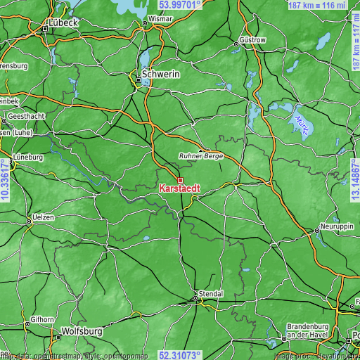
| \ | Map #1 | Map #2 | Topo.Map |
| Scale [m] | 21..67 m | 19..79 m | × |
| Scale [ft] | 69..220 ft | 62..259 ft | × |
| Average | 34.2 m = 112 ft | 39 m = 128 ft | × |
| Width | 5.86 km = 3.6 mi | 11.72 km = 7.3 mi | 187.5 km = 116.5 mi |
| Height | 5.86 km = 3.6 mi | 11.72 km = 7.3 mi | 187.5 km = 116.5 mi |
| ↑Max Latitude | 53.188489° | 53.214813° | 53.99701° |
| Latitude at center | 53.16215° | 53.16215° | 53.16215° |
| ↓Min Latitude | 53.135794° | 53.109423° | 52.31073° |
| ← Min Longitude | 11.698475° | 11.654529° | 10.33617° |
| Longitude center | 11.74242° | 11.74242° | 11.74242° |
| →Max Longitude | 11.786365° | 11.830311° | 13.14867° |
Nearby cities:
Cities around Karstädt sort by population:
• Wittenberge elevation 23 m
17.4 km,  178°
178°
• Perleberg 32 m
12.3 km,  141°
141°
• Grabow 30 m
17.6 km,  317°
317°
• Groß Pankow 57 m
21 km,  103°
103°
• Putlitz 57 m
22.2 km,  64°
64°
• Löcknitz 39 m
14.1 km,  10°
10°
• Lenzen 21 m
19.5 km,  246°
246°
• Breese 21 m
18.4 km,  167°
167°
• Eldena 24 m
23 km,  289°
289°
• Gartow 20 m
24.2 km,  230°
230°
• Weisen 24 m
15.5 km, 168°
• Groß Laasch 39 m
24.2 km,  327°
327°
Multilingual:
 En español:
Karstädt elevación 32 m.
 En France:
Karstädt élévation 32 m.


Sources and notes:
- [note 1] Map square and city borders are not equal. Map elevation data is calculated only from area inside that square.
- [src 1] Elevation data from geonames database provided with same terms of usage.
- [src 2] The elevation map of Karstädt is generated using elevation data from NASA's 3 arcsec (90m) resolution SRTM data.
- [src 3] Base (background) map © OpenStreetMap contributors tiles are generated by Geofabrik and OpenTopoMap.
Copyright & License:
This Karstädt Elevation Map is licensed under CC BY-SA. You may reuse any part from this page, if you give a proper credit by linking to this URL:
 More info on terms of use page.