Grabow elevation
Grabow (Mecklenburg-Vorpommern), Germany elevation is 30 meters and Grabow elevation in feet is 98 ft above sea level [src 1]. Grabow is a populated place (feature code) with elevation that is 228 meters (748 ft) smaller than average city elevation in Germany.
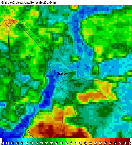
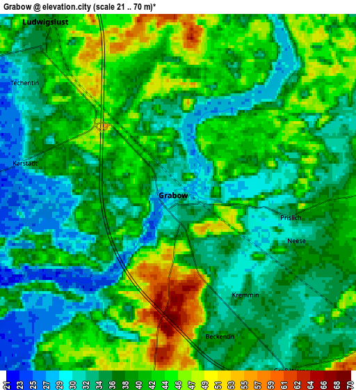
Below is the Elevation map of Grabow, which displays elevation range with different colors. Scale of the first map is from 23 to 64 m (75 to 210 ft) with average elevation of 37.5 meters (=123 ft) [note 1]
These maps also provides idea of topography and contour of this city, they are displayed at different zoom levels. More info about maps, scale and edge coordinates you can find below images.
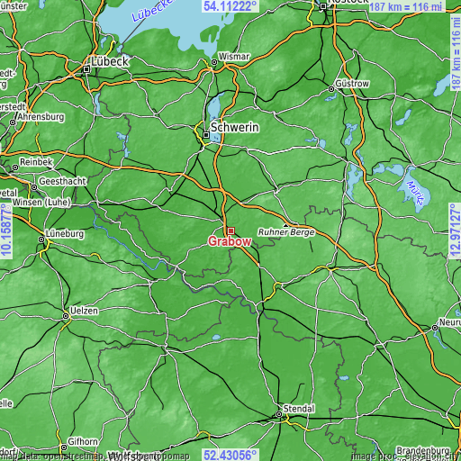
| \ | Map #1 | Map #2 | Topo.Map |
| Scale [m] | 23..64 m | 21..70 m | × |
| Scale [ft] | 75..210 ft | 69..230 ft | × |
| Average | 37.5 m = 123 ft | 38.3 m = 126 ft | × |
| Width | 5.84 km = 3.6 mi | 11.69 km = 7.3 mi | 187 km = 116.2 mi |
| Height | 5.84 km = 3.6 mi | 11.69 km = 7.3 mi | 187 km = 116.2 mi |
| ↑Max Latitude | 53.305927° | 53.332178° | 54.11222° |
| Latitude at center | 53.27966° | 53.27966° | 53.27966° |
| ↓Min Latitude | 53.253377° | 53.227077° | 52.43056° |
| ← Min Longitude | 11.521075° | 11.477129° | 10.15877° |
| Longitude center | 11.56502° | 11.56502° | 11.56502° |
| →Max Longitude | 11.608965° | 11.652911° | 12.97127° |
Nearby cities:
Cities around Grabow sort by population:
• Parchim elevation 52 m
24.9 km,  49°
49°
• Ludwigslust 36 m
7.1 km,  320°
320°
• Karstädt 32 m
17.6 km,  137°
137°
• Neustadt-Glewe 35 m
11.1 km,  9°
9°
• Löcknitz 39 m
14.4 km,  86°
86°
• Lenzen 21 m
21.7 km,  196°
196°
• Neu Kaliß 16 m
21.5 km,  237°
237°
• Rastow 41 m
21.6 km,  335°
335°
• Spornitz 58 m
17.5 km,  35°
35°
• Eldena 24 m
11.1 km, 241°
• Malliß 40 m
17.6 km, 244°
• Groß Laasch 39 m
7.5 km,  351°
351°
Multilingual:
 En español:
Grabow elevación 30 m.
 En France:
Grabow élévation 30 m.


Sources and notes:
- [note 1] Map square and city borders are not equal. Map elevation data is calculated only from area inside that square.
- [src 1] Elevation data from geonames database provided with same terms of usage.
- [src 2] The elevation map of Grabow is generated using elevation data from NASA's 3 arcsec (90m) resolution SRTM data.
- [src 3] Base (background) map © OpenStreetMap contributors tiles are generated by Geofabrik and OpenTopoMap.
Copyright & License:
This Grabow Elevation Map is licensed under CC BY-SA. You may reuse any part from this page, if you give a proper credit by linking to this URL:
 More info on terms of use page.