Monte Vista elevation
Monte Vista (Colorado, Rio Grande County), United States elevation is 2341 meters and Monte Vista elevation in feet is 7680 ft above sea level [src 1]. Monte Vista is a populated place (feature code) with elevation that is 2062 meters (6765 ft) bigger than average city elevation in United States.
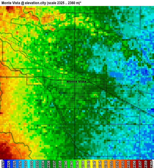
Below is the Elevation map of Monte Vista, which displays elevation range with different colors. Scale of the first map is from 2325 to 2360 m (7628 to 7743 ft) with average elevation of 2338.5 meters (=7672 ft) [note 1]
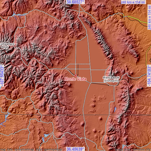
These maps also provides idea of topography and contour of this city, they are displayed at different zoom levels. More info about maps, scale and edge coordinates you can find below images.
| \ | Map #1 | Map #2 | Topo.Map |
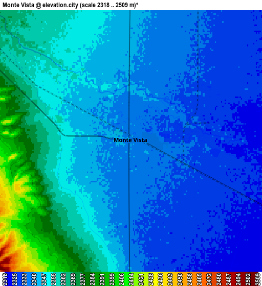
| Scale [m] | 2325..2360 m | 2318..2509 m | × |
| Scale [ft] | 7628..7743 ft | 7605..8232 ft | × |
| Average | 2338.5 m = 7672 ft | 2347.5 m = 7702 ft | × |
| Width | 7.74 km = 4.8 mi | 15.49 km = 9.6 mi | 247.8 km = 154 mi |
| Height | 7.74 km = 4.8 mi | 15.49 km = 9.6 mi | 247.8 km = 154 mi |
| ↑Max Latitude | 37.613989° | 37.648792° | 38.68527° |
| Latitude at center | 37.57917° | 37.57917° | 37.57917° |
| ↓Min Latitude | 37.544335° | 37.509483° | 36.45639° |
| ← Min Longitude | -106.192025° | -106.235971° | -107.55433° |
| Longitude center | -106.14808° | -106.14808° | -106.14808° |
| →Max Longitude | -106.104135° | -106.060189° | -104.74183° |
Nearby cities:
Cities around Monte Vista sort by population:
• Alamosa elevation 2303 m
27.4 km,  116°
116°
• Center 2333 m
19.6 km,  10°
10°
• Pagosa Springs 2170 m
83.5 km,  245°
245°
• Del Norte 2405 m
21.2 km,  301°
301°
• Alamosa East 2297 m
29.3 km,  112°
112°
• Chama 2396 m
84.3 km,  206°
206°
• San Luis 2433 m
76.6 km, 123°
• Westcliffe 2404 m
86 km,  44°
44°
• Saguache 2354 m
56.5 km,  0°
0°
• Creede 2693 m
74.8 km,  293°
293°
• Tierra Amarilla 2295 m
104 km,  200°
200°
• Conejos 2413 m
55.7 km,  168°
168°
Multilingual:
 En español:
Monte Vista elevación 2341 m.
 En France:
Monte Vista élévation 2341 m.
 Auf Deutsch:
Monte Vista höhe über dem Meeresspiegel ist 2341 m.

Sources and notes:
- [note 1] Map square and city borders are not equal. Map elevation data is calculated only from area inside that square.
- [src 1] Elevation data from geonames database provided with same terms of usage.
- [src 2] The elevation map of Monte Vista is generated using elevation data from NASA's 3 arcsec (90m) resolution SRTM data.
- [src 3] Base (background) map © OpenStreetMap contributors tiles are generated by Geofabrik and OpenTopoMap.
Copyright & License:
This Monte Vista Elevation Map is licensed under CC BY-SA. You may reuse any part from this page, if you give a proper credit by linking to this URL:
 More info on terms of use page.