Attica elevation
Attica (New York, Wyoming County), United States elevation is 302 meters and Attica elevation in feet is 991 ft above sea level [src 1]. Attica is a populated place (feature code) with elevation that is 23 meters (75 ft) bigger than average city elevation in United States.
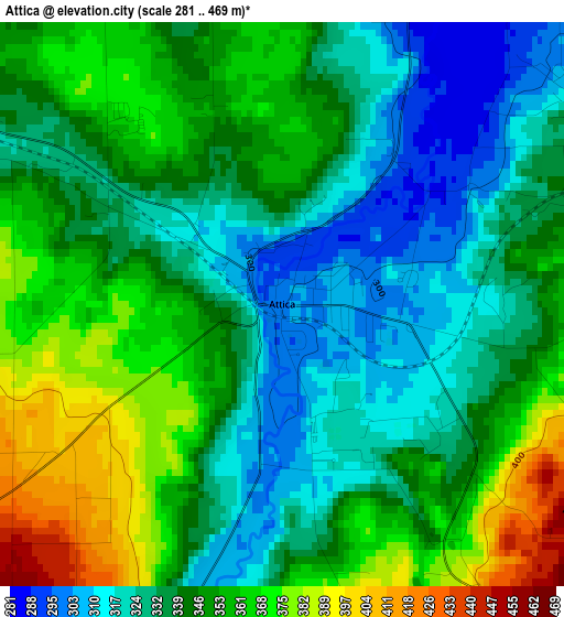
Below is the Elevation map of Attica, which displays elevation range with different colors. Scale of the first map is from 281 to 469 m (922 to 1539 ft) with average elevation of 343.7 meters (=1128 ft) [note 1]
These maps also provides idea of topography and contour of this city, they are displayed at different zoom levels. More info about maps, scale and edge coordinates you can find below images.
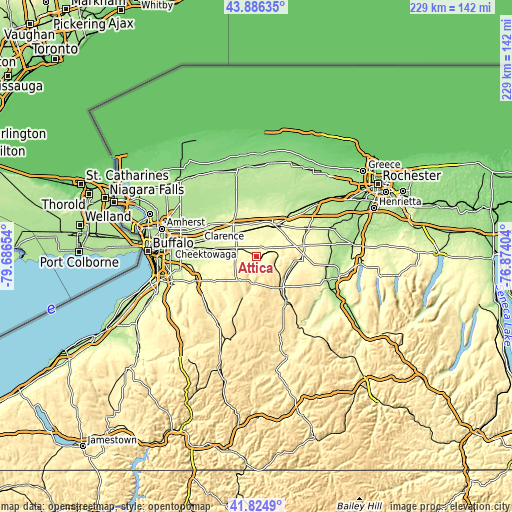
| \ | Map #1 | Topo.Map |
| Scale [m] | 281..469 m | × |
| Scale [ft] | 922..1539 ft | × |
| Average | 343.7 m = 1128 ft | × |
| Width | 7.16 km = 4.4 mi | 229.2 km = 142.4 mi |
| Height | 7.16 km = 4.4 mi | 229.2 km = 142.4 mi |
| ↑Max Latitude | 42.896432° | 43.88635° |
| Latitude at center | 42.86423° | 42.86423° |
| ↓Min Latitude | 42.832011° | 41.8249° |
| ← Min Longitude | -78.324235° | -79.68654° |
| Longitude center | -78.28029° | -78.28029° |
| →Max Longitude | -78.236345° | -76.87404° |
Nearby cities:
Cities around Attica sort by population:
• Batavia elevation 272 m
16.7 km,  26°
26°
• East Aurora 281 m
29.2 km,  248°
248°
• Le Roy 279 m
27.2 km,  62°
62°
• Perry 419 m
27.8 km,  126°
126°
• Warsaw 310 m
18.3 km,  138°
138°
• Akron 229 m
24.7 km,  314°
314°
• Clarence 230 m
28.3 km,  296°
296°
• Alden 267 m
17.7 km,  283°
283°
• Elma Center 247 m
29.3 km,  262°
262°
• Town Line 230 m
24.4 km, 276°
• Alabama 198 m
27.3 km,  340°
340°
• Oakfield 232 m
22.4 km,  2°
2°
Multilingual:
 En español:
Attica elevación 302 m.
 En France:
Attica élévation 302 m.


Sources and notes:
- [note 1] Map square and city borders are not equal. Map elevation data is calculated only from area inside that square.
- [src 1] Elevation data from geonames database provided with same terms of usage.
- [src 2] The elevation map of Attica is generated using elevation data from NASA's 3 arcsec (90m) resolution SRTM data.
- [src 3] Base (background) map © OpenStreetMap contributors tiles are generated by Geofabrik and OpenTopoMap.
Copyright & License:
This Attica Elevation Map is licensed under CC BY-SA. You may reuse any part from this page, if you give a proper credit by linking to this URL:
 More info on terms of use page.