Le Roy elevation
Le Roy (New York, Genesee County), United States elevation is 279 meters and Le Roy elevation in feet is 915 ft above sea level [src 1]. Le Roy is a populated place (feature code) with elevation that is 0 meters (0 ft) bigger than average city elevation in United States.
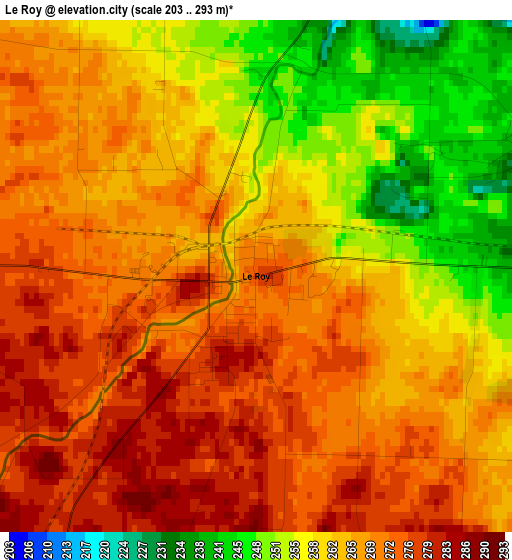
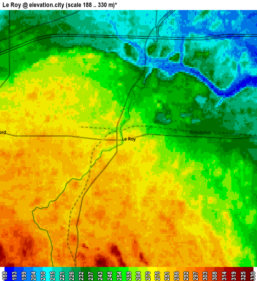
Below is the Elevation map of Le Roy, which displays elevation range with different colors. Scale of the first map is from 203 to 293 m (666 to 961 ft) with average elevation of 265.4 meters (=871 ft) [note 1]
These maps also provides idea of topography and contour of this city, they are displayed at different zoom levels. More info about maps, scale and edge coordinates you can find below images.
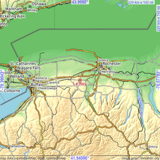
| \ | Map #1 | Map #2 | Topo.Map |
| Scale [m] | 203..293 m | 188..330 m | × |
| Scale [ft] | 666..961 ft | 617..1083 ft | × |
| Average | 265.4 m = 871 ft | 258.2 m = 847 ft | × |
| Width | 7.15 km = 4.4 mi | 14.3 km = 8.9 mi | 228.8 km = 142.2 mi |
| Height | 7.15 km = 4.4 mi | 14.3 km = 8.9 mi | 228.8 km = 142.2 mi |
| ↑Max Latitude | 43.010532° | 43.042658° | 43.9986° |
| Latitude at center | 42.97839° | 42.97839° | 42.97839° |
| ↓Min Latitude | 42.946231° | 42.914055° | 41.94096° |
| ← Min Longitude | -78.028125° | -78.072071° | -79.39043° |
| Longitude center | -77.98418° | -77.98418° | -77.98418° |
| →Max Longitude | -77.940235° | -77.896289° | -76.57793° |
Nearby cities:
Cities around Le Roy sort by population:
• Batavia elevation 272 m
16.7 km,  277°
277°
• Brockport 162 m
26.4 km,  7°
7°
• Geneseo 238 m
24.4 km,  146°
146°
• Spencerport 172 m
27.4 km,  32°
32°
• Avon 200 m
20.8 km,  110°
110°
• Attica 302 m
27.2 km,  242°
242°
• Caledonia 201 m
10.7 km,  93°
93°
• Churchville 179 m
16.2 km, 30°
• Scottsville 190 m
20.1 km,  74°
74°
• Oakfield 232 m
25.2 km,  292°
292°
• Holley 167 m
27.8 km,  352°
352°
• Bergen 187 m
12.4 km,  15°
15°
Multilingual:
 En español:
Le Roy elevación 279 m.
 En France:
Le Roy élévation 279 m.


Sources and notes:
- [note 1] Map square and city borders are not equal. Map elevation data is calculated only from area inside that square.
- [src 1] Elevation data from geonames database provided with same terms of usage.
- [src 2] The elevation map of Le Roy is generated using elevation data from NASA's 3 arcsec (90m) resolution SRTM data.
- [src 3] Base (background) map © OpenStreetMap contributors tiles are generated by Geofabrik and OpenTopoMap.
Copyright & License:
This Le Roy Elevation Map is licensed under CC BY-SA. You may reuse any part from this page, if you give a proper credit by linking to this URL:
 More info on terms of use page.