Itasca elevation
Itasca (Texas, Hill County), United States elevation is 218 meters and Itasca elevation in feet is 715 ft above sea level [src 1]. Itasca is a populated place (feature code) with elevation that is 61 meters (200 ft) smaller than average city elevation in United States.
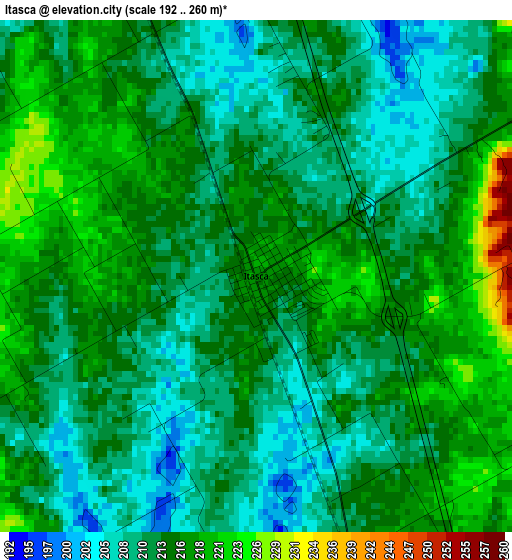
Below is the Elevation map of Itasca, which displays elevation range with different colors. Scale of the first map is from 192 to 260 m (630 to 853 ft) with average elevation of 213.1 meters (=699 ft) [note 1]
These maps also provides idea of topography and contour of this city, they are displayed at different zoom levels. More info about maps, scale and edge coordinates you can find below images.
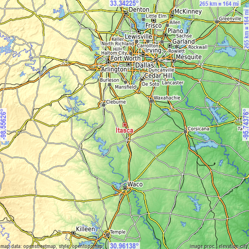
| \ | Map #1 | Topo.Map |
| Scale [m] | 192..260 m | × |
| Scale [ft] | 630..853 ft | × |
| Average | 213.1 m = 699 ft | × |
| Width | 8.27 km = 5.1 mi | 264.7 km = 164.5 mi |
| Height | 8.27 km = 5.1 mi | 264.7 km = 164.5 mi |
| ↑Max Latitude | 32.196785° | 33.34225° |
| Latitude at center | 32.15959° | 32.15959° |
| ↓Min Latitude | 32.12238° | 30.96138° |
| ← Min Longitude | -97.193955° | -98.55626° |
| Longitude center | -97.15001° | -97.15001° |
| →Max Longitude | -97.106065° | -95.74376° |
Nearby cities:
Cities around Itasca sort by population:
• Waxahachie elevation 174 m
38 km,  48°
48°
• Cleburne 240 m
30.5 km,  313°
313°
• Midlothian 233 m
38.8 km,  22°
22°
• Hillsboro 197 m
16.6 km,  173°
173°
• Keene 279 m
31 km,  328°
328°
• Alvarado 237 m
28.1 km,  348°
348°
• Venus 207 m
30.8 km,  8°
8°
• Nash 164 m
33.8 km,  69°
69°
• Whitney 182 m
28.2 km,  214°
214°
• Italy 175 m
25.1 km,  83°
83°
• Grandview 217 m
12.6 km, 347°
• Plum Grove 230 m
15.6 km, 75°
Multilingual:
 En español:
Itasca elevación 218 m.
 En France:
Itasca élévation 218 m.


Sources and notes:
- [note 1] Map square and city borders are not equal. Map elevation data is calculated only from area inside that square.
- [src 1] Elevation data from geonames database provided with same terms of usage.
- [src 2] The elevation map of Itasca is generated using elevation data from NASA's 3 arcsec (90m) resolution SRTM data.
- [src 3] Base (background) map © OpenStreetMap contributors tiles are generated by Geofabrik and OpenTopoMap.
Copyright & License:
This Itasca Elevation Map is licensed under CC BY-SA. You may reuse any part from this page, if you give a proper credit by linking to this URL:
 More info on terms of use page.