Midlothian elevation
Midlothian (Texas, Ellis County), United States elevation is 233 meters and Midlothian elevation in feet is 764 ft above sea level [src 1]. Midlothian is a populated place (feature code) with elevation that is 46 meters (151 ft) smaller than average city elevation in United States.
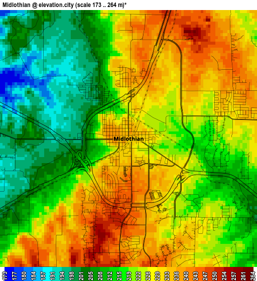
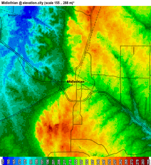
Below is the Elevation map of Midlothian, which displays elevation range with different colors. Scale of the first map is from 173 to 264 m (568 to 866 ft) with average elevation of 220.7 meters (=724 ft) [note 1]
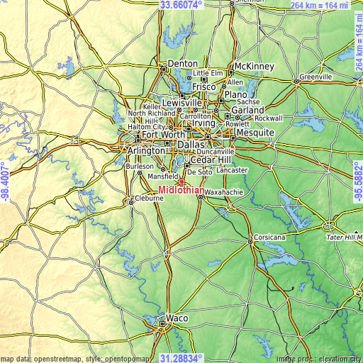
These maps also provides idea of topography and contour of this city, they are displayed at different zoom levels. More info about maps, scale and edge coordinates you can find below images.
| \ | Map #1 | Map #2 | Topo.Map |
| Scale [m] | 173..264 m | 155..288 m | × |
| Scale [ft] | 568..866 ft | 509..945 ft | × |
| Average | 220.7 m = 724 ft | 214.4 m = 703 ft | × |
| Width | 8.24 km = 5.1 mi | 16.49 km = 10.2 mi | 263.8 km = 163.9 mi |
| Height | 8.24 km = 5.1 mi | 16.49 km = 10.2 mi | 263.8 km = 163.9 mi |
| ↑Max Latitude | 32.519423° | 32.55647° | 33.66074° |
| Latitude at center | 32.48236° | 32.48236° | 32.48236° |
| ↓Min Latitude | 32.445282° | 32.408189° | 31.28834° |
| ← Min Longitude | -97.038395° | -97.082341° | -98.4007° |
| Longitude center | -96.99445° | -96.99445° | -96.99445° |
| →Max Longitude | -96.950505° | -96.906559° | -95.5882° |
Nearby cities:
Cities around Midlothian sort by population:
• Mansfield elevation 188 m
16.5 km,  303°
303°
• DeSoto 205 m
17.6 km,  47°
47°
• Cedar Hill 258 m
12.3 km,  16°
16°
• Duncanville 224 m
20.5 km, 23°
• Waxahachie 174 m
17.4 km,  127°
127°
• Glenn Heights 206 m
14.9 km,  60°
60°
• Red Oak 190 m
18.2 km,  77°
77°
• Alvarado 237 m
22.1 km,  247°
247°
• Ovilla 193 m
11.3 km, 64°
• Venus 207 m
11.5 km,  241°
241°
• Shamrock 216 m
16.4 km,  37°
37°
• Oak Leaf 187 m
13.8 km,  72°
72°
Multilingual:
 En español:
Midlothian elevación 233 m.
 En France:
Midlothian élévation 233 m.
 Auf Deutsch:
Midlothian höhe über dem Meeresspiegel ist 233 m.

Sources and notes:
- [note 1] Map square and city borders are not equal. Map elevation data is calculated only from area inside that square.
- [src 1] Elevation data from geonames database provided with same terms of usage.
- [src 2] The elevation map of Midlothian is generated using elevation data from NASA's 3 arcsec (90m) resolution SRTM data.
- [src 3] Base (background) map © OpenStreetMap contributors tiles are generated by Geofabrik and OpenTopoMap.
Copyright & License:
This Midlothian Elevation Map is licensed under CC BY-SA. You may reuse any part from this page, if you give a proper credit by linking to this URL:
 More info on terms of use page.