DeSoto elevation
DeSoto (Texas, Dallas County), United States elevation is 205 meters and DeSoto elevation in feet is 673 ft above sea level [src 1]. DeSoto is a populated place (feature code) with elevation that is 74 meters (243 ft) smaller than average city elevation in United States.
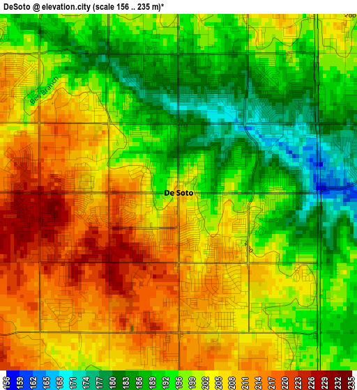
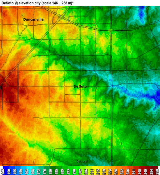
Below is the Elevation map of DeSoto, which displays elevation range with different colors. Scale of the first map is from 156 to 235 m (512 to 771 ft) with average elevation of 200.1 meters (=656 ft) [note 1]
These maps also provides idea of topography and contour of this city, they are displayed at different zoom levels. More info about maps, scale and edge coordinates you can find below images.
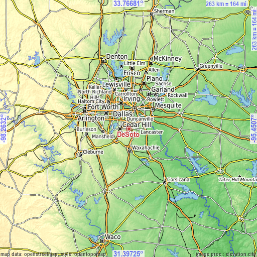
| \ | Map #1 | Map #2 | Topo.Map |
| Scale [m] | 156..235 m | 146..258 m | × |
| Scale [ft] | 512..771 ft | 479..846 ft | × |
| Average | 200.1 m = 656 ft | 201.8 m = 662 ft | × |
| Width | 8.23 km = 5.1 mi | 16.47 km = 10.2 mi | 263.5 km = 163.7 mi |
| Height | 8.23 km = 5.1 mi | 16.47 km = 10.2 mi | 263.5 km = 163.7 mi |
| ↑Max Latitude | 32.626878° | 32.663881° | 33.76681° |
| Latitude at center | 32.58986° | 32.58986° | 32.58986° |
| ↓Min Latitude | 32.552826° | 32.515777° | 31.39725° |
| ← Min Longitude | -96.900895° | -96.944841° | -98.2632° |
| Longitude center | -96.85695° | -96.85695° | -96.85695° |
| →Max Longitude | -96.813005° | -96.769059° | -95.4507° |
Nearby cities:
Cities around DeSoto sort by population:
• Cedar Hill elevation 258 m
9.3 km,  269°
269°
• Duncanville 224 m
8.4 km,  325°
325°
• Lancaster 161 m
9.5 km,  88°
88°
• Midlothian 233 m
17.6 km,  227°
227°
• Glenn Heights 206 m
4.6 km,  179°
179°
• Red Oak 190 m
9.4 km,  148°
148°
• Hutchins 146 m
15 km,  63°
63°
• Cockrell Hill 202 m
16.5 km,  350°
350°
• Wilmer 146 m
16.1 km, 90°
• Ovilla 193 m
7.6 km,  201°
201°
• Shamrock 216 m
3 km,  290°
290°
• Oak Leaf 187 m
7.7 km, 178°
Multilingual:
 En español:
DeSoto elevación 205 m.
 En France:
DeSoto élévation 205 m.


Sources and notes:
- [note 1] Map square and city borders are not equal. Map elevation data is calculated only from area inside that square.
- [src 1] Elevation data from geonames database provided with same terms of usage.
- [src 2] The elevation map of DeSoto is generated using elevation data from NASA's 3 arcsec (90m) resolution SRTM data.
- [src 3] Base (background) map © OpenStreetMap contributors tiles are generated by Geofabrik and OpenTopoMap.
Copyright & License:
This DeSoto Elevation Map is licensed under CC BY-SA. You may reuse any part from this page, if you give a proper credit by linking to this URL:
 More info on terms of use page.