Alvarado elevation
Alvarado (Texas, Johnson County), United States elevation is 237 meters and Alvarado elevation in feet is 778 ft above sea level [src 1]. Alvarado is a populated place (feature code) with elevation that is 42 meters (138 ft) smaller than average city elevation in United States.
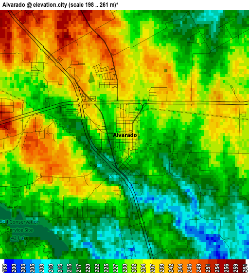
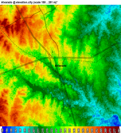
Below is the Elevation map of Alvarado, which displays elevation range with different colors. Scale of the first map is from 198 to 261 m (650 to 856 ft) with average elevation of 228.2 meters (=749 ft) [note 1]
These maps also provides idea of topography and contour of this city, they are displayed at different zoom levels. More info about maps, scale and edge coordinates you can find below images.
| \ | Map #1 | Map #2 | Topo.Map |
| Scale [m] | 198..261 m | 180..281 m | × |
| Scale [ft] | 650..856 ft | 591..922 ft | × |
| Average | 228.2 m = 749 ft | 228.7 m = 750 ft | × |
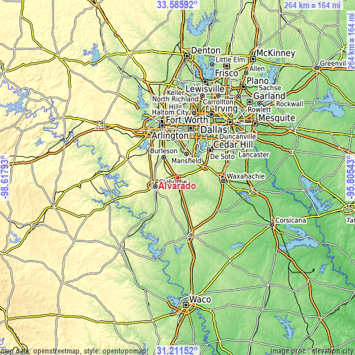
| Width | 8.25 km = 5.1 mi | 16.5 km = 10.3 mi | 264 km = 164 mi |
| Height | 8.25 km = 5.1 mi | 16.5 km = 10.3 mi | 264 km = 164 mi |
| ↑Max Latitude | 32.443624° | 32.480703° | 33.58592° |
| Latitude at center | 32.40653° | 32.40653° | 32.40653° |
| ↓Min Latitude | 32.369421° | 32.332296° | 31.21152° |
| ← Min Longitude | -97.255625° | -97.299571° | -98.61793° |
| Longitude center | -97.21168° | -97.21168° | -97.21168° |
| →Max Longitude | -97.167735° | -97.123789° | -95.80543° |
Nearby cities:
Cities around Alvarado sort by population:
• Mansfield elevation 188 m
18.6 km,  20°
20°
• Burleson 220 m
18.2 km,  325°
325°
• Cleburne 240 m
17.7 km,  248°
248°
• Midlothian 233 m
22.1 km,  67°
67°
• Crowley 241 m
23.8 km,  323°
323°
• Rendon 226 m
19.1 km,  351°
351°
• Kennedale 197 m
26.7 km,  357°
357°
• Everman 208 m
26 km,  343°
343°
• Keene 279 m
10.6 km,  264°
264°
• Joshua 289 m
17.6 km,  290°
290°
• Venus 207 m
10.7 km, 73°
• Grandview 217 m
15.4 km,  168°
168°
Multilingual:
 En español:
Alvarado elevación 237 m.
 En France:
Alvarado élévation 237 m.
 Auf Deutsch:
Alvarado höhe über dem Meeresspiegel ist 237 m.

Sources and notes:
- [note 1] Map square and city borders are not equal. Map elevation data is calculated only from area inside that square.
- [src 1] Elevation data from geonames database provided with same terms of usage.
- [src 2] The elevation map of Alvarado is generated using elevation data from NASA's 3 arcsec (90m) resolution SRTM data.
- [src 3] Base (background) map © OpenStreetMap contributors tiles are generated by Geofabrik and OpenTopoMap.
Copyright & License:
This Alvarado Elevation Map is licensed under CC BY-SA. You may reuse any part from this page, if you give a proper credit by linking to this URL:
 More info on terms of use page.