Whitney elevation
Whitney (Texas, Hill County), United States elevation is 182 meters and Whitney elevation in feet is 597 ft above sea level [src 1]. Whitney is a populated place (feature code) with elevation that is 97 meters (318 ft) smaller than average city elevation in United States.
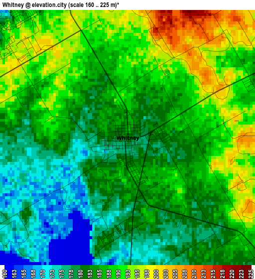
Below is the Elevation map of Whitney, which displays elevation range with different colors. Scale of the first map is from 160 to 225 m (525 to 738 ft) with average elevation of 185.1 meters (=607 ft) [note 1]
These maps also provides idea of topography and contour of this city, they are displayed at different zoom levels. More info about maps, scale and edge coordinates you can find below images.
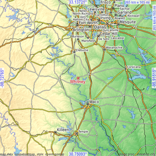
| \ | Map #1 | Topo.Map |
| Scale [m] | 160..225 m | × |
| Scale [ft] | 525..738 ft | × |
| Average | 185.1 m = 607 ft | × |
| Width | 8.29 km = 5.2 mi | 265.3 km = 164.8 mi |
| Height | 8.29 km = 5.2 mi | 265.3 km = 164.8 mi |
| ↑Max Latitude | 31.9891° | 33.13721° |
| Latitude at center | 31.95182° | 31.95182° |
| ↓Min Latitude | 31.914525° | 30.75093° |
| ← Min Longitude | -97.365345° | -98.72765° |
| Longitude center | -97.3214° | -97.3214° |
| →Max Longitude | -97.277455° | -95.91515° |
Nearby cities:
Cities around Whitney sort by population:
• Hillsboro elevation 197 m
19.2 km,  69°
69°
• Lacy-Lakeview 154 m
41.4 km,  150°
150°
• Clifton 209 m
30.6 km,  231°
231°
• West 197 m
27.3 km,  127°
127°
• Northcrest 154 m
40.8 km, 149°
• Itasca 218 m
28.2 km,  34°
34°
• Grandview 217 m
37.9 km,  20°
20°
• Meridian 236 m
31.8 km,  264°
264°
• Laguna Park 188 m
11.7 km,  208°
208°
• Valley Mills 185 m
35.5 km,  203°
203°
• Gholson 135 m
29.6 km,  160°
160°
• Plum Grove 230 m
41.4 km,  49°
49°
Multilingual:
 En español:
Whitney elevación 182 m.
 En France:
Whitney élévation 182 m.


Sources and notes:
- [note 1] Map square and city borders are not equal. Map elevation data is calculated only from area inside that square.
- [src 1] Elevation data from geonames database provided with same terms of usage.
- [src 2] The elevation map of Whitney is generated using elevation data from NASA's 3 arcsec (90m) resolution SRTM data.
- [src 3] Base (background) map © OpenStreetMap contributors tiles are generated by Geofabrik and OpenTopoMap.
Copyright & License:
This Whitney Elevation Map is licensed under CC BY-SA. You may reuse any part from this page, if you give a proper credit by linking to this URL:
 More info on terms of use page.