Gholson elevation
Gholson (Texas, McLennan County), United States elevation is 135 meters and Gholson elevation in feet is 443 ft above sea level [src 1]. Gholson is a populated place (feature code) with elevation that is 144 meters (472 ft) smaller than average city elevation in United States.
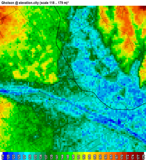
Below is the Elevation map of Gholson, which displays elevation range with different colors. Scale of the first map is from 118 to 179 m (387 to 587 ft) with average elevation of 139.1 meters (=456 ft) [note 1]
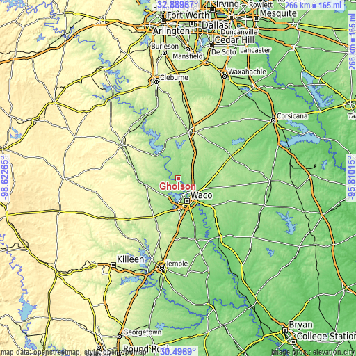
These maps also provides idea of topography and contour of this city, they are displayed at different zoom levels. More info about maps, scale and edge coordinates you can find below images.
| \ | Map #1 | Topo.Map |
| Scale [m] | 118..179 m | × |
| Scale [ft] | 387..587 ft | × |
| Average | 139.1 m = 456 ft | × |
| Width | 8.31 km = 5.2 mi | 266.1 km = 165.3 mi |
| Height | 8.31 km = 5.2 mi | 266.1 km = 165.3 mi |
| ↑Max Latitude | 31.738381° | 32.88967° |
| Latitude at center | 31.701° | 31.701° |
| ↓Min Latitude | 31.663604° | 30.4969° |
| ← Min Longitude | -97.260345° | -98.62265° |
| Longitude center | -97.2164° | -97.2164° |
| →Max Longitude | -97.172455° | -95.81015° |
Nearby cities:
Cities around Gholson sort by population:
• Waco elevation 147 m
18.1 km,  158°
158°
• Hewitt 202 m
26.6 km,  175°
175°
• Robinson 155 m
27.7 km, 159°
• Bellmead 137 m
15.7 km,  139°
139°
• Woodway 196 m
21.7 km, 177°
• Lacy-Lakeview 154 m
13.4 km,  126°
126°
• West 197 m
16.3 km,  46°
46°
• Beverly 152 m
20.8 km, 160°
• Beverly Hills 167 m
20.8 km, 163°
• Northcrest 154 m
13.2 km,  122°
122°
• Laguna Park 188 m
23.4 km,  318°
318°
• Valley Mills 185 m
24.6 km,  259°
259°
Multilingual:
 En español:
Gholson elevación 135 m.
 En France:
Gholson élévation 135 m.


Sources and notes:
- [note 1] Map square and city borders are not equal. Map elevation data is calculated only from area inside that square.
- [src 1] Elevation data from geonames database provided with same terms of usage.
- [src 2] The elevation map of Gholson is generated using elevation data from NASA's 3 arcsec (90m) resolution SRTM data.
- [src 3] Base (background) map © OpenStreetMap contributors tiles are generated by Geofabrik and OpenTopoMap.
Copyright & License:
This Gholson Elevation Map is licensed under CC BY-SA. You may reuse any part from this page, if you give a proper credit by linking to this URL:
 More info on terms of use page.