Waco elevation
Waco (Texas, McLennan County), United States elevation is 147 meters and Waco elevation in feet is 482 ft above sea level [src 1]. Waco is a seat of a second-order administrative division (feature code) with elevation that is 132 meters (433 ft) smaller than average city elevation in United States.
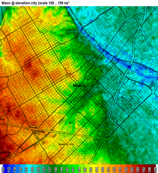
Below is the Elevation map of Waco, which displays elevation range with different colors. Scale of the first map is from 109 to 199 m (358 to 653 ft) with average elevation of 149.9 meters (=492 ft) [note 1]
These maps also provides idea of topography and contour of this city, they are displayed at different zoom levels. More info about maps, scale and edge coordinates you can find below images.
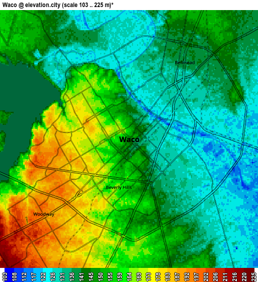
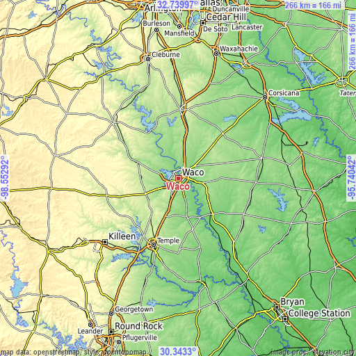
| \ | Map #1 | Map #2 | Topo.Map |
| Scale [m] | 109..199 m | 103..225 m | × |
| Scale [ft] | 358..653 ft | 338..738 ft | × |
| Average | 149.9 m = 492 ft | 148.1 m = 486 ft | × |
| Width | 8.33 km = 5.2 mi | 16.66 km = 10.4 mi | 266.5 km = 165.6 mi |
| Height | 8.33 km = 5.2 mi | 16.66 km = 10.4 mi | 266.5 km = 165.6 mi |
| ↑Max Latitude | 31.586772° | 31.624199° | 32.73997° |
| Latitude at center | 31.54933° | 31.54933° | 31.54933° |
| ↓Min Latitude | 31.511873° | 31.4744° | 30.3433° |
| ← Min Longitude | -97.190615° | -97.234561° | -98.55292° |
| Longitude center | -97.14667° | -97.14667° | -97.14667° |
| →Max Longitude | -97.102725° | -97.058779° | -95.74042° |
Nearby cities:
Cities around Waco sort by population:
• Hewitt elevation 202 m
10.7 km,  205°
205°
• Robinson 155 m
9.6 km,  161°
161°
• Bellmead 137 m
6.1 km,  35°
35°
• Woodway 196 m
7.3 km,  228°
228°
• Lacy-Lakeview 154 m
9.8 km,  25°
25°
• McGregor 218 m
27.5 km,  244°
244°
• Beverly 152 m
2.7 km,  170°
170°
• Beverly Hills 167 m
3.2 km,  192°
192°
• Northcrest 154 m
10.7 km,  24°
24°
• Lorena 190 m
19.2 km,  199°
199°
• Gholson 135 m
18.1 km,  338°
338°
• Riesel 158 m
22.7 km,  111°
111°
Multilingual:
 En español:
Waco elevación 147 m.
 En France:
Waco élévation 147 m.


Sources and notes:
- [note 1] Map square and city borders are not equal. Map elevation data is calculated only from area inside that square.
- [src 1] Elevation data from geonames database provided with same terms of usage.
- [src 2] The elevation map of Waco is generated using elevation data from NASA's 3 arcsec (90m) resolution SRTM data.
- [src 3] Base (background) map © OpenStreetMap contributors tiles are generated by Geofabrik and OpenTopoMap.
Copyright & License:
This Waco Elevation Map is licensed under CC BY-SA. You may reuse any part from this page, if you give a proper credit by linking to this URL:
 More info on terms of use page.