McGregor elevation
McGregor (Texas, McLennan County), United States elevation is 218 meters and McGregor elevation in feet is 715 ft above sea level [src 1]. McGregor is a populated place (feature code) with elevation that is 61 meters (200 ft) smaller than average city elevation in United States.
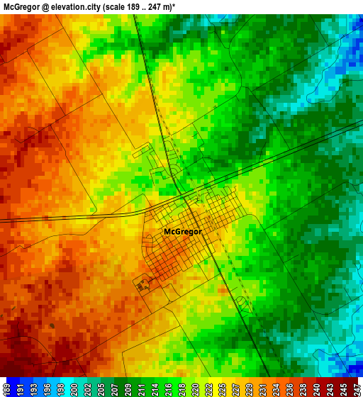
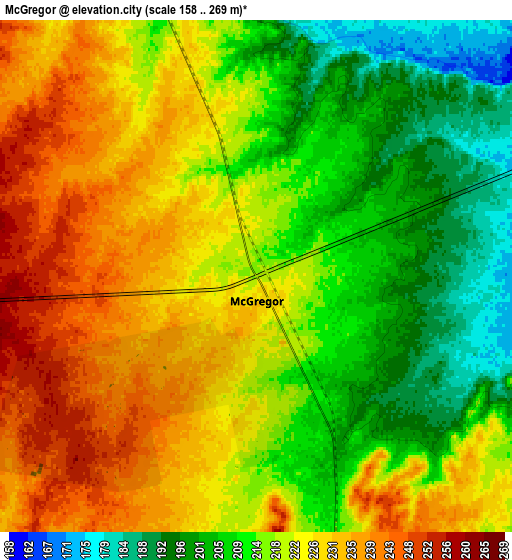
Below is the Elevation map of McGregor, which displays elevation range with different colors. Scale of the first map is from 189 to 247 m (620 to 810 ft) with average elevation of 220.5 meters (=723 ft) [note 1]
These maps also provides idea of topography and contour of this city, they are displayed at different zoom levels. More info about maps, scale and edge coordinates you can find below images.
| \ | Map #1 | Map #2 | Topo.Map |
| Scale [m] | 189..247 m | 158..269 m | × |
| Scale [ft] | 620..810 ft | 518..883 ft | × |
| Average | 220.5 m = 723 ft | 219.2 m = 719 ft | × |
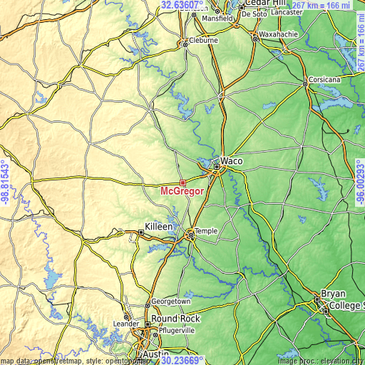
| Width | 8.34 km = 5.2 mi | 16.67 km = 10.4 mi | 266.8 km = 165.8 mi |
| Height | 8.34 km = 5.2 mi | 16.67 km = 10.4 mi | 266.8 km = 165.8 mi |
| ↑Max Latitude | 31.481544° | 31.519014° | 32.63607° |
| Latitude at center | 31.44406° | 31.44406° | 31.44406° |
| ↓Min Latitude | 31.406561° | 31.369046° | 30.23669° |
| ← Min Longitude | -97.453125° | -97.497071° | -98.81543° |
| Longitude center | -97.40918° | -97.40918° | -97.40918° |
| →Max Longitude | -97.365235° | -97.321289° | -96.00293° |
Nearby cities:
Cities around McGregor sort by population:
• Waco elevation 147 m
27.5 km,  64°
64°
• Gatesville 252 m
31.8 km,  268°
268°
• Hewitt 202 m
20.3 km,  84°
84°
• Robinson 155 m
28.1 km, 84°
• Woodway 196 m
20.5 km,  70°
70°
• Beverly 152 m
26.9 km, 70°
• Beverly Hills 167 m
25.7 km, 70°
• Troy 209 m
28.2 km,  159°
159°
• Lorena 190 m
19.5 km,  109°
109°
• Bruceville-Eddy 213 m
21.5 km,  135°
135°
• Moody 243 m
15.8 km, 163°
• Valley Mills 185 m
24.7 km,  345°
345°
Multilingual:
 En español:
McGregor elevación 218 m.
 En France:
McGregor élévation 218 m.
 Auf Deutsch:
McGregor höhe über dem Meeresspiegel ist 218 m.

Sources and notes:
- [note 1] Map square and city borders are not equal. Map elevation data is calculated only from area inside that square.
- [src 1] Elevation data from geonames database provided with same terms of usage.
- [src 2] The elevation map of McGregor is generated using elevation data from NASA's 3 arcsec (90m) resolution SRTM data.
- [src 3] Base (background) map © OpenStreetMap contributors tiles are generated by Geofabrik and OpenTopoMap.
Copyright & License:
This McGregor Elevation Map is licensed under CC BY-SA. You may reuse any part from this page, if you give a proper credit by linking to this URL:
 More info on terms of use page.